How to get to Assertive Protective Services by bus?
Click on the bus route to see step by step directions with maps, line arrival times and updated time schedules.
From Wal Mart Southpark, Edmonton
44 minFrom Kenilworth, Edmonton
49 minFrom The Derrick Golf & Country Club, Edmonton
52 minFrom Southgate Mall, Edmonton
79 minFrom Midway, Edmonton
38 minFrom Albian Central Receiving CNRL, Edmonton
46 minFrom Alberta Mobile Repair, Edmonton
53 minFrom Eaux Claires Transit Centre, Edmonton
26 minFrom Candlewood Suites West Edmonton - Mall Area, Edmonton
55 minFrom 1 SVC Supply Coy (bldg 236 West) CMTT, Edmonton
63 min
Bus stops near Assertive Protective Services in Edmonton
Light Rail stations near Assertive Protective Services in Edmonton
Bus lines to Assertive Protective Services in Edmonton
- 701, Government Transit Centre,VIEW
- 009, Century Park Transit Centre,VIEW
- 111, Stadium Transit Centre,VIEW
- 202, St Albert Via Nait,VIEW
- 211, Edmonton Express,VIEW
- 201, Edmonton Via 118 Ave,VIEW
- 560, 560 Spruce Grove,VIEW
- 692, West Edmonton Mall Transit Centre,VIEW
- 120X, Eaux Claires - Government Centre,VIEW
- 130X, Baturyn - Eaux Claires - Government Centre,VIEW
- 150X, Dunluce - Castle Downs - Government Centre,VIEW
- 003, Stadium Transit Centre,VIEW
What are the closest stations to Assertive Protective Services?
The closest stations to Assertive Protective Services are:
- 97 Street & 109 Avenue is 29 meters away, 1 min walk.
- 101 Street & 108a Avenue is 291 meters away, 5 min walk.
- 101 Street & Kingsway is 299 meters away, 5 min walk.
- 97 Street & 107 Avenue is 355 meters away, 5 min walk.
- 97 Street & 111 Avenue is 457 meters away, 7 min walk.
- Kingsway Rah Station is 1167 meters away, 16 min walk.
- Quarters Stop is 1451 meters away, 19 min walk.
- Churchill Station Underground is 3228 meters away, 42 min walk.
Which bus lines stop near Assertive Protective Services?
These bus lines stop near Assertive Protective Services: 005, 009, 103, 701.
What’s the nearest light rail station to Assertive Protective Services in Edmonton?
The nearest light rail station to Assertive Protective Services in Edmonton is Kingsway Rah Station. It’s a 16 min walk away.
What’s the nearest bus station to Assertive Protective Services in Edmonton?
The nearest bus station to Assertive Protective Services in Edmonton is 97 Street & 109 Avenue. It’s a 1 min walk away.
What time is the first light rail to Assertive Protective Services in Edmonton?
The VALLEY is the first light rail that goes to Assertive Protective Services in Edmonton. It stops nearby at 5:17 AM.
What time is the last light rail to Assertive Protective Services in Edmonton?
The VALLEY is the last light rail that goes to Assertive Protective Services in Edmonton. It stops nearby at 1:11 AM.
What time is the first bus to Assertive Protective Services in Edmonton?
The 009 is the first bus that goes to Assertive Protective Services in Edmonton. It stops nearby at 3:05 AM.
What time is the last bus to Assertive Protective Services in Edmonton?
The 009 is the last bus that goes to Assertive Protective Services in Edmonton. It stops nearby at 3:05 AM.
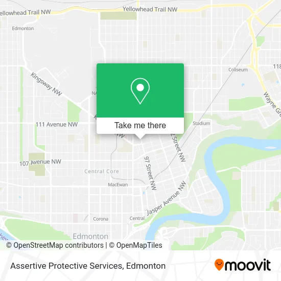
See Assertive Protective Services, Edmonton, on the map
Public Transit to Assertive Protective Services in Edmonton
Wondering how to get to Assertive Protective Services in Edmonton? Moovit helps you find the best way to get to Assertive Protective Services with step-by-step directions from the nearest public transit station.
Moovit provides free maps and live directions to help you navigate through your city. View schedules, routes, timetables, and find out how long does it take to get to Assertive Protective Services in real time.
Looking for the nearest stop or station to Assertive Protective Services? Check out this list of stops closest to your destination: 97 Street & 109 Avenue; 101 Street & 108a Avenue; 101 Street & Kingsway; 97 Street & 107 Avenue; 97 Street & 111 Avenue; Kingsway Rah Station; Quarters Stop; Churchill Station Underground.
Bus: 005, 009, 103, 701, 111, 202, 211, 201, 560, 692, 120X, 130X, 150X, 003.
Want to see if there’s another route that gets you there at an earlier time? Moovit helps you find alternative routes or times. Get directions from and directions to Assertive Protective Services easily from the Moovit App or Website.
We make riding to Assertive Protective Services easy, which is why over 1.5 million users, including users in Edmonton, trust Moovit as the best app for public transit. You don’t need to download an individual bus app or train app, Moovit is your all-in-one transit app that helps you find the best bus time or train time available.
For information on prices of bus, costs and ride fares to Assertive Protective Services, please check the Moovit app.
Use the app to navigate to popular places including to the airport, hospital, stadium, grocery store, mall, coffee shop, school, college, and university.
Assertive Protective Services Address: 10872 97 St NW Edmonton, AB T5H 2M5 street in Edmonton
- Granger Advertising,
- U-Haul,
- Rocky Mountain International Trading,
- Tom Convenience Store,
- Primera,
- Multicultural Health Brokers Company-OP,
- Mike Cares,
- Solidearth Geotechnical,
- Edmonton Bosnia Hercegovina Society,
- FX Exchange Pawn Shop,
- Royal Alexandra Hospital Parking Garage,
- Eskimos Auto Detailing LTD,
- Taj Western Cuisine,
- Grewal Roofing,
- Karaffka,
- Xelow Tech,
- AB LTD O/A,
- Trendy Modern Optical,
- National Black Coalition Edmntn Chapter,
- Another Concrete and Contracting Co
Places Near Assertive Protective Services (Edmonton)
- Edmonton VIA Rail Station, Edmonton,
- West Edmonton Mall, Edmonton,
- Kaye Edmonton Clinic, Edmonton,
- Whyte Avenue, Edmonton,
- Alberta Legislature Building, Edmonton,
- Borden Park, Edmonton,
- Edmonton Commonwealth Stadium, Edmonton,
- MacEwan University, Edmonton,
- Edmonton EXPO Centre, Edmonton,
- Royal Alexandra Hospital, Edmonton,
- Fort Edmonton Park, Edmonton,
- University of Alberta, Edmonton,
- Kingsway Mall, Edmonton,
- Edmonton Valley Zoo, Edmonton,
- Londonderry Mall, Edmonton,
- Grey Nuns Community Hospital, Edmonton,
- Cross Cancer Institute, Edmonton,
- Northgate Centre, Edmonton,
- Canada Place Service Canada Centre, Edmonton,
- Rogers Place, Edmonton
How to get to popular places in Edmonton with public transit
Get around Edmonton by public transit!
Traveling around Edmonton has never been so easy. See step by step directions as you travel to any attraction, street or major public transit station. View bus and train schedules, arrival times, service alerts and detailed routes on a map, so you know exactly how to get to anywhere in Edmonton.
When traveling to any destination around Edmonton use Moovit's Live Directions with Get Off Notifications to know exactly where and how far to walk, how long to wait for your line, and how many stops are left. Moovit will alert you when it's time to get off — no need to constantly re-check whether yours is the next stop.
Wondering how to use public transit in Edmonton or how to pay for public transit in Edmonton? Moovit public transit app can help you navigate your way with public transit easily, and at minimum cost. It includes public transit fees, ticket prices, and costs. Looking for a map of Edmonton public transit lines? Moovit public transit app shows all public transit maps in Edmonton with all Bus and Light Rail routes and stops on an interactive map.
Edmonton has 2 transit type(s), including: Bus and Light Rail, operated by several transit agencies, including ETS LRT, ETS, Strathcona County Transit, St. Albert Transit, Spruce Grove Transit, Fort Saskatchewan Transit, Beaumont Transit and Leduc Transit