How to get to Aston Carter by bus?
Click on the bus route to see step by step directions with maps, line arrival times and updated time schedules.
From McQueen Crossings S.C., Reno
64 minFrom St-Mary's Medical Group, Reno
65 minFrom Bus Stop @robb/mae Anne, Reno
63 minFrom Nugget Rib Cook Off Shuttle, Sparks
57 minFrom Quality Upholstery by Commercial Seating, Reno
48 minFrom Medhandler, Reno
63 minFrom Hiir, Reno
34 minFrom Asuka Sushi (Asuka Hotpot Sushi and Buffet), Sparks
57 minFrom Elite Curb & Concrete, Sparks
49 minFrom ZSK*, Reno
64 min
Bus stops near Aston Carter in Reno
Bus lines to Aston Carter in Reno
What are the closest stations to Aston Carter?
The closest stations to Aston Carter are:
- Neil Lane And Neil Road is 491 yards away, 7 min walk.
- Kietzke Lane And S Mccarran Boulevard is 656 yards away, 9 min walk.
- Rtc Transfer Center / Meadowood Mall is 888 yards away, 11 min walk.
Which bus lines stop near Aston Carter?
These bus lines stop near Aston Carter: 1, 9, VRGN.
What’s the nearest bus station to Aston Carter in Reno?
The nearest bus station to Aston Carter in Reno is Neil Lane And Neil Road. It’s a 7 min walk away.
What time is the first bus to Aston Carter in Reno?
The 1 is the first bus that goes to Aston Carter in Reno. It stops nearby at 3:30 AM.
What time is the last bus to Aston Carter in Reno?
The 1 is the last bus that goes to Aston Carter in Reno. It stops nearby at 2:45 AM.
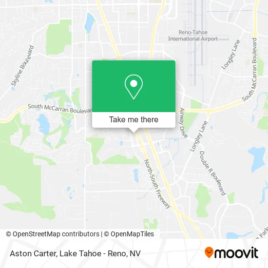
See Aston Carter, Reno, on the map
Public Transit to Aston Carter in Reno
Wondering how to get to Aston Carter in Reno? Moovit helps you find the best way to get to Aston Carter with step-by-step directions from the nearest public transit station.
Moovit provides free maps and live directions to help you navigate through your city. View schedules, routes, timetables, and find out how long does it take to get to Aston Carter in real time.
Looking for the nearest stop or station to Aston Carter? Check out this list of stops closest to your destination: Neil Lane And Neil Road; Kietzke Lane And S Mccarran Boulevard; Rtc Transfer Center / Meadowood Mall.
Bus: 1, 9, VRGN, 12, 54, 56, CRSN.
Want to see if there’s another route that gets you there at an earlier time? Moovit helps you find alternative routes or times. Get directions from and directions to Aston Carter easily from the Moovit App or Website.
We make riding to Aston Carter easy, which is why over 1.5 million users, including users in Reno, trust Moovit as the best app for public transit. You don’t need to download an individual bus app or train app, Moovit is your all-in-one transit app that helps you find the best bus time or train time available.
For information on prices of bus, costs and ride fares to Aston Carter, please check the Moovit app.
Use the app to navigate to popular places including to the airport, hospital, stadium, grocery store, mall, coffee shop, school, college, and university.
Aston Carter Address: 5340 Kietzke Ln Reno, NV 89511 street in Reno
- Assuredpartners,
- Actalent,
- First Citizens Bank,
- Guild Mortgage - Amanda Rea,
- Better Homes and Gardens Mason-McDuffie Real Estate,
- Senior Dimension,
- Pilot Corporation,
- United States Government Representative,
- NHP No Comm West Fees,
- Its the Blind Spot,
- Stewart Title of Northern Nevada,
- Edgar Manjarrez - Morgan Stanley,
- Relocation Reno,
- Kang David, MD,
- Macy's,
- Shred Nations,
- Wallbeds N More,
- Adept Physical Therapy,
- Skincare NV,
- Sierra Inst for Plstic Surgery
Places Near Aston Carter (Reno)
- Tesla, Carson City,
- Boreal Mountain Resort, Truckee,
- DMV, Reno,
- Boomtown Hotel, Reno,
- Department of Motor Vehicles (DMV), Reno,
- 2777 usa Parkway, Sparks,
- Mount Rose Ski Resort Entrance, Reno,
- Tesla, Reno,
- Walmart Supercenter, Reno,
- Grand Sierra Resort, Reno,
- Social Security Administration, Reno,
- The Nugget Sparks - Tesla Destination, Sparks,
- The Summit (Summit Shopping Center), Reno,
- Reno, Nevada, Reno,
- Hidden Beach, Incline Village,
- Meadowood Mall, Reno,
- Tesla, Reno,
- University of Nevada, Reno, Reno,
- Emerald Bay, South Lake Tahoe,
- Peppermill, Reno
How to get to popular places in Lake Tahoe - Reno, NV with public transit
Get around Reno by public transit!
Traveling around Reno has never been so easy. See step by step directions as you travel to any attraction, street or major public transit station. View bus and train schedules, arrival times, service alerts and detailed routes on a map, so you know exactly how to get to anywhere in Reno.
When traveling to any destination around Reno use Moovit's Live Directions with Get Off Notifications to know exactly where and how far to walk, how long to wait for your line, and how many stops are left. Moovit will alert you when it's time to get off — no need to constantly re-check whether yours is the next stop.
Wondering how to use public transit in Reno or how to pay for public transit in Reno? Moovit public transit app can help you navigate your way with public transit easily, and at minimum cost. It includes public transit fees, ticket prices, and costs. Looking for a map of Reno public transit lines? Moovit public transit app shows all public transit maps in Reno with all Bus and Train routes and stops on an interactive map.
Lake Tahoe - Reno, NV has 2 transit type(s), including: Bus and Train, operated by several transit agencies, including RTC RIDE, Tahoe Truckee Area Regional Transit, North Lake Tahoe Express - 24 hour advance reservations required, Tahoe Transportation District, Amtrak and Greyhound-us