Directions to Astro (Arlington County) with public transportation
The following transit lines have routes that pass near Astro
 Bus: 43, A40, A1X, 598, 282.
- Train: MANASSAS LINE, FREDERICKSBURG LINE.
- Metro: BLUE, YELLOW, METRO STATION CLOSURE SHUTTLE.
How to get to Astro by bus?
Click on the bus route to see step by step directions with maps, line arrival times and updated time schedules.
From Citi Open, Washington
70 minFrom Meridian Hill Park, Washington
57 minFrom Fairfield Inn by Marriott-Washington (Fairfield Inn & Suites by Marriott Washington, DC/Downtown), Washington
52 minFrom Tenleytown, Washington
48 minFrom William Hg Fitzgerald Tennis Center, Washington
69 minFrom Arlington Central Library, Arlington County
34 minFrom Rock Creek Park Tennis Center (William Hg Fitzgerald), Washington
74 minFrom Punch Bowl Social, Arlington County
37 minFrom Washington Yu Ying Public Charter School, Washington
96 minFrom National Law Enforcement Officers Memorial, Washington
57 min
How to get to Astro by train?
Click on the train route to see step by step directions with maps, line arrival times and updated time schedules.
How to get to Astro by metro?
Click on the metro route to see step by step directions with maps, line arrival times and updated time schedules.
From Meridian Hill Park, Washington
34 minFrom Fairfield Inn by Marriott-Washington (Fairfield Inn & Suites by Marriott Washington, DC/Downtown), Washington
20 minFrom Tenleytown, Washington
31 minFrom Arlington Central Library, Arlington County
32 minFrom Punch Bowl Social, Arlington County
31 minFrom Washington Yu Ying Public Charter School, Washington
46 minFrom National Law Enforcement Officers Memorial, Washington
22 min
Bus stops near Astro in Arlington County
Metro station near Astro in Arlington County
- Crystal City, 15 min walk,VIEW
Train station near Astro in Arlington County
- Crystal City, 15 min walk,VIEW
Bus lines to Astro in Arlington County
- A1X, South To Braddock Rd,VIEW
- A40, East To Crystal City,VIEW
- 43, Crystal City,VIEW
- 598, 598 Pentagon - Crystal City,VIEW
- 282, Crystal City Via Rosslyn & Pentagon,VIEW
- 482, Crystal City Via Rosslyn And Pentagon,VIEW
- 682, East Gate Via Stone Ridge II,VIEW
- 882, Loudoun Gateway,VIEW
- 972-C, Pentagon / Dale City,VIEW
- A11, North To Pentagon,VIEW
What are the closest stations to Astro?
The closest stations to Astro are:
- Crystal Dr+18 St S is 71 yards away, 1 min walk.
- Crystal Dr Nb @ 18th St S Fs-Transitway Station E is 78 yards away, 1 min walk.
- 18th St @ Crystal City Metro is 370 yards away, 5 min walk.
- 18th St & Route 1 is 393 yards away, 5 min walk.
- 18th St Bus Bays is 416 yards away, 5 min walk.
- S Eads St+18 St S is 528 yards away, 7 min walk.
- Crystal City is 1167 yards away, 15 min walk.
Which bus lines stop near Astro?
These bus lines stop near Astro: 43, A40.
Which train line stops near Astro?
MANASSAS LINE (Broad Run)
Which metro lines stop near Astro?
These metro lines stop near Astro: BLUE, YELLOW.
What’s the nearest metro station to Astro in Arlington County?
The nearest metro station to Astro in Arlington County is Crystal City. It’s a 15 min walk away.
What’s the nearest train station to Astro in Arlington County?
The nearest train station to Astro in Arlington County is Crystal City. It’s a 15 min walk away.
What’s the nearest bus station to Astro in Arlington County?
The nearest bus stations to Astro in Arlington County are Crystal Dr+18 St S and Crystal Dr Nb @ 18th St S Fs-Transitway Station E. The closest one is a 1 min walk away.
What time is the first metro to Astro in Arlington County?
The YELLOW is the first metro that goes to Astro in Arlington County. It stops nearby at 5:11 AM.
What time is the last metro to Astro in Arlington County?
The BLUE is the last metro that goes to Astro in Arlington County. It stops nearby at 12:26 AM.
What time is the first train to Astro in Arlington County?
The MANASSAS LINE is the first train that goes to Astro in Arlington County. It stops nearby at 6:04 AM.
What time is the last train to Astro in Arlington County?
The MANASSAS LINE is the last train that goes to Astro in Arlington County. It stops nearby at 7:15 PM.
What time is the first bus to Astro in Arlington County?
The A11 is the first bus that goes to Astro in Arlington County. It stops nearby at 4:57 AM.
What time is the last bus to Astro in Arlington County?
The A40 is the last bus that goes to Astro in Arlington County. It stops nearby at 2:10 AM.
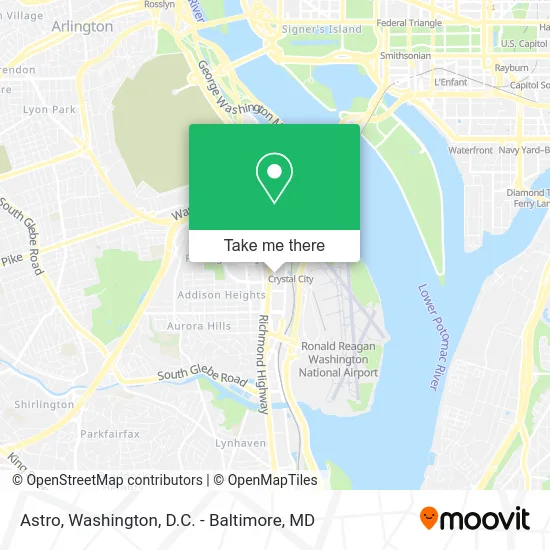
See Astro, Arlington County, on the map
Public Transit to Astro in Arlington County
Wondering how to get to Astro in Arlington County? Moovit helps you find the best way to get to Astro with step-by-step directions from the nearest public transit station.
Moovit provides free maps and live directions to help you navigate through your city. View schedules, routes, timetables, and find out how long does it take to get to Astro in real time.
Looking for the nearest stop or station to Astro? Check out this list of stops closest to your destination: Crystal Dr+18 St S; Crystal Dr Nb @ 18th St S Fs-Transitway Station E; 18th St @ Crystal City Metro; 18th St & Route 1; 18th St Bus Bays; S Eads St+18 St S; Crystal City.
Bus: 43, A40, A1X, 598, 282, 482, 682, 882.Train: MANASSAS LINE, FREDERICKSBURG LINE.Metro: BLUE, YELLOW, METRO STATION CLOSURE SHUTTLE.
Want to see if there’s another route that gets you there at an earlier time? Moovit helps you find alternative routes or times. Get directions from and directions to Astro easily from the Moovit App or Website.
We make riding to Astro easy, which is why over 1.5 million users, including users in Arlington County, trust Moovit as the best app for public transit. You don’t need to download an individual bus app or train app, Moovit is your all-in-one transit app that helps you find the best bus time or train time available.
For information on prices of bus, metro and train, costs and ride fares to Astro, please check the Moovit app.
Use the app to navigate to popular places including to the airport, hospital, stadium, grocery store, mall, coffee shop, school, college, and university.
Astro Address: 251 18th St S Arlington, VA 22202 street in Arlington County
- Technology Service Corporation,
- Crystal City Metro Station,
- Kearfott Guidance & Navigation,
- National Defense Indl Association,
- Amazon - Was14 (Amazon Hq2 - Was16),
- Global Cold Chain Alliance,
- Gcyber,
- Air Force Aid Society,
- Life Key Chiropractic,
- Department of Housing and Urban Development,
- Research!America,
- Amazon Was14,
- US Air Force,
- Parsons CHRYSLER Plymouth,
- 18th St S Bell St,
- Parc View Arlington,
- Arlington County Government, Recreation, Recreation Centers, Aurora Hills,
- Bloomberg Industry Group,
- Crystal Mall Barbershop,
- Amazon Hq2 - Was15
Places Near Astro (Arlington County)
- National Mall, Washington,
- National Zoo, Washington,
- Marriott Marquis Washington, DC, Washington,
- Capital One Arena, Washington,
- Georgetown, Washington,
- Sibley Memorial Hospital, Washington,
- The Anthem, Washington,
- Pennsylvania Ave NW (3rd st and pennsylvania), Washington,
- Rock Creek Tennis Center, Washington,
- Warner Theatre, Washington,
- Washington National Cathedral, Washington,
- M&T Bank Stadium, Baltimore,
- Westfield Montgomery Mall, Montgomery County,
- Basilica of the National Shrine, Washington,
- Camden Yards, Baltimore,
- Museum Of The Bible, Washington,
- Amazon Hq2, Arlington County,
- Washington DC VA Medical Center, Washington,
- National Museum of African American History and Culture, Washington,
- PG Mall, Prince George's County
How to get to popular places in Washington, D.C. - Baltimore, MD with public transit
Get around Arlington County by public transit!
Traveling around Arlington County has never been so easy. See step by step directions as you travel to any attraction, street or major public transit station. View bus and train schedules, arrival times, service alerts and detailed routes on a map, so you know exactly how to get to anywhere in Arlington County.
When traveling to any destination around Arlington County use Moovit's Live Directions with Get Off Notifications to know exactly where and how far to walk, how long to wait for your line, and how many stops are left. Moovit will alert you when it's time to get off — no need to constantly re-check whether yours is the next stop.
Wondering how to use public transit in Arlington County or how to pay for public transit in Arlington County? Moovit public transit app can help you navigate your way with public transit easily, and at minimum cost. It includes public transit fees, ticket prices, and costs. Looking for a map of Arlington County public transit lines? Moovit public transit app shows all public transit maps in Arlington County with all Bus, Train, Metro, Light Rail and Ferry routes and stops on an interactive map.
Washington, D.C. - Baltimore, MD has 5 transit type(s), including: Bus, Train, Metro, Light Rail and Ferry, operated by several transit agencies, including WMATA, Montgomery County Ride On, Fairfax Connector, TheBus, PRTC, DASH - Alexandria, Arlington Transit (ART), RTA of Central Maryland, MDOT MTA, MDOT MTA Light RailLink, MDOT MTA Commuter Bus, MDOT MTA Local Bus, FXBGO!, Virginia Railway Express (VRE) and MARC