How to get to At&T Meridiam Park Ags by bus?
Click on the bus route to see step by step directions with maps, line arrival times and updated time schedules.
From Universidad La Concordia Campus Forum Internacional, Aguascalientes
52 minFrom Funeraria Ramírez, Aguascalientes
44 minFrom Circunvalación Norte, Aguascalientes
56 minFrom Jose Guadalupe Posada, Aguascalientes
50 minFrom Secundaria Tecnica, 1, Jose Reyes Martinez, Aguascalientes
50 minFrom Aguascalientes Boca de Túnel, Aguascalientes
39 minFrom Segundo Anillo, Aguascalientes
57 minFrom Fracc. Bajio de las Palmas, Aguascalientes
57 minFrom Finanzas, Aguascalientes
39 minFrom Juzgado Tercero Civil, Aguascalientes
47 min
Bus stops near At&T Meridiam Park Ags in Aguascalientes
Bus lines to At&T Meridiam Park Ags in Aguascalientes
What are the closest stations to At&T Meridiam Park Ags?
The closest stations to At&T Meridiam Park Ags are:
- Coto 213, 213 is 309 meters away, 5 min walk.
- Aguascalientes-Encarnación De Díaz, 210 is 560 meters away, 8 min walk.
Which bus lines stop near At&T Meridiam Park Ags?
These bus lines stop near At&T Meridiam Park Ags: RUTA 10, RUTA 43.
What’s the nearest bus station to At&T Meridiam Park Ags in Aguascalientes?
The nearest bus station to At&T Meridiam Park Ags in Aguascalientes is Coto 213, 213. It’s a 5 min walk away.
What time is the first bus to At&T Meridiam Park Ags in Aguascalientes?
The RUTA 34 is the first bus that goes to At&T Meridiam Park Ags in Aguascalientes. It stops nearby at 6:05 AM.
What time is the last bus to At&T Meridiam Park Ags in Aguascalientes?
The RUTA 43 is the last bus that goes to At&T Meridiam Park Ags in Aguascalientes. It stops nearby at 10:41 PM.
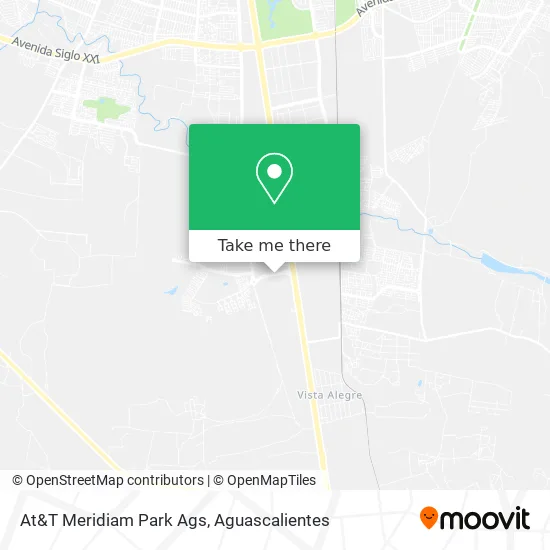
See At&T Meridiam Park Ags, Aguascalientes, on the map
Public Transit to At&T Meridiam Park Ags in Aguascalientes
Wondering how to get to At&T Meridiam Park Ags in Aguascalientes? Moovit helps you find the best way to get to At&T Meridiam Park Ags with step-by-step directions from the nearest public transit station.
Moovit provides free maps and live directions to help you navigate through your city. View schedules, routes, timetables, and find out how long does it take to get to At&T Meridiam Park Ags in real time.
Looking for the nearest stop or station to At&T Meridiam Park Ags? Check out this list of stops closest to your destination: Coto 213; Aguascalientes-Encarnación De Díaz.
Bus: RUTA 10, RUTA 43, RUTA 03, RUTA 34.
Want to see if there’s another route that gets you there at an earlier time? Moovit helps you find alternative routes or times. Get directions from and directions to At&T Meridiam Park Ags easily from the Moovit App or Website.
We make riding to At&T Meridiam Park Ags easy, which is why over 1.5 million users, including users in Aguascalientes, trust Moovit as the best app for public transit. You don’t need to download an individual bus app or train app, Moovit is your all-in-one transit app that helps you find the best bus time or train time available.
For information on prices of bus, costs and ride fares to At&T Meridiam Park Ags, please check the Moovit app.
Use the app to navigate to popular places including to the airport, hospital, stadium, grocery store, mall, coffee shop, school, college, and university.
At&T Meridiam Park Ags Address: At&T Meridiam Park Ags, Avenida Paseo de San Gerardo, Cond Centro Comercial Galerias I, 20283 Aguas street in Aguascalientes
- WESTERN UNION,
- Birote Tortas Ahogadas,
- Meridiam Park,
- Sicsa,
- TRACSA CAT,
- Alamo,
- Pts,
- Gasolinera Repsol,
- San Gerardo textil,
- "La Costeña",
- Interpec San Marcos S.A de C.V (Sabropollo),
- Jesus Álvarez Gutierrez,
- WESTERN UNION,
- BBVA Bancomer,
- COMPAS Oficinas Temporales A1,
- San Gerardo Residencial,
- Nissan Mexicana A1,
- Cajero Automático HSBC Mexico,
- San Gerardo,
- Ex-Hacienda de Peñuelas
Places Near At&T Meridiam Park Ags (Aguascalientes)
- Hospital Imss No. 3, Aguascalientes,
- Jesús María, Aguascalientes,
- Parque Las Tres Centurias, Aguascalientes,
- La Isla San Marcos, Aguascalientes,
- Villasuncion, Aguascalientes,
- Imss Clinica 1, Aguascalientes,
- ESPACIOS, Aguascalientes,
- Terminal De Combis, Aguascalientes,
- Ciudad industrial, Aguascalientes,
- Centro Comercial Altaria, Aguascalientes,
- Central De Autobuses, Aguascalientes,
- clinica 3 uaa, Aguascalientes,
- Blvd. Luis Donaldo Colosio, Aguascalientes,
- Isla San Marcos, Aguascalientes,
- Aeropuerto de Aguascalientes S.A. de C.V., Aguascalientes,
- Villas de Nuestra Señora de la Asunción, Aguascalientes,
- Universidad Autónoma de Aguascalientes, Aguascalientes,
- Agropecuario, Aguascalientes,
- Centro, Aguascalientes,
- Nuevo Hospital Hidalgo, Aguascalientes
How to get to popular places in Aguascalientes with public transit
Get around Aguascalientes by public transit!
Traveling around Aguascalientes has never been so easy. See step by step directions as you travel to any attraction, street or major public transit station. View bus and train schedules, arrival times, service alerts and detailed routes on a map, so you know exactly how to get to anywhere in Aguascalientes.
When traveling to any destination around Aguascalientes use Moovit's Live Directions with Get Off Notifications to know exactly where and how far to walk, how long to wait for your line, and how many stops are left. Moovit will alert you when it's time to get off — no need to constantly re-check whether yours is the next stop.
Wondering how to use public transit in Aguascalientes or how to pay for public transit in Aguascalientes? Moovit public transit app can help you navigate your way with public transit easily, and at minimum cost. It includes public transit fees, ticket prices, and costs. Looking for a map of Aguascalientes public transit lines? Moovit public transit app shows all public transit maps in Aguascalientes with all bus routes and stops on an interactive map.
Aguascalientes has 1 transit type(s), including: bus, operated by several transit agencies, including Coordinación General de Movilidad