How to get to At&T Store by bus?
Click on the bus route to see step by step directions with maps, line arrival times and updated time schedules.
From New Rochelle, NY, New Rochelle
40 minFrom Elmsford, NY, Elmsford
58 minFrom Cross County Mall, Yonkers
83 minFrom City of Mount Vernon, NY, Mount Vernon
57 minFrom Ridge Hill Mall, Yonkers
120 minFrom Cross County Shopping Center, Yonkers
82 minFrom Port Chester, NY, Port Chester
22 minFrom Empire City Casino, Yonkers
71 minFrom White Plains, NY, White Plains
39 minFrom Westchester Mall, White Plains
46 min
How to get to At&T Store by train?
Click on the train route to see step by step directions with maps, line arrival times and updated time schedules.
Bus stops near At&T Store in Harrison
Train station near At&T Store in Harrison
- Mamaroneck, 10 min walk,VIEW
What are the closest stations to At&T Store?
The closest stations to At&T Store are:
- Halstead Ave @ Macy Ave is 539 yards away, 7 min walk.
- Oakland Ave @ Halstead Ave is 574 yards away, 7 min walk.
- Mamaroneck is 809 yards away, 10 min walk.
Which bus lines stop near At&T Store?
These bus lines stop near At&T Store: 5, 61.
Which train line stops near At&T Store?
3 (1310#| Greenwich)
What’s the nearest train station to At&T Store in Harrison?
The nearest train station to At&T Store in Harrison is Mamaroneck. It’s a 10 min walk away.
What’s the nearest bus station to At&T Store in Harrison?
The nearest bus stations to At&T Store in Harrison are Halstead Ave @ Macy Ave and Oakland Ave @ Halstead Ave. The closest one is a 7 min walk away.
What time is the first train to At&T Store in Harrison?
The 3 is the first train that goes to At&T Store in Harrison. It stops nearby at 4:57 AM.
What time is the last train to At&T Store in Harrison?
The 3 is the last train that goes to At&T Store in Harrison. It stops nearby at 2:39 AM.
What time is the first bus to At&T Store in Harrison?
The 61 is the first bus that goes to At&T Store in Harrison. It stops nearby at 6:26 AM.
What time is the last bus to At&T Store in Harrison?
The 5 is the last bus that goes to At&T Store in Harrison. It stops nearby at 8:34 PM.
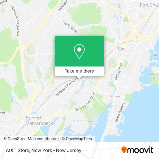
See At&T Store, Harrison, on the map
Public Transit to At&T Store in Harrison
Wondering how to get to At&T Store in Harrison? Moovit helps you find the best way to get to At&T Store with step-by-step directions from the nearest public transit station.
Moovit provides free maps and live directions to help you navigate through your city. View schedules, routes, timetables, and find out how long does it take to get to At&T Store in real time.
Looking for the nearest stop or station to At&T Store? Check out this list of stops closest to your destination: Halstead Ave @ Macy Ave; Oakland Ave @ Halstead Ave; Mamaroneck.
Bus: 5, 61.Train: 3, 4.
Want to see if there’s another route that gets you there at an earlier time? Moovit helps you find alternative routes or times. Get directions from and directions to At&T Store easily from the Moovit App or Website.
We make riding to At&T Store easy, which is why over 1.5 million users, including users in Harrison, trust Moovit as the best app for public transit. You don’t need to download an individual bus app or train app, Moovit is your all-in-one transit app that helps you find the best bus time or train time available.
For information on prices of bus and train, costs and ride fares to At&T Store, please check the Moovit app.
Use the app to navigate to popular places including to the airport, hospital, stadium, grocery store, mall, coffee shop, school, college, and university.
At&T Store Address: 341 Halstead Ave street in Harrison
- Pmc Consulting Inc.,
- Jersey Mike's,
- Harrison Shopping Square,
- Soup Man,
- NY Pizza Co.,
- Taku Chens,
- Mta Harrison,
- Fat Stu's All-American Burger,
- NY Hair Creations,
- Starbucks,
- Intercontinental Car Care Center,
- New York Rug Cleaning,
- Café Deux,
- Colour Connie Nails,
- The Pureganic Cafe,
- Daltile, American Olean, Marazzi Sales Service Center,
- Beauty Blow Dry Bar,
- Hal’S Deli,
- Heir Theory Extensions + Salon,
- Hals Grill and Deli
Places Near At&T Store (Harrison)
- 66 John Street, Manhattan,
- Pier 83, Manhattan,
- 26 Federal Plaza, Manhattan,
- Mountainside Hospital, Glen Ridge,
- Katz's Deli, Manhattan,
- Times Square, Manhattan,
- qqqq, Manhattan,
- Wall Street, Manhattan,
- SoHo, Manhattan,
- Bellevue Hospital, Manhattan,
- 376 Hudson Street, Manhattan,
- Hudson Yards, Manhattan,
- 1 Police Plaza, Manhattan,
- 111 Centre New York City Supreme Court, Manhattan,
- 3 Stone St, Manhattan,
- Chinatown, Manhattan,
- Rockefeller Center, Manhattan,
- San Gennaro Feast, Manhattan,
- Queens Center Mall, Queens,
- 911 Memorial, Manhattan
How to get to popular places in New York - New Jersey with public transit
Get around Harrison by public transit!
Traveling around Harrison has never been so easy. See step by step directions as you travel to any attraction, street or major public transit station. View bus and train schedules, arrival times, service alerts and detailed routes on a map, so you know exactly how to get to anywhere in Harrison.
When traveling to any destination around Harrison use Moovit's Live Directions with Get Off Notifications to know exactly where and how far to walk, how long to wait for your line, and how many stops are left. Moovit will alert you when it's time to get off — no need to constantly re-check whether yours is the next stop.
Wondering how to use public transit in Harrison or how to pay for public transit in Harrison? Moovit public transit app can help you navigate your way with public transit easily, and at minimum cost. It includes public transit fees, ticket prices, and costs. Looking for a map of Harrison public transit lines? Moovit public transit app shows all public transit maps in Harrison with all Bus, Train, Subway, Light Rail, Ferry and Cable Car routes and stops on an interactive map.
New York - New Jersey has 6 transit type(s), including: Bus, Train, Subway, Light Rail, Ferry and Cable Car, operated by several transit agencies, including MTA Subway, Metro-North Railroad, LIRR, PATH, MTA New York City Transit - Express routes, MTA Bus, NJ Transit, NYC Ferry, NICE bus, Bee-Line Bus, NJ Transit Rail, Norwalk Transit District, Hartford Line, River Valley Transit and HART