Directions to At Wade Tile (Roanoke County) with public transportation
The following transit lines have routes that pass near At Wade Tile
 Bus: 35, 36, 32, 31.
- Train: NORTHEAST REGIONAL.
How to get to At Wade Tile by bus?
Click on the bus route to see step by step directions with maps, line arrival times and updated time schedules.
Bus stops near At Wade Tile in Roanoke County
Train station near At Wade Tile in Roanoke County
- Roanoke, 14 min walk,VIEW
Bus lines to At Wade Tile in Roanoke County
What are the closest stations to At Wade Tile?
The closest stations to At Wade Tile are:
- Pollard Sb at Post Office is 59 yards away, 2 min walk.
- Washington Eb at Maple is 74 yards away, 2 min walk.
- Dunkirk Sb at GUS Nicks is 744 yards away, 9 min walk.
- Roanoke is 1089 yards away, 14 min walk.
- Dale Nb at Clyde is 1098 yards away, 14 min walk.
Which bus line stops near At Wade Tile?
35 (35 - Third Street Station To Vinton)
What’s the nearest train station to At Wade Tile in Roanoke County?
The nearest train station to At Wade Tile in Roanoke County is Roanoke. It’s a 14 min walk away.
What’s the nearest bus station to At Wade Tile in Roanoke County?
The nearest bus stations to At Wade Tile in Roanoke County are Pollard Sb at Post Office and Washington Eb at Maple. The closest one is a 2 min walk away.
What time is the first train to At Wade Tile in Roanoke County?
The NORTHEAST REGIONAL is the first train that goes to At Wade Tile in Roanoke County. It stops nearby at 9:35 AM.
What time is the last train to At Wade Tile in Roanoke County?
The NORTHEAST REGIONAL is the last train that goes to At Wade Tile in Roanoke County. It stops nearby at 10:13 PM.
What time is the first bus to At Wade Tile in Roanoke County?
The 36 is the first bus that goes to At Wade Tile in Roanoke County. It stops nearby at 5:53 AM.
What time is the last bus to At Wade Tile in Roanoke County?
The 35 is the last bus that goes to At Wade Tile in Roanoke County. It stops nearby at 8:33 PM.
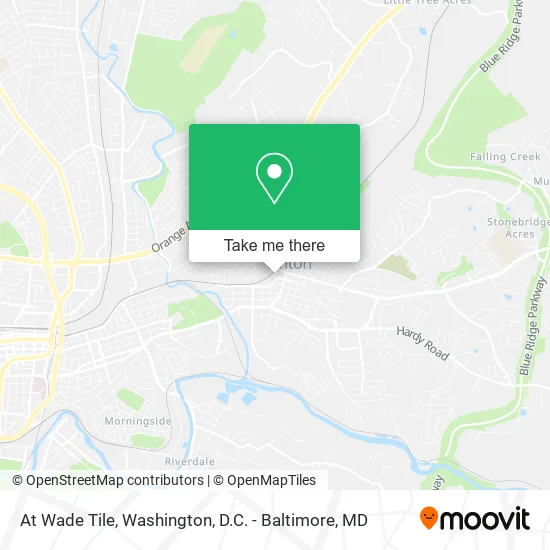
See At Wade Tile, Roanoke County, on the map
Public Transit to At Wade Tile in Roanoke County
Wondering how to get to At Wade Tile in Roanoke County? Moovit helps you find the best way to get to At Wade Tile with step-by-step directions from the nearest public transit station.
Moovit provides free maps and live directions to help you navigate through your city. View schedules, routes, timetables, and find out how long does it take to get to At Wade Tile in real time.
Looking for the nearest stop or station to At Wade Tile? Check out this list of stops closest to your destination: Pollard Sb at Post Office; Washington Eb at Maple; Dunkirk Sb at GUS Nicks; Roanoke; Dale Nb at Clyde.
Bus: 35, 36, 32, 31.Train: NORTHEAST REGIONAL.
Want to see if there’s another route that gets you there at an earlier time? Moovit helps you find alternative routes or times. Get directions from and directions to At Wade Tile easily from the Moovit App or Website.
We make riding to At Wade Tile easy, which is why over 1.5 million users, including users in Roanoke County, trust Moovit as the best app for public transit. You don’t need to download an individual bus app or train app, Moovit is your all-in-one transit app that helps you find the best bus time or train time available.
For information on prices of bus and train, costs and ride fares to At Wade Tile, please check the Moovit app.
Use the app to navigate to popular places including to the airport, hospital, stadium, grocery store, mall, coffee shop, school, college, and university.
At Wade Tile Address: 214 W Lee Ave Vinton, VA 24179 street in Roanoke County
- Chamber of Commerce,
- B&C Exterminating,
- Vinton Farmer's Market,
- Succotash Fine Foods,
- Stratford Properties,
- Rubicon Planning,
- 3 Point Marketing,
- Steve's Automotive Service Center,
- Lynchburg Roofing,
- Mikula-Harris,
- Inprint,
- Bonnie Law,
- Allstate Insurance,
- Gillespie Bill,
- Larry Mattox Ins,
- 206 Salon,
- Charme Beauty Shop Unisex,
- Bennett Transmissions,
- Town of Vinton, Virginia Government,
- Vinton Volunteer Fire Department
Places Near At Wade Tile (Roanoke County)
- National Museum of African American History and Culture, Washington,
- Pennsylvania Ave NW (3rd st and pennsylvania), Washington,
- The Anthem, Washington,
- Rock Creek Tennis Center, Washington,
- Capital One Arena, Washington,
- Marriott Marquis Washington, DC, Washington,
- Camden Yards, Baltimore,
- Warner Theatre, Washington,
- Basilica of the National Shrine, Washington,
- Sibley Memorial Hospital, Washington,
- Amazon Hq2, Arlington County,
- Georgetown, Washington,
- M&T Bank Stadium, Baltimore,
- Westfield Montgomery Mall, Montgomery County,
- Museum Of The Bible, Washington,
- PG Mall, Prince George's County,
- Washington DC VA Medical Center, Washington,
- National Theatre, Washington,
- National Zoo, Washington,
- Washington National Cathedral, Washington
How to get to popular places in Washington, D.C. - Baltimore, MD with public transit
Get around Roanoke County by public transit!
Traveling around Roanoke County has never been so easy. See step by step directions as you travel to any attraction, street or major public transit station. View bus and train schedules, arrival times, service alerts and detailed routes on a map, so you know exactly how to get to anywhere in Roanoke County.
When traveling to any destination around Roanoke County use Moovit's Live Directions with Get Off Notifications to know exactly where and how far to walk, how long to wait for your line, and how many stops are left. Moovit will alert you when it's time to get off — no need to constantly re-check whether yours is the next stop.
Wondering how to use public transit in Roanoke County or how to pay for public transit in Roanoke County? Moovit public transit app can help you navigate your way with public transit easily, and at minimum cost. It includes public transit fees, ticket prices, and costs. Looking for a map of Roanoke County public transit lines? Moovit public transit app shows all public transit maps in Roanoke County with all Bus, Train, Metro, Light Rail and Ferry routes and stops on an interactive map.
Washington, D.C. - Baltimore, MD has 5 transit type(s), including: Bus, Train, Metro, Light Rail and Ferry, operated by several transit agencies, including WMATA, Montgomery County Ride On, Fairfax Connector, TheBus, PRTC, DASH - Alexandria, Arlington Transit (ART), RTA of Central Maryland, MDOT MTA, MDOT MTA Light RailLink, MDOT MTA Commuter Bus, MDOT MTA Local Bus, FXBGO!, Virginia Railway Express (VRE) and MARC