How to get to Atane by bus?
Click on the bus route to see step by step directions with maps, line arrival times and updated time schedules.
From Hallets Point, Queens
99 minFrom Long Island City Courthouse, Queens
63 minFrom 5 E 98th St, Manhattan
42 minFrom 5 East 98th Street, Manhattan
42 minFrom East 96th Street, Manhattan
69 minFrom Carnegie Hall, Manhattan
38 minFrom Community Lines, Jersey City
78 minFrom Times Square New York City, Usa, Manhattan
54 min
How to get to Atane by train?
Click on the train route to see step by step directions with maps, line arrival times and updated time schedules.
How to get to Atane by subway?
Click on the subway route to see step by step directions with maps, line arrival times and updated time schedules.
Subway stations near Atane in Manhattan
Bus stops near Atane in Manhattan
- Broadway & Wall St, 3 min walk,VIEW
- Broadway/Rector St, 4 min walk,VIEW
- Broadway/Exchange Alley, 5 min walk,VIEW
- Broadway at Exchange Pl#, 5 min walk,VIEW
- Water St/Gouverneur Ln, 5 min walk,VIEW
- New York - Broadway @ Exchange Pl (Northbound), 5 min walk,VIEW
- Broadway Between Liberty & Cedar St, 6 min walk,VIEW
Bus lines to Atane in Manhattan
- SHORTLINE HUDSON, 500 - Monroe - Chester - Goshen,VIEW
- SHORTLINE HUDSON, 200 - Northern District – Nanuet,VIEW
- SHORTLINE HUDSON, 800 - Pennsylvania,VIEW
- SHORTLINE HUDSON, 700 - Newburgh - Poughkeepsie,VIEW
- SHORTLINE HUDSON, 300 - NYC - Middletown,VIEW
- M55, South Ferry,VIEW
- BXM18, Downtown Wall St Via 5 Av Via Broadway,VIEW
- SIM4, Annadale Via Richmond Av,VIEW
- SIM4C, Huguenot Via Richmond Av Via Arthur Kill,VIEW
- SIM1, Eltngvlle Trans Ctr Via Hylan Via Rich,VIEW
- SIM1C, Eltngvlle Trans Ctr Via Hylan Via Rich,VIEW
- SIM3C, Pt Rchmnd Via Narrows Rd N Via Watchogue,VIEW
- SIM33C, Mariners Harbor Via N Gannon Av,VIEW
- X27, Bay Ridge Shore Rd Via Broadway,VIEW
- X28, Coney Island Sea Gate Via Broadway,VIEW
- 120, New York Lower Manhattan,VIEW
- 404, Route 9 to Wall Street,VIEW
- 604, Route 36 to Wall Street - Highlands Middle Road,VIEW
- 720, Exit 5 to Port Authority - Wall Street,VIEW
- DOWNTOWN CONNECTION, Chambers Street,VIEW
What are the closest stations to Atane?
The closest stations to Atane are:
- Wall St is 42 yards away, 1 min walk.
- Broad St is 61 yards away, 2 min walk.
- Broadway & Wall St is 215 yards away, 3 min walk.
- Broadway/Rector St is 254 yards away, 4 min walk.
- Broadway/Exchange Alley is 325 yards away, 5 min walk.
- Broadway at Exchange Pl# is 366 yards away, 5 min walk.
- Water St/Gouverneur Ln is 367 yards away, 5 min walk.
- New York - Broadway @ Exchange Pl (Northbound) is 373 yards away, 5 min walk.
- Broadway Between Liberty & Cedar St is 406 yards away, 6 min walk.
- Rector St is 433 yards away, 6 min walk.
Which bus lines stop near Atane?
These bus lines stop near Atane: 120, BM2, BXM18, M15, M15-SBS, X28.
Which train lines stop near Atane?
These train lines stop near Atane: BLU, GRE.
Which subway lines stop near Atane?
These subway lines stop near Atane: 2, 3, 4.
What’s the nearest subway station to Atane in Manhattan?
The nearest subway station to Atane in Manhattan is Wall St. It’s a 1 min walk away.
What’s the nearest bus station to Atane in Manhattan?
The nearest bus station to Atane in Manhattan is Broadway & Wall St. It’s a 3 min walk away.
What time is the first subway to Atane in Manhattan?
The 3 is the first subway that goes to Atane in Manhattan. It stops nearby at 3:00 AM.
What time is the last subway to Atane in Manhattan?
The 2 is the last subway that goes to Atane in Manhattan. It stops nearby at 4:12 AM.
What time is the first bus to Atane in Manhattan?
The SIM1C is the first bus that goes to Atane in Manhattan. It stops nearby at 3:56 AM.
What time is the last bus to Atane in Manhattan?
The SIM1C is the last bus that goes to Atane in Manhattan. It stops nearby at 2:56 AM.
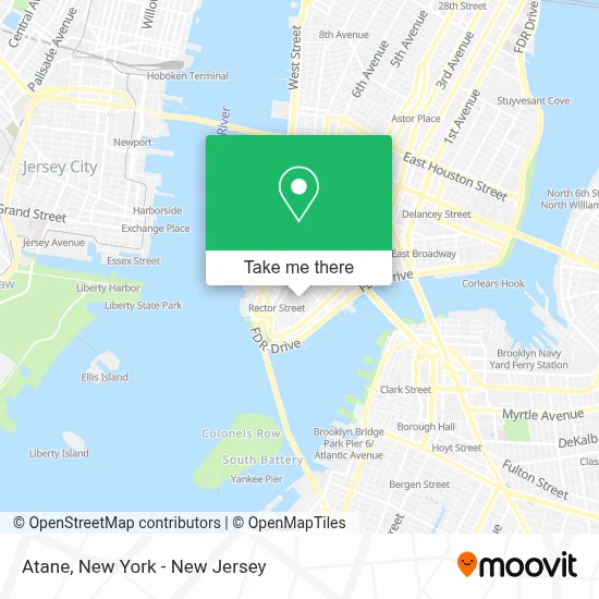
See Atane, Manhattan, on the map
Public Transit to Atane in Manhattan
Wondering how to get to Atane in Manhattan? Moovit helps you find the best way to get to Atane with step-by-step directions from the nearest public transit station.
Moovit provides free maps and live directions to help you navigate through your city. View schedules, routes, timetables, and find out how long does it take to get to Atane in real time.
Looking for the nearest stop or station to Atane? Check out this list of stops closest to your destination: Wall St; Broad St; Broadway & Wall St; Broadway/Rector St; Broadway/Exchange Alley; Broadway at Exchange Pl#; Water St/Gouverneur Ln; New York - Broadway @ Exchange Pl (Northbound); Broadway Between Liberty & Cedar St; Rector St.
Bus: 120, BM2, BXM18, M15, M15-SBS, X28, SHORTLINE HUDSON, SHORTLINE HUDSON, SHORTLINE HUDSON, SHORTLINE HUDSON, SHORTLINE HUDSON.Train: BLU, GRE.Subway: 2, 3, 4, J, Z, 5, N, Q, R, W, 1.
Want to see if there’s another route that gets you there at an earlier time? Moovit helps you find alternative routes or times. Get directions from and directions to Atane easily from the Moovit App or Website.
We make riding to Atane easy, which is why over 1.5 million users, including users in Manhattan, trust Moovit as the best app for public transit. You don’t need to download an individual bus app or train app, Moovit is your all-in-one transit app that helps you find the best bus time or train time available.
For information on prices of subway, bus and train, costs and ride fares to Atane, please check the Moovit app.
Use the app to navigate to popular places including to the airport, hospital, stadium, grocery store, mall, coffee shop, school, college, and university.
Atane Address: 40 Wall St street in Manhattan
- Darkside Enterprises, Inc.,
- Perry Schumachers Leadership,
- American University Of Antigua New York Headquarters,
- Rapid Factors,
- J&D Corporation,
- Process Lend Service,
- Hudson Properties,
- Zzaiffa New York Llc,
- New York Tribeca Group,
- Austin Macauley Publishers Usa,
- Small Business Loan Association,
- 40 Wall Street,
- Money Times,
- Anne's at Trump New York,
- The Student Reserve,
- Wall Street Florist,
- Tradeway Forex Mgt,
- Dassi Cole,
- Imc Trading,
- Cea Legal, P.C.
Places Near Atane (Manhattan)
- Pier 83, Manhattan,
- 376 Hudson Street, Manhattan,
- qqqq, Manhattan,
- 1 Police Plaza, Manhattan,
- Katz's Deli, Manhattan,
- Queens Center Mall, Queens,
- 911 Memorial, Manhattan,
- 111 Centre New York City Supreme Court, Manhattan,
- 3 Stone St, Manhattan,
- Mountainside Hospital, Glen Ridge,
- Chinatown, Manhattan,
- 66 John Street, Manhattan,
- 26 Federal Plaza, Manhattan,
- San Gennaro Feast, Manhattan,
- Hudson Yards, Manhattan,
- Rockefeller Center, Manhattan,
- SoHo, Manhattan,
- Wall Street, Manhattan,
- Bellevue Hospital, Manhattan,
- Times Square, Manhattan
How to get to popular places in New York - New Jersey with public transit
Get around Manhattan by public transit!
Traveling around Manhattan has never been so easy. See step by step directions as you travel to any attraction, street or major public transit station. View bus and train schedules, arrival times, service alerts and detailed routes on a map, so you know exactly how to get to anywhere in Manhattan.
When traveling to any destination around Manhattan use Moovit's Live Directions with Get Off Notifications to know exactly where and how far to walk, how long to wait for your line, and how many stops are left. Moovit will alert you when it's time to get off — no need to constantly re-check whether yours is the next stop.
Wondering how to use public transit in Manhattan or how to pay for public transit in Manhattan? Moovit public transit app can help you navigate your way with public transit easily, and at minimum cost. It includes public transit fees, ticket prices, and costs. Looking for a map of Manhattan public transit lines? Moovit public transit app shows all public transit maps in Manhattan with all Bus, Train, Subway, Light Rail, Ferry and Cable Car routes and stops on an interactive map.
New York - New Jersey has 6 transit type(s), including: Bus, Train, Subway, Light Rail, Ferry and Cable Car, operated by several transit agencies, including MTA Subway, Metro-North Railroad, LIRR, PATH, MTA New York City Transit - Express routes, MTA Bus, NJ Transit, NYC Ferry, NICE bus, Bee-Line Bus, NJ Transit Rail, Norwalk Transit District, Hartford Line, River Valley Transit and HART