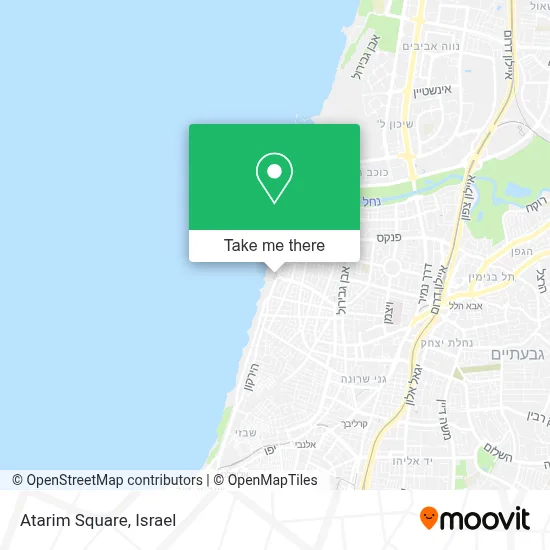
Directions to Atarim Square (Tel Aviv-Yafo) with public transportation
The following transit lines have routes that pass near Atarim Square
 Bus: 10, 115, 161, 2, 4.
- Israel Railways: Be'er Sheva Center - Herzliya, Binyamina - Ashkelon, Herzliya - Ashkelon, Herzliya - Be'er Sheva Center.
How to get to Atarim Square by bus?
Click on the bus route to see step by step directions with maps, line arrival times and updated time schedules.
From Ramat HaChayal, Tel Aviv-Yafo
35 minFrom Yarkon Cemetery, Petah Tikva
51 minFrom Assuta Hospital Habarzel 23, Tel Aviv-Yafo
34 minFrom 7 Jabotinsky - Mor Institute Bnei Brak, Bnei Brak
22 minFrom Em HaMoshavot, Petah Tikva
42 minFrom Herzliya Park, Herzliya
39 minFrom Beit Balev, Rishon LeZion
55 minFrom Beach 4, Rishon LeZion
50 minFrom Rabbi Kahaneman, Bnei Brak
37 minFrom Pi Glilot Complex, Ramat HaSharon
31 min
How to get to Atarim Square by Israel Railways?
Click on the Israel Railways route to see step by step directions with maps, line arrival times and updated time schedules.
Bus stops near Atarim Square in Tel Aviv-Yafo
Light Rail stations near Atarim Square in Tel Aviv-Yafo
- Arlozorov Light Rail Station, 20 min walk,VIEW
Bus lines to Atarim Square in Tel Aviv-Yafo
- 4, Tel Aviv-Yafo,VIEW
- 10, Bat Yam,VIEW
- 62, Ramat Gan,VIEW
- 115, Kiryat Ono,VIEW
- 161, Bnei Brak,VIEW
- 222, Modi'in-Maccabim-Re'ut,VIEW
- 296, Beit Dagan,VIEW
- 333, Ashdod,VIEW
- 445, Ben Gurion Airport,VIEW
- 463, Givat Shmuel,VIEW
- 466, Petah Tikva,VIEW
- 489, Holon,VIEW
- 555, Yehud,VIEW
- 566, Rosh HaAyin,VIEW
- 599, Petah Tikva,VIEW
- 705, Givatayim,VIEW
- 717, Tel Aviv-Yafo,VIEW
- 55, Kiryat Ono,VIEW
- 174, Rehovot,VIEW
- 418, Bat Yam,VIEW
What are the closest stations to Atarim Square?
The closest stations to Atarim Square are:
- Marina is 212 meters away, 3 min walk.
- Hayarkon/Ben Gurion Boulevard is 244 meters away, 4 min walk.
- HaYarkon/Arlozorov is 295 meters away, 4 min walk.
- Dizengoff/Ben Gurion Boulevard is 556 meters away, 8 min walk.
- Dizengoff/Yodfat is 607 meters away, 8 min walk.
- Arlozorov Light Rail Station is 1466 meters away, 20 min walk.
Which bus lines stop near Atarim Square?
These bus lines stop near Atarim Square: 10, 115, 161, 2.
Which Israel Railways lines stop near Atarim Square?
These Israel Railways lines stop near Atarim Square: Be'er Sheva Center - Herzliya, Binyamina - Ashkelon, Herzliya - Ashkelon, Herzliya - Be'er Sheva Center.
What’s the nearest light rail station to Atarim Square in Tel Aviv-Yafo?
The nearest light rail station to Atarim Square in Tel Aviv-Yafo is Arlozorov Light Rail Station. It’s a 20 min walk away.
What’s the nearest bus station to Atarim Square in Tel Aviv-Yafo?
The nearest bus station to Atarim Square in Tel Aviv-Yafo is Marina. It’s a 3 min walk away.
What time is the first light rail to Atarim Square in Tel Aviv-Yafo?
The R3 is the first light rail that goes to Atarim Square in Tel Aviv-Yafo. It stops nearby at 5:32 AM.
What time is the last light rail to Atarim Square in Tel Aviv-Yafo?
The R2 is the last light rail that goes to Atarim Square in Tel Aviv-Yafo. It stops nearby at 12:55 AM.
What time is the first bus to Atarim Square in Tel Aviv-Yafo?
The 445 is the first bus that goes to Atarim Square in Tel Aviv-Yafo. It stops nearby at 3:17 AM.
What time is the last bus to Atarim Square in Tel Aviv-Yafo?
The 445 is the last bus that goes to Atarim Square in Tel Aviv-Yafo. It stops nearby at 3:18 AM.
See Atarim Square, Tel Aviv-Yafo, on the map
Public Transit to Atarim Square in Tel Aviv-Yafo
Wondering how to get to Atarim Square in Tel Aviv-Yafo? Moovit helps you find the best way to get to Atarim Square with step-by-step directions from the nearest public transit station.
Moovit provides free maps and live directions to help you navigate through your city. View schedules, routes, timetables, and find out how long does it take to get to Atarim Square in real time.
Looking for the nearest stop or station to Atarim Square? Check out this list of stops closest to your destination: Marina; Hayarkon/Ben Gurion Boulevard; HaYarkon/Arlozorov; Dizengoff/Ben Gurion Boulevard; Dizengoff/Yodfat; Arlozorov Light Rail Station.
Bus: 10, 115, 161, 2, 4, 62, 717, 55, 174, 418, Green Savbus, Blue Savbus, 5, 8, 36, 39, 708.Israel Railways: Be'er Sheva Center - Herzliya, Binyamina - Ashkelon, Herzliya - Ashkelon, Herzliya - Be'er Sheva Center.
Want to see if there’s another route that gets you there at an earlier time? Moovit helps you find alternative routes or times. Get directions from and directions to Atarim Square easily from the Moovit App or Website.
We make riding to Atarim Square easy, which is why over 1.5 million users, including users in Tel Aviv-Yafo, trust Moovit as the best app for public transit. You don’t need to download an individual bus app or train app, Moovit is your all-in-one transit app that helps you find the best bus time or train time available.
For information on prices of bus, Israel Railways and light rail, costs and ride fares to Atarim Square, please check the Moovit app.
Use the app to navigate to popular places including to the airport, hospital, stadium, grocery store, mall, coffee shop, school, college, and university.
Atarim Square Address: Eliezer Peri street in Tel Aviv-Yafo
- Atarim Parking Lot,
- Shelter - Tel Aviv-Yafo, Eliezer Peri,
- Hayarkon 165,
- Shelter Tel Aviv-Yafo,
- HaYarkon Street,
- Leonardo Gordon Beach Tel Aviv,
- Topsea,
- Atarim Square,
- Atarim Square Parking Lot,
- Four du Soleil,
- Adidas Runbase Tel Aviv,
- Marina Ben Gurion Hostel,
- Panorama,
- Leonardo Art Tel Aviv,
- Baywatch Hotel,
- Adi Rotem - Thai Boxing,
- Stolero,
- Yamit Trade,
- Ben Gurion Boulevard,
- HaYarkon
Places Near Atarim Square (Tel Aviv-Yafo)
- Tel Hashomer Base, Ramat Gan,
- Ichilov Hospital, Tel Aviv-Yafo,
- Southern Medical Center, Ramat Negev Regional Council,
- Kashcafe, Kiryat Ata,
- Ramat Gan Stadium, Ramat Gan,
- HaKotel, Jerusalem,
- Bislach 17, Ramat Negev Regional Council,
- Dizengoff Center, Tel Aviv-Yafo,
- Glilot Complex, Hof HaSharon Regional Council,
- Gideon Camp - Military Base 7, Emek Lod Regional Council,
- Azrieli, Tel Aviv-Yafo,
- Carmel Market, Tel Aviv-Yafo,
- Bloomfield Stadium, Tel Aviv-Yafo,
- Beilinson Hospital, Petah Tikva,
- Yarkon Park, Tel Aviv-Yafo,
- Assuta Hospital - Ramat HaHayal, Tel Aviv-Yafo,
- Expo Tel Aviv, Tel Aviv-Yafo,
- Menora Mivtachim Arena, Tel Aviv-Yafo,
- Tel HaShomer North Gate, Ramat Gan,
- Moovit Office, Nes Ziona
How to get to popular places in Israel with public transit
Get around Tel Aviv-Yafo by public transit!
Traveling around Tel Aviv-Yafo has never been so easy. See step by step directions as you travel to any attraction, street or major public transit station. View bus and train schedules, arrival times, service alerts and detailed routes on a map, so you know exactly how to get to anywhere in Tel Aviv-Yafo.
When traveling to any destination around Tel Aviv-Yafo use Moovit's Live Directions with Get Off Notifications to know exactly where and how far to walk, how long to wait for your line, and how many stops are left. Moovit will alert you when it's time to get off — no need to constantly re-check whether yours is the next stop.
Wondering how to use public transit in Tel Aviv-Yafo or how to pay for public transit in Tel Aviv-Yafo? Moovit public transit app can help you navigate your way with public transit easily, and at minimum cost. It includes public transit fees, ticket prices, and costs. Looking for a map of Tel Aviv-Yafo public transit lines? Moovit public transit app shows all public transit maps in Tel Aviv-Yafo with all Bus, Israel Railways, Light Rail, Carmelit / Rachbalit and Shuttle routes and stops on an interactive map.
Israel has 5 transit type(s), including: Bus, Israel Railways, Light Rail, Carmelit / Rachbalit and Shuttle, operated by several transit agencies, including Dan, Tel Aviv Light Rail - Tevel - Red Line, Israel Railways, Egged, Metropoline, Kavim, Electra Afikim, Nateev Express, Extra, Extra Jerusalem, Jerusalem Light Rail - Kfir, Egged Jerusalem Envelope Route, Dan Badarom, Dan Beer-Sheva and Electra Afikim Transport