How to get to Atilano by bus?
Click on the bus route to see step by step directions with maps, line arrival times and updated time schedules.
From San Francisco de Los Romo-Aguascalientes, Aguascalientes
47 minFrom Minth de México, Aguascalientes
47 minFrom Los Arquitos Jesús Maria, ags., Aguascalientes
37 minFrom Plaza Cuatro Hojas, Aguascalientes
35 minFrom Fracc Rinconada Jesús María, Aguascalientes
67 minFrom Fracc. Bajio de las Palmas, Aguascalientes
32 minFrom Terminal 50, Aguascalientes
43 minFrom Avenida Ajedrecistas, Aguascalientes
46 minFrom CENTRAL CAMIONERA, Aguascalientes
41 minFrom CERESO, Aguascalientes
21 min
Bus stops near Atilano in Aguascalientes
Bus lines to Atilano in Aguascalientes
- RUTA 10, Uaa Sur,VIEW
- RUTA 12, Vicente Guerrero,VIEW
- RUTA 23, Villa Montaña,VIEW
- RUTA 24, Vistas De Oriente - Los Negritos,VIEW
- RUTA 25, Las Palmas,VIEW
- RUTA 41, Terminal Oriente (Penal),VIEW
- RUTA 41, Terminal Oriente (Alameda),VIEW
- RUTA 39, Centro (Jardínde Zaragoza),VIEW
- RUTA 03, La Ribera - UAA Sur,VIEW
- RUTA 04, Jesús María - Mahatma Gandhi,VIEW
- RUTA 05, Vicente Guerrero - La Ribera,VIEW
- RUTA 06, Jesús María - Mahatma Gandhi,VIEW
- RUTA 09, Cumbres III - Mahatma Gandhi,VIEW
- RUTA 09, Mahatma Gandhi - Los Laureles,VIEW
- RUTA 11, Mahatma Gandhi - Chichimeco,VIEW
- RUTA 34, Villa Montaña - UPA,VIEW
- RUTA 37, UTMA - Hacienda San Marcos,VIEW
- RUTA 38, Vicente Guerrero - Paso Blanco,VIEW
- RUTA 43, UTMA - Lomas de New York - San Antonio,VIEW
- RUTA 43, San Antonio - UTMA,VIEW
What are the closest stations to Atilano?
The closest stations to Atilano are:
- Licenciado Adolfo López Mateos Poniente, 303 is 200 meters away, 3 min walk.
- Calle Cristobal Colon, 402 is 264 meters away, 4 min walk.
- Dr. Jesus Diaz De Leon, 111 is 299 meters away, 5 min walk.
- Juan De Montoro, 207a is 415 meters away, 6 min walk.
- Jose Maria Chavez, 524 is 457 meters away, 7 min walk.
Which bus lines stop near Atilano?
These bus lines stop near Atilano: RUTA 01, RUTA 03, RUTA 05, RUTA 07, RUTA 11, RUTA 23, RUTA 29, RUTA 38, RUTA 41.
What’s the nearest bus station to Atilano in Aguascalientes?
The nearest bus station to Atilano in Aguascalientes is Licenciado Adolfo López Mateos Poniente, 303. It’s a 3 min walk away.
What time is the first bus to Atilano in Aguascalientes?
The RUTA 41 is the first bus that goes to Atilano in Aguascalientes. It stops nearby at 5:54 AM.
What time is the last bus to Atilano in Aguascalientes?
The RUTA 07 is the last bus that goes to Atilano in Aguascalientes. It stops nearby at 10:48 PM.
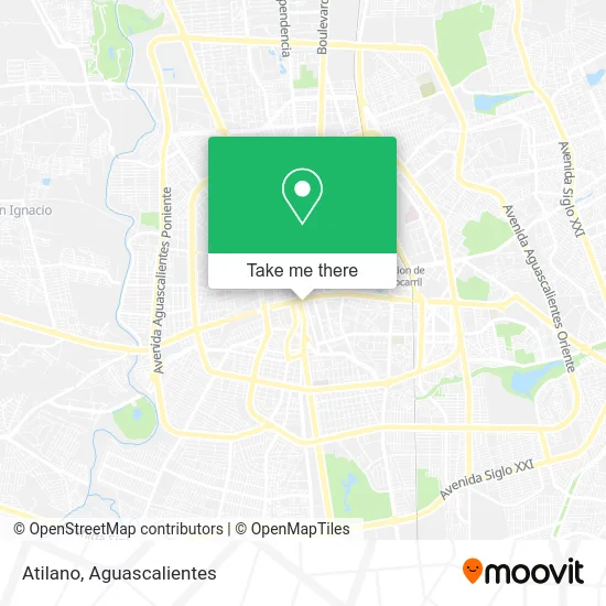
See Atilano, Aguascalientes, on the map
Public Transit to Atilano in Aguascalientes
Wondering how to get to Atilano in Aguascalientes? Moovit helps you find the best way to get to Atilano with step-by-step directions from the nearest public transit station.
Moovit provides free maps and live directions to help you navigate through your city. View schedules, routes, timetables, and find out how long does it take to get to Atilano in real time.
Looking for the nearest stop or station to Atilano? Check out this list of stops closest to your destination: Licenciado Adolfo López Mateos Poniente; Calle Cristobal Colon; Dr. Jesus Diaz De Leon; Juan De Montoro; Jose Maria Chavez.
Bus: RUTA 01, RUTA 03, RUTA 05, RUTA 07, RUTA 11, RUTA 23, RUTA 29, RUTA 38, RUTA 41, RUTA 10, RUTA 12, RUTA 24, RUTA 25, RUTA 39, RUTA 04, RUTA 06, RUTA 09, RUTA 48.
Want to see if there’s another route that gets you there at an earlier time? Moovit helps you find alternative routes or times. Get directions from and directions to Atilano easily from the Moovit App or Website.
We make riding to Atilano easy, which is why over 1.5 million users, including users in Aguascalientes, trust Moovit as the best app for public transit. You don’t need to download an individual bus app or train app, Moovit is your all-in-one transit app that helps you find the best bus time or train time available.
For information on prices of bus, costs and ride fares to Atilano, please check the Moovit app.
Use the app to navigate to popular places including to the airport, hospital, stadium, grocery store, mall, coffee shop, school, college, and university.
Atilano Address: Atilano, Calle Héroes de Chapultepec, Barrio El Encino, 20240 Aguascalientes, Aguascalientes street in Aguascalientes
- Avenida Lic Adolfo López Mateos Pte,
- el puerto de mazatlan,
- Tony Súper Papelería,
- Opticas Cristal,
- Hospital de Joyas,
- Suskaa Campamentos,
- ACADEMIA NUEVA GENERACION DE AGUASCALIENTES, S.C.,
- Inaes,
- Cristóbal Colón #421,
- Refrigerantes de San Luis,
- El Heraldo De Aguascalientes,
- Caja Popular Mexicana Sucursal 28 Centro Ags,
- Heroes de Chapultepec 217,
- Jardín de los Palacios,
- Telecom Telegrafos,
- Funerales Arriaga,
- Distribuidora De Globos Ags,
- Plaza Patria,
- Palacio Del Gobierno De Aguascalientes,
- ISSSSPEA
Places Near Atilano (Aguascalientes)
- Universidad Autónoma de Aguascalientes, Aguascalientes,
- Ciudad industrial, Aguascalientes,
- Blvd. Luis Donaldo Colosio, Aguascalientes,
- Jesús María, Aguascalientes,
- Aeropuerto de Aguascalientes S.A. de C.V., Aguascalientes,
- Central De Autobuses, Aguascalientes,
- Hospital Imss No. 3, Aguascalientes,
- La Isla San Marcos, Aguascalientes,
- Nuevo Hospital Hidalgo, Aguascalientes,
- ESPACIOS, Aguascalientes,
- Isla San Marcos, Aguascalientes,
- Villas de Nuestra Señora de la Asunción, Aguascalientes,
- Imss Clinica 1, Aguascalientes,
- Parque Las Tres Centurias, Aguascalientes,
- Agropecuario, Aguascalientes,
- Centro, Aguascalientes,
- Centro Comercial Altaria, Aguascalientes,
- Terminal De Combis, Aguascalientes,
- Villasuncion, Aguascalientes,
- clinica 3 uaa, Aguascalientes
How to get to popular places in Aguascalientes with public transit
Get around Aguascalientes by public transit!
Traveling around Aguascalientes has never been so easy. See step by step directions as you travel to any attraction, street or major public transit station. View bus and train schedules, arrival times, service alerts and detailed routes on a map, so you know exactly how to get to anywhere in Aguascalientes.
When traveling to any destination around Aguascalientes use Moovit's Live Directions with Get Off Notifications to know exactly where and how far to walk, how long to wait for your line, and how many stops are left. Moovit will alert you when it's time to get off — no need to constantly re-check whether yours is the next stop.
Wondering how to use public transit in Aguascalientes or how to pay for public transit in Aguascalientes? Moovit public transit app can help you navigate your way with public transit easily, and at minimum cost. It includes public transit fees, ticket prices, and costs. Looking for a map of Aguascalientes public transit lines? Moovit public transit app shows all public transit maps in Aguascalientes with all bus routes and stops on an interactive map.
Aguascalientes has 1 transit type(s), including: bus, operated by several transit agencies, including Coordinación General de Movilidad