How to get to Atlantic Wireless by bus?
Click on the bus route to see step by step directions with maps, line arrival times and updated time schedules.
From Adventist HealthCare White Oak Medical Center-ER (Adventist White Oak Med Ctr-ER), Montgomery County
47 minFrom IKEA - College Park, Prince George's County
64 minFrom Riderwood Senior Living Community, Montgomery County
37 minFrom Mva - Beltsville, Prince George's County
74 minFrom Beltsville, Maryland, Prince George's County
67 minFrom Brookside Gardens, Montgomery County
53 minFrom IKEA, Prince George's County
68 minFrom Laurel, Maryland, Prince George's County
99 minFrom Georgia Ave & Icc Park & Ride Lot, Montgomery County
60 minFrom Lincoln Tech, Howard County
170 min
Bus stops near Atlantic Wireless in Montgomery County
Bus lines to Atlantic Wireless in Montgomery County
What are the closest stations to Atlantic Wireless?
The closest stations to Atlantic Wireless are:
- Old Columbia Rd+National Dr is 280 yards away, 4 min walk.
- Burtonsville Park & Ride is 606 yards away, 8 min walk.
- Burtonsville Park & Ride & is 689 yards away, 9 min walk.
Which bus line stops near Atlantic Wireless?
M52 (North To Burtonsville)
What’s the nearest bus station to Atlantic Wireless in Montgomery County?
The nearest bus station to Atlantic Wireless in Montgomery County is Old Columbia Rd+National Dr. It’s a 4 min walk away.
What time is the first bus to Atlantic Wireless in Montgomery County?
The M52 is the first bus that goes to Atlantic Wireless in Montgomery County. It stops nearby at 4:20 AM.
What time is the last bus to Atlantic Wireless in Montgomery County?
The 201 is the last bus that goes to Atlantic Wireless in Montgomery County. It stops nearby at 10:51 PM.
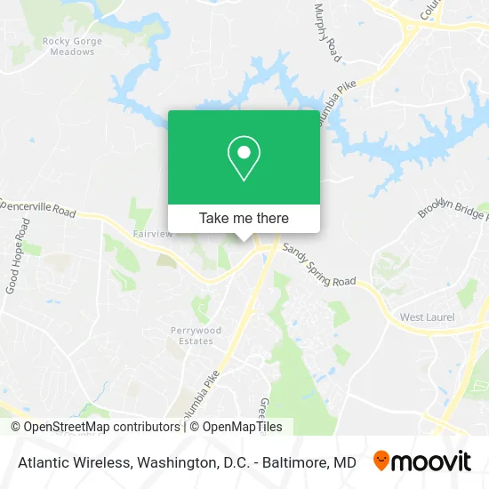
See Atlantic Wireless, Montgomery County, on the map
Public Transit to Atlantic Wireless in Montgomery County
Wondering how to get to Atlantic Wireless in Montgomery County? Moovit helps you find the best way to get to Atlantic Wireless with step-by-step directions from the nearest public transit station.
Moovit provides free maps and live directions to help you navigate through your city. View schedules, routes, timetables, and find out how long does it take to get to Atlantic Wireless in real time.
Looking for the nearest stop or station to Atlantic Wireless? Check out this list of stops closest to your destination: Old Columbia Rd+National Dr; Burtonsville Park & Ride; Burtonsville Park & Ride &.
Bus: M52, 201, 203, 305, 315, FLASH.
Want to see if there’s another route that gets you there at an earlier time? Moovit helps you find alternative routes or times. Get directions from and directions to Atlantic Wireless easily from the Moovit App or Website.
We make riding to Atlantic Wireless easy, which is why over 1.5 million users, including users in Montgomery County, trust Moovit as the best app for public transit. You don’t need to download an individual bus app or train app, Moovit is your all-in-one transit app that helps you find the best bus time or train time available.
For information on prices of bus, costs and ride fares to Atlantic Wireless, please check the Moovit app.
Use the app to navigate to popular places including to the airport, hospital, stadium, grocery store, mall, coffee shop, school, college, and university.
Atlantic Wireless Address: 15610 Old Columbia Pike Burtonsville, MD 20866 street in Montgomery County
- American Lock & Key,
- Shell,
- Hissho Sushi Giant,
- First National Bank ATM,
- Keyme Locksmiths,
- STARBUCKS,
- Alonzo T. Thomas, DMD,
- William F. Milton, III, DDS,
- Khatereh Nematollahi, DDS,
- Building and Engineering Elite Services,
- Church of the Holy Donut, Burtonsville,
- Old Columbia Pike Locksmith Company,
- Libertyx Bitcoin ATM,
- Volta,
- Burtonsville Elementary School,
- Wireless Zone,
- MCG Abs Burtonsville,
- Domino's Pizza,
- United Healthcare,
- 15707 Columbia Pike Parking
Places Near Atlantic Wireless (Montgomery County)
- National Mall, Washington,
- Washington National Cathedral, Washington,
- Washington DC VA Medical Center, Washington,
- Basilica of the National Shrine, Washington,
- Pennsylvania Ave NW (3rd st and pennsylvania), Washington,
- Amazon Hq2, Arlington County,
- National Zoo, Washington,
- Georgetown, Washington,
- Warner Theatre, Washington,
- The Anthem, Washington,
- Westfield Montgomery Mall, Montgomery County,
- Capital One Arena, Washington,
- Museum Of The Bible, Washington,
- Rock Creek Tennis Center, Washington,
- Sibley Memorial Hospital, Washington,
- Camden Yards, Baltimore,
- M&T Bank Stadium, Baltimore,
- National Museum of African American History and Culture, Washington,
- Marriott Marquis Washington, DC, Washington,
- PG Mall, Prince George's County
How to get to popular places in Washington, D.C. - Baltimore, MD with public transit
Get around Montgomery County by public transit!
Traveling around Montgomery County has never been so easy. See step by step directions as you travel to any attraction, street or major public transit station. View bus and train schedules, arrival times, service alerts and detailed routes on a map, so you know exactly how to get to anywhere in Montgomery County.
When traveling to any destination around Montgomery County use Moovit's Live Directions with Get Off Notifications to know exactly where and how far to walk, how long to wait for your line, and how many stops are left. Moovit will alert you when it's time to get off — no need to constantly re-check whether yours is the next stop.
Wondering how to use public transit in Montgomery County or how to pay for public transit in Montgomery County? Moovit public transit app can help you navigate your way with public transit easily, and at minimum cost. It includes public transit fees, ticket prices, and costs. Looking for a map of Montgomery County public transit lines? Moovit public transit app shows all public transit maps in Montgomery County with all Bus, Train, Metro, Light Rail and Ferry routes and stops on an interactive map.
Washington, D.C. - Baltimore, MD has 5 transit type(s), including: Bus, Train, Metro, Light Rail and Ferry, operated by several transit agencies, including WMATA, Montgomery County Ride On, Fairfax Connector, TheBus, PRTC, DASH - Alexandria, Arlington Transit (ART), RTA of Central Maryland, MDOT MTA, MDOT MTA Light RailLink, MDOT MTA Commuter Bus, MDOT MTA Local Bus, FXBGO!, Virginia Railway Express (VRE) and MARC