How to get to Atlas by bus?
Click on the bus route to see step by step directions with maps, line arrival times and updated time schedules.
From Blandy-les-Tours, Blandy
67 minFrom Ile de loisir de Bois Le Roi, Bois-Le-Roi
55 minFrom Centre Hospitalier de Melun, Melun
60 minFrom Carré Sénart, Lieusaint
115 minFrom Barbizon, Barbizon
65 minFrom Safran, Reau
79 minFrom Corbeil-Essonnes, Corbeil-Essonnes
206 minFrom Moret Sur Loing, Moret-Loing-Et-Orvanne
33 minFrom Centre Hospitalier Corbeil-Essonnes, Corbeil-Essonnes
305 minFrom Vert-Saint-Denis, Vert-Saint-Denis
95 min
How to get to Atlas by train?
Click on the train route to see step by step directions with maps, line arrival times and updated time schedules.
Bus stops near Atlas in Fontainebleau
Train station near Atlas in Fontainebleau
- Fontainebleau - Avon, 24 min walk,VIEW
Bus lines to Atlas in Fontainebleau
- 3401, Gare de Fontainebleau–Avon (Quai 9),VIEW
- 3430, Palais de Justice,VIEW
- 3403, Gare de Fontainebleau–Avon (Quai 9),VIEW
- 3408, Crevat Jaurès,VIEW
- 3418, Crevat Jaurès,VIEW
- 3417, Stade de la Faisanderie,VIEW
- 3420, Route de Corbeil,VIEW
- 3421, Centre Commercial,VIEW
- 3423, Jacques Durand,VIEW
- 3404, La Fourche,VIEW
- 7711, Gare de Fontainebleau–Avon (Quai 8),VIEW
- 34, Place Verdun,VIEW
- 3531, Lycée Uruguay,VIEW
- N137, Avenue de Surville,VIEW
- 3443, Sivry D605,VIEW
- 3445, Clos de la Mulatière,VIEW
What are the closest stations to Atlas?
The closest stations to Atlas are:
- Palais de Justice is 102 meters away, 2 min walk.
- Aristide Briand is 218 meters away, 3 min walk.
- Les Maréchaux is 370 meters away, 5 min walk.
- Place de L'Étape is 372 meters away, 5 min walk.
- Fontainebleau - Avon is 1826 meters away, 24 min walk.
Which train line stops near Atlas?
R (Montargis/ Montereau)
Which bus lines stop near Atlas?
These bus lines stop near Atlas: 34, 3401, 3445.
What’s the nearest train station to Atlas in Fontainebleau?
The nearest train station to Atlas in Fontainebleau is Fontainebleau - Avon. It’s a 24 min walk away.
What’s the nearest bus station to Atlas in Fontainebleau?
The nearest bus station to Atlas in Fontainebleau is Palais de Justice. It’s a 2 min walk away.
What time is the first train to Atlas in Fontainebleau?
The R is the first train that goes to Atlas in Fontainebleau. It stops nearby at 5:31 AM.
What time is the last train to Atlas in Fontainebleau?
The R is the last train that goes to Atlas in Fontainebleau. It stops nearby at 1:27 AM.
What time is the first bus to Atlas in Fontainebleau?
The N137 is the first bus that goes to Atlas in Fontainebleau. It stops nearby at 5:29 AM.
What time is the last bus to Atlas in Fontainebleau?
The SOIR is the last bus that goes to Atlas in Fontainebleau. It stops nearby at 12:15 AM.
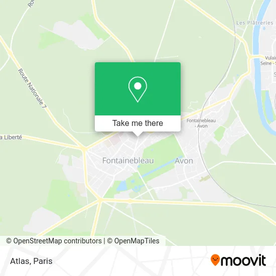
See Atlas, Fontainebleau, on the map
Public Transit to Atlas in Fontainebleau
Wondering how to get to Atlas in Fontainebleau? Moovit helps you find the best way to get to Atlas with step-by-step directions from the nearest public transit station.
Moovit provides free maps and live directions to help you navigate through your city. View schedules, routes, timetables, and find out how long does it take to get to Atlas in real time.
Looking for the nearest stop or station to Atlas? Check out this list of stops closest to your destination: Palais de Justice; Aristide Briand; Les Maréchaux; Place de L'Étape; Fontainebleau - Avon.
Train: R.Bus: 34, 3401, 3445, 3430, 3403, 3408, 3418, 3417, 3420, 3421, 3423, 3404, 7711, 3531, N137.
Want to see if there’s another route that gets you there at an earlier time? Moovit helps you find alternative routes or times. Get directions from and directions to Atlas easily from the Moovit App or Website.
We make riding to Atlas easy, which is why over 1.5 million users, including users in Fontainebleau, trust Moovit as the best app for public transit. You don’t need to download an individual bus app or train app, Moovit is your all-in-one transit app that helps you find the best bus time or train time available.
For information on prices of bus, RER and train, costs and ride fares to Atlas, please check the Moovit app.
Use the app to navigate to popular places including to the airport, hospital, stadium, grocery store, mall, coffee shop, school, college, and university.
Atlas Address: 185 Rue Grande 77300 Fontainebleau street in Fontainebleau
- Épicerie,
- Vival by Casino (Sarl Bam),
- AVIS,
- Mediacompact Factory,
- Nannybag Luggage Storage,
- Syfal Syndicat Français des Allergologues,
- Edouard Sève,
- Jean Marc Laurent,
- Haab Léonie,
- Latour Cécile,
- Fontaineblow,
- La Poste Annexe les Marechaux,
- La Banque Postale,
- Lesvignes Franck,
- Mairet Jean-Pierre Robert,
- Chic And Blo,
- Club des Cadres Sud 77,
- École Élémentaire Paul Jozon,
- Agence d'Intérim Proman Bleau,
- Audition Santé
Places Near Atlas (Fontainebleau)
- Marché Saint-Pierre, Paris,
- 29 Rue Manin, Paris,
- Atelier Des Lumieres, Paris,
- Hôpital Saint-Joseph, Paris,
- Galeries Lafayette, Paris,
- Hôpital Necker, Paris,
- Hopital Foch, Suresnes,
- Beaugrenelle, Paris,
- Hôpital de la Pitié-Salpêtrière, Paris,
- Hôpital Beaujon, Clichy,
- Hôpital Henri Mondor, Creteil,
- Hôpital Pitié Salpêtrière, Paris,
- Centre Hospitalier des 15/20, Paris,
- Hopital Lariboisière, Paris,
- Galeries Lafayette Haussmann, Paris,
- Gare Routière Flixbus, Paris,
- Créteil Soleil, Creteil,
- Hôpital Cochin, Paris,
- Théâtre Mogador, Paris,
- Fondation Louis Vuitton, Paris
How to get to popular places in Paris with public transit
Get around Fontainebleau by public transit!
Traveling around Fontainebleau has never been so easy. See step by step directions as you travel to any attraction, street or major public transit station. View bus and train schedules, arrival times, service alerts and detailed routes on a map, so you know exactly how to get to anywhere in Fontainebleau.
When traveling to any destination around Fontainebleau use Moovit's Live Directions with Get Off Notifications to know exactly where and how far to walk, how long to wait for your line, and how many stops are left. Moovit will alert you when it's time to get off — no need to constantly re-check whether yours is the next stop.
Wondering how to use public transit in Fontainebleau or how to pay for public transit in Fontainebleau? Moovit public transit app can help you navigate your way with public transit easily, and at minimum cost. It includes public transit fees, ticket prices, and costs. Looking for a map of Fontainebleau public transit lines? Moovit public transit app shows all public transit maps in Fontainebleau with all Bus, Train, Metro, Light Rail, RER, Funicular and Gondola routes and stops on an interactive map.
Paris has 7 transit type(s), including: Bus, Train, Metro, Light Rail, RER, Funicular and Gondola, operated by several transit agencies, including RATP, RER, RER Bus de remplacement, Train, Train Bus de remplacement, Tramway Bus de remplacement, TER, ADP, Magical Shuttle, Argenteuil - Boucles de Seine, Autocars Dominique, Bièvre, Brie et 2 Morin, Le Bus - C.C. du Clermontois and Cœur d’Essonne