Directions to Atm (Talbot County) with public transportation
The following transit lines have routes that pass near Atm
 Bus: 1, C, D, WALMART - TOWN PARKING LOT, HAPS BUILDING - WALMART.
How to get to Atm by bus?
Click on the bus route to see step by step directions with maps, line arrival times and updated time schedules.
From U.S. Rt. 50 (Exit 23) West St / MD 450, Anne Arundel County
165 minFrom Whole Foods Market, Anne Arundel County
174 minFrom Anne Arundel Community College, Anne Arundel County
242 minFrom Sajak Pavilion - AAMC, Anne Arundel County
176 minFrom Gate #8 - U.S. Naval Academy, Anne Arundel County
227 minFrom Arnold, MD, Anne Arundel County
248 minFrom Harry S. Truman Park & Ride, Anne Arundel County
203 min
Bus stops near Atm in Talbot County
Bus lines to Atm in Talbot County
What are the closest stations to Atm?
The closest stations to Atm are:
- East Ave. at Goldsborough is 179 yards away, 3 min walk.
- Doverbrook is 463 yards away, 6 min walk.
- Easton Post Office is 649 yards away, 8 min walk.
- Goldsborough & Calvert is 762 yards away, 10 min walk.
- High & Choptank is 1039 yards away, 13 min walk.
- 612/Greyhound is 1094 yards away, 13 min walk.
- Saints Peter & Paul Elementary School is 1136 yards away, 14 min walk.
Which bus line stops near Atm?
1
What’s the nearest bus station to Atm in Talbot County?
The nearest bus station to Atm in Talbot County is East Ave. at Goldsborough. It’s a 3 min walk away.
What time is the first bus to Atm in Talbot County?
The HIGH & CHOPTANK - WALMART is the first bus that goes to Atm in Talbot County. It stops nearby at 5:50 AM.
What time is the last bus to Atm in Talbot County?
The D is the last bus that goes to Atm in Talbot County. It stops nearby at 6:33 PM.
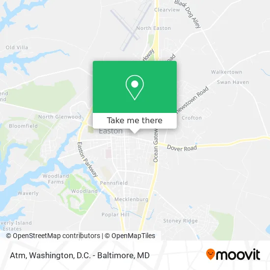
See Atm, Talbot County, on the map
Public Transit to Atm in Talbot County
Wondering how to get to Atm in Talbot County? Moovit helps you find the best way to get to Atm with step-by-step directions from the nearest public transit station.
Moovit provides free maps and live directions to help you navigate through your city. View schedules, routes, timetables, and find out how long does it take to get to Atm in real time.
Looking for the nearest stop or station to Atm? Check out this list of stops closest to your destination: East Ave. at Goldsborough; Doverbrook; Easton Post Office; Goldsborough & Calvert; High & Choptank; 612/Greyhound; Saints Peter & Paul Elementary School.
Bus: 1, C, D, WALMART - TOWN PARKING LOT, HAPS BUILDING - WALMART, HIGH & CHOPTANK - WALMART, 5, 11, 4.
Want to see if there’s another route that gets you there at an earlier time? Moovit helps you find alternative routes or times. Get directions from and directions to Atm easily from the Moovit App or Website.
We make riding to Atm easy, which is why over 1.5 million users, including users in Talbot County, trust Moovit as the best app for public transit. You don’t need to download an individual bus app or train app, Moovit is your all-in-one transit app that helps you find the best bus time or train time available.
For information on prices of bus, costs and ride fares to Atm, please check the Moovit app.
Use the app to navigate to popular places including to the airport, hospital, stadium, grocery store, mall, coffee shop, school, college, and university.
Atm Address: 10 East Ave Easton, MD 21601 street in Talbot County
- Womb Clinic,
- Wil & Son Landscaping,
- G.T.E Lawn Care & Land Management,
- JC Quality Remodeling,
- Easton MD Plumbers,
- Ecoturf,
- Velly's Mobile Auto Detailing,
- Albright Lawn Service,
- Ar Expert,
- Gigi's Cleaning Services,
- Elevate Student Ministries,
- Oakview Candle Company,
- Le Hatchery Galleria,
- Rude Burger,
- The Chesapeake Bay Maritime Museum,
- Super Clean Mobile Car & Boat Detailing,
- Easton Associates,
- Mk2 Mayday,
- Flight Helmet,
- Chesapeake Graphics
Places Near Atm (Talbot County)
- Georgetown, Washington,
- Capital One Arena, Washington,
- Washington National Cathedral, Washington,
- Washington DC VA Medical Center, Washington,
- National Zoo, Washington,
- Westfield Montgomery Mall, Montgomery County,
- Rock Creek Tennis Center, Washington,
- M&T Bank Stadium, Baltimore,
- PG Mall, Prince George's County,
- Amazon Hq2, Arlington County,
- National Mall, Washington,
- Camden Yards, Baltimore,
- Museum Of The Bible, Washington,
- Sibley Memorial Hospital, Washington,
- Basilica of the National Shrine, Washington,
- Pennsylvania Ave NW (3rd st and pennsylvania), Washington,
- The Anthem, Washington,
- Warner Theatre, Washington,
- National Museum of African American History and Culture, Washington,
- Marriott Marquis Washington, DC, Washington
How to get to popular places in Washington, D.C. - Baltimore, MD with public transit
Get around Talbot County by public transit!
Traveling around Talbot County has never been so easy. See step by step directions as you travel to any attraction, street or major public transit station. View bus and train schedules, arrival times, service alerts and detailed routes on a map, so you know exactly how to get to anywhere in Talbot County.
When traveling to any destination around Talbot County use Moovit's Live Directions with Get Off Notifications to know exactly where and how far to walk, how long to wait for your line, and how many stops are left. Moovit will alert you when it's time to get off — no need to constantly re-check whether yours is the next stop.
Wondering how to use public transit in Talbot County or how to pay for public transit in Talbot County? Moovit public transit app can help you navigate your way with public transit easily, and at minimum cost. It includes public transit fees, ticket prices, and costs. Looking for a map of Talbot County public transit lines? Moovit public transit app shows all public transit maps in Talbot County with all Bus, Train, Metro, Light Rail and Ferry routes and stops on an interactive map.
Washington, D.C. - Baltimore, MD has 5 transit type(s), including: Bus, Train, Metro, Light Rail and Ferry, operated by several transit agencies, including WMATA, Montgomery County Ride On, Fairfax Connector, TheBus, PRTC, DASH - Alexandria, Arlington Transit (ART), RTA of Central Maryland, MDOT MTA, MDOT MTA Light RailLink, MDOT MTA Commuter Bus, MDOT MTA Local Bus, FXBGO!, Virginia Railway Express (VRE) and MARC