How to get to Atm by bus?
Click on the bus route to see step by step directions with maps, line arrival times and updated time schedules.
How to get to Atm by train?
Click on the train route to see step by step directions with maps, line arrival times and updated time schedules.
Bus stops near Atm in Schladming
Funicular station near Atm in Schladming
- Schladming Planai Seilbahn Talstation, 55 min walk,VIEW
Train stations near Atm in Schladming
- Schladming Bahnhof, 56 min walk,VIEW
Bus lines to Atm in Schladming
- 900, Winkl Abenteuerpark,VIEW
- 902, Radstadt Postamt,VIEW
- 960, Schladming Rathausplatz,VIEW
- 965D, Schladming Planet Planai,VIEW
- 965, Obere Klaus - Schladming - Untere Klaus,VIEW
- 971, Schladming - Rohrmoos - Hochwurzen - Untertal,VIEW
- 972, Schladming - Rohrmoos - Hochwurzen - Preunegg - Ursprungalm,VIEW
- 973, Schladming - Rohrmoos - Hochwurzen - Untertal - Obertal - Eschachalm,VIEW
- 974, Schladming - Rohrmoos - Hochwurzen - Untertal - Janerbrücke - Waldhäuslalm,VIEW
- 976, Schladming - Haus - Ruperting - Steirischer Bodensee,VIEW
- 965B, Schladming Planet Planai - Rathausplatz - Hofer-Markt - Obere Klaus - Zentrum Obere Klaus - Planai West - Planet Planai,VIEW
- BWP, Bike- & Wanderbus | Schladming - Hochwurzen - Reiteralm Preunegg Jet,VIEW
- 965C, Schladming Planet Planai - Lendplatz / Bahnhof - Planai West,VIEW
- N97, Nachtbus | Schladming - Mauterndorf / Rohrmoos - Hochwurzen - Untertal,VIEW
- 900S, Skibus | (Gröbming -) Hauser Kaibling - Planai - Reiteralm,VIEW
- SV250, Schladming Bahnhof,VIEW
- 965A, Schladming Zentrum,VIEW
What are the closest stations to Atm?
The closest stations to Atm are:
- Schladming Lendplatz is 93 meters away, 2 min walk.
- Schladming Bahnhof is 489 meters away, 7 min walk.
- Schladming Zentrum is 494 meters away, 7 min walk.
- Schladming Planai Seilbahn Talstation is 4273 meters away, 55 min walk.
Which train lines stop near Atm?
These train lines stop near Atm: A8, R9.
Which bus lines stop near Atm?
These bus lines stop near Atm: 900, 902.
What’s the nearest bus station to Atm in Schladming?
The nearest bus station to Atm in Schladming is Schladming Lendplatz. It’s a 2 min walk away.
What time is the first train to Atm in Schladming?
The 960-A is the first train that goes to Atm in Schladming. It stops nearby at 4:42 AM.
What time is the last train to Atm in Schladming?
The A17 is the last train that goes to Atm in Schladming. It stops nearby at 12:27 AM.
What time is the first bus to Atm in Schladming?
The 900 is the first bus that goes to Atm in Schladming. It stops nearby at 5:43 AM.
What time is the last bus to Atm in Schladming?
The 971 is the last bus that goes to Atm in Schladming. It stops nearby at 7:49 PM.
What time is the first funicular to Atm in Schladming?
The PLA is the first funicular that goes to Atm in Schladming. It stops nearby at 9:00 AM.
What time is the last funicular to Atm in Schladming?
The PLA is the last funicular that goes to Atm in Schladming. It stops nearby at 5:00 PM.
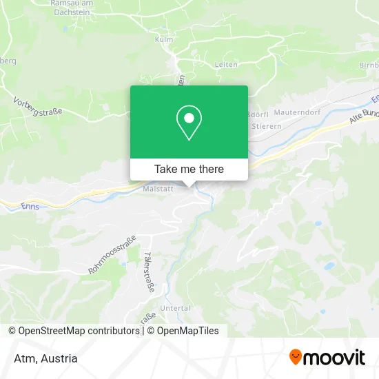
See Atm, Schladming, on the map
Public Transit to Atm in Schladming
Wondering how to get to Atm in Schladming? Moovit helps you find the best way to get to Atm with step-by-step directions from the nearest public transit station.
Moovit provides free maps and live directions to help you navigate through your city. View schedules, routes, timetables, and find out how long does it take to get to Atm in real time.
Looking for the nearest stop or station to Atm? Check out this list of stops closest to your destination: Schladming Lendplatz; Schladming Bahnhof; Schladming Zentrum; Schladming Planai Seilbahn Talstation.
Train: A8, R9, 960-A, A17, REX3, 960-A.Bus: 900, 902, 960, 965D, 965, 971, 972, 973, 974, 965A.Funicular: PLA.
Want to see if there’s another route that gets you there at an earlier time? Moovit helps you find alternative routes or times. Get directions from and directions to Atm easily from the Moovit App or Website.
We make riding to Atm easy, which is why over 1.5 million users, including users in Schladming, trust Moovit as the best app for public transit. You don’t need to download an individual bus app or train app, Moovit is your all-in-one transit app that helps you find the best bus time or train time available.
For information on prices of train and bus, costs and ride fares to Atm, please check the Moovit app.
Use the app to navigate to popular places including to the airport, hospital, stadium, grocery store, mall, coffee shop, school, college, and university.
Atm Address: Salzburger Straße 534 8970 Schladming street in Schladming
- Gruber Joachim E.U,
- Ferienwohnungen Schütter,
- Gartengestalltung Gerald Marx,
- Restaurant Dorfstöckl,
- Appartement Hochfilzer,
- Dagmar Steiner Steirisches Dirndl,
- Appartements Freiraum,
- Appatements Stocker,
- Brau Union Oesterreich,
- Loisi,
- Dr. Helmut Thier,
- Bahnhofstraße 377 Parking,
- Tritscher Liegenschaftsverwaltungs GmbH,
- Ski Wm Schladming 2013,
- Appartements Vorstadtstub'n,
- Ringhofer GmbH,
- Book-in Hotelsoftware,
- Malerei - Farben Weitgasser,
- Landhaus Sonnenschein,
- Bliem Living
Places Near Atm (Schladming)
- Schiffsanleger Wien-Nussdorf, Döbling,
- Klinik Floridsdorf (Krankenhaus Nord), Floridsdorf,
- Thomas-Klestil-Platz, Landstraße,
- Wien Rennbahn Freudenau, Leopoldstadt,
- 10er Marie, Ottakring,
- Türkenschanzpark, Währing,
- Setagayapark, Döbling,
- Feuerhalle Simmering, Simmering,
- Kabarett Simpl, 1., Innere Stadt,
- Lugner City, Rudolfsheim-Fünfhaus,
- Auhof-Center, Penzing,
- Ghegastraße 3, Landstraße,
- Schweizerhaus (Karl Kolariks Schweizerhaus), Leopoldstadt,
- Zentralfriedhof Halle 3, Simmering,
- Raimund-Theater, Mariahilf,
- Strandbad Gänsehäufel, Donaustadt,
- Ronacher, 1., Innere Stadt,
- Donauzentrum, Donaustadt,
- Mariahilfer Strasse, Mariahilf,
- Leopoldauer Alm, Floridsdorf
How to get to popular places in Austria with public transit
Get around Schladming by public transit!
Traveling around Schladming has never been so easy. See step by step directions as you travel to any attraction, street or major public transit station. View bus and train schedules, arrival times, service alerts and detailed routes on a map, so you know exactly how to get to anywhere in Schladming.
When traveling to any destination around Schladming use Moovit's Live Directions with Get Off Notifications to know exactly where and how far to walk, how long to wait for your line, and how many stops are left. Moovit will alert you when it's time to get off — no need to constantly re-check whether yours is the next stop.
Wondering how to use public transit in Schladming or how to pay for public transit in Schladming? Moovit public transit app can help you navigate your way with public transit easily, and at minimum cost. It includes public transit fees, ticket prices, and costs. Looking for a map of Schladming public transit lines? Moovit public transit app shows all public transit maps in Schladming with all Bus, Train, Subway, Light Rail, Ferry and Funicular routes and stops on an interactive map.
Austria has 6 transit type(s), including: Bus, Train, Subway, Light Rail, Ferry and Funicular, operated by several transit agencies, including Wiener Linien GmbH & Co KG, Vienna Airport Lines, OEBB Personenverkehr AG Kundenservice, Wiener Lokalbahnen GmbH, City Air Terminal Betriebsgesellschaft m.b.H., CAT, Österreichische Postbus AG, VOR GmbH, Graz Linien, Graz-Köflacher Bahn und Busbetrieb GmbH, Steiermarkbahn und Bus GmbH, Linz Linien GmbH, Salzburg AG (Salzburger Lokalbahn), Salzburg AG (OBus) and KMG Klagenfurt Mobil GmbH
Public transit lines with stations closest to Atm in Schladming
Train lines with stations closest to Atm in Schladming
Bus lines with stations closest to Atm in Schladming
Schladming Lendplatz
 965Obere Klaus - Schladming - Untere Klaus
- 971Schladming - Rohrmoos - Hochwurzen - Untertal
- 972Schladming - Rohrmoos - Hochwurzen - Preunegg - Ursprungalm
- 973Schladming - Rohrmoos - Hochwurzen - Untertal - Obertal - Eschachalm
- 974Schladming - Rohrmoos - Hochwurzen - Untertal - Janerbrücke - Waldhäuslalm