How to get to Atm Cvs by bus?
Click on the bus route to see step by step directions with maps, line arrival times and updated time schedules.
From Yonkers, NY, Yonkers
79 minFrom Empire City Casino, Yonkers
62 minFrom One Larkin Plaza, Yonkers
81 minFrom White Plains, NY, White Plains
34 minFrom Westchester Mall, White Plains
35 minFrom Rye Playland, Rye
110 minFrom Co-Op City, Bronx
82 minFrom Cross County Mall, Yonkers
60 minFrom Regeneron Pharmaceuticals Inc, Tarrytown
87 minFrom New Rochelle, NY, New Rochelle
35 min
How to get to Atm Cvs by train?
Click on the train route to see step by step directions with maps, line arrival times and updated time schedules.
Bus stops near Atm Cvs in New Rochelle
Train station near Atm Cvs in New Rochelle
- Hartsdale, 53 min walk,VIEW
Bus lines to Atm Cvs in New Rochelle
What are the closest stations to Atm Cvs?
The closest stations to Atm Cvs are:
- Wilmot Rd @ Scarsdale Shopping Ctr is 101 yards away, 2 min walk.
- Wilmot Rd @ Baraud Rd is 626 yards away, 8 min walk.
- Hartsdale is 4488 yards away, 53 min walk.
Which bus lines stop near Atm Cvs?
These bus lines stop near Atm Cvs: 63, 66.
Which train line stops near Atm Cvs?
2 (515#| North White Plains)
What’s the nearest bus station to Atm Cvs in New Rochelle?
The nearest bus station to Atm Cvs in New Rochelle is Wilmot Rd @ Scarsdale Shopping Ctr. It’s a 2 min walk away.
What time is the first train to Atm Cvs in New Rochelle?
The 2 is the first train that goes to Atm Cvs in New Rochelle. It stops nearby at 4:51 AM.
What time is the last train to Atm Cvs in New Rochelle?
The 2 is the last train that goes to Atm Cvs in New Rochelle. It stops nearby at 2:43 AM.
What time is the first bus to Atm Cvs in New Rochelle?
The 63 is the first bus that goes to Atm Cvs in New Rochelle. It stops nearby at 6:10 AM.
What time is the last bus to Atm Cvs in New Rochelle?
The 66 is the last bus that goes to Atm Cvs in New Rochelle. It stops nearby at 7:32 PM.
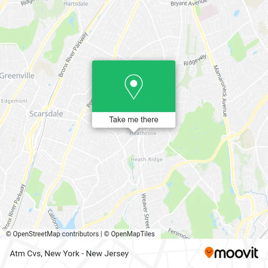
See Atm Cvs, New Rochelle, on the map
Public Transit to Atm Cvs in New Rochelle
Wondering how to get to Atm Cvs in New Rochelle? Moovit helps you find the best way to get to Atm Cvs with step-by-step directions from the nearest public transit station.
Moovit provides free maps and live directions to help you navigate through your city. View schedules, routes, timetables, and find out how long does it take to get to Atm Cvs in real time.
Looking for the nearest stop or station to Atm Cvs? Check out this list of stops closest to your destination: Wilmot Rd @ Scarsdale Shopping Ctr; Wilmot Rd @ Baraud Rd; Hartsdale.
Bus: 63, 66, 45.Train: 2.
Want to see if there’s another route that gets you there at an earlier time? Moovit helps you find alternative routes or times. Get directions from and directions to Atm Cvs easily from the Moovit App or Website.
We make riding to Atm Cvs easy, which is why over 1.7 million users, including users in New Rochelle, trust Moovit as the best app for public transit. You don’t need to download an individual bus app or train app, Moovit is your all-in-one transit app that helps you find the best bus time or train time available.
For information on prices of bus and train, costs and ride fares to Atm Cvs, please check the Moovit app.
Use the app to navigate to popular places including to the airport, hospital, stadium, grocery store, mall, coffee shop, school, college, and university.
Atm Cvs Address: 1064 Wilmont Rd street in New Rochelle
- Compass, Daniel Mckeon,
- Tami Earnest,
- The Zach and Heather Harrison Team,
- Angela Retelny Scarsdale Real Estate Broker,
- Andrea West Real Estate Broker,
- The Keslow Hurwitz Team,
- Randi Culang Team at Compass,
- Sakura Japanese Cuisine,
- Chop't,
- Sakura New York,
- Golden Horseshoe Shopping Center,
- STARBUCKS,
- Garage Door Opener Installation & Repair Garage do,
- Marco Vitolo - Platinum Drive Realty,
- The Ivy League of Comedy,
- Post Office,
- USPS Collection Box - Blue Box,
- Medicare Insurance Advisors Scarsdale,
- Cvs Pharmacy,
- Last Licks Scarsdale
Places Near Atm Cvs (New Rochelle)
- qqqq, Manhattan,
- Chinatown, Manhattan,
- 376 Hudson Street, Manhattan,
- Wall Street, Manhattan,
- 26 Federal Plaza, Manhattan,
- 111 Centre New York City Supreme Court, Manhattan,
- 3 Stone St, Manhattan,
- SoHo, Manhattan,
- Queens Center Mall, Queens,
- Pier 83, Manhattan,
- Bellevue Hospital, Manhattan,
- Mountainside Hospital, Glen Ridge,
- Rockefeller Center, Manhattan,
- Katz's Deli, Manhattan,
- Times Square, Manhattan,
- San Gennaro Feast, Manhattan,
- 66 John Street, Manhattan,
- 1 Police Plaza, Manhattan,
- 911 Memorial, Manhattan,
- Hudson Yards, Manhattan
How to get to popular places in New York - New Jersey with public transit
Get around New Rochelle by public transit!
Traveling around New Rochelle has never been so easy. See step by step directions as you travel to any attraction, street or major public transit station. View bus and train schedules, arrival times, service alerts and detailed routes on a map, so you know exactly how to get to anywhere in New Rochelle.
When traveling to any destination around New Rochelle use Moovit's Live Directions with Get Off Notifications to know exactly where and how far to walk, how long to wait for your line, and how many stops are left. Moovit will alert you when it's time to get off — no need to constantly re-check whether yours is the next stop.
Wondering how to use public transit in New Rochelle or how to pay for public transit in New Rochelle? Moovit public transit app can help you navigate your way with public transit easily, and at minimum cost. It includes public transit fees, ticket prices, and costs. Looking for a map of New Rochelle public transit lines? Moovit public transit app shows all public transit maps in New Rochelle with all Bus, Train, Subway, Light Rail, Ferry and Cable Car routes and stops on an interactive map.
New York - New Jersey has 6 transit type(s), including: Bus, Train, Subway, Light Rail, Ferry and Cable Car, operated by several transit agencies, including MTA Subway, Metro-North Railroad, LIRR, PATH, MTA New York City Transit - Express routes, MTA Bus, NJ Transit, NYC Ferry, NICE bus, Bee-Line Bus, NJ Transit Rail, Norwalk Transit District, Hartford Line, River Valley Transit and HART