How to get to Atm Target by bus?
Click on the bus route to see step by step directions with maps, line arrival times and updated time schedules.
From E 34th St, Manhattan
45 minFrom Walter Kerr Theatre, Manhattan
58 minFrom Grand Central Station, Manhattan
46 minFrom Angelika Film Center, Manhattan
76 minFrom Broadway–Lafayette Street, Manhattan
73 minFrom High Line, Manhattan
74 minFrom Film Forum, Manhattan
83 minFrom 7th Avenue, Manhattan
49 minFrom College Point, Queens
80 min
How to get to Atm Target by train?
Click on the train route to see step by step directions with maps, line arrival times and updated time schedules.
From E 34th St, Manhattan
40 minFrom Walter Kerr Theatre, Manhattan
37 minFrom Grand Central Station, Manhattan
21 minFrom Angelika Film Center, Manhattan
127 minFrom Broadway–Lafayette Street, Manhattan
128 minFrom High Line, Manhattan
84 minFrom Film Forum, Manhattan
121 minFrom 7th Avenue, Manhattan
38 min
How to get to Atm Target by subway?
Click on the subway route to see step by step directions with maps, line arrival times and updated time schedules.
Bus stops near Atm Target in Manhattan
Subway stations near Atm Target in Manhattan
- 125 St, 5 min walk,VIEW
Train station near Atm Target in Manhattan
- Harlem-125th St., 5 min walk,VIEW
Bus lines to Atm Target in Manhattan
What are the closest stations to Atm Target?
The closest stations to Atm Target are:
- Adam C Powell Blvd/W 125 St is 26 yards away, 1 min walk.
- W 125 St/Adam C Powell Blvd is 109 yards away, 2 min walk.
- Malcolm X Blvd/W 127 St is 272 yards away, 4 min walk.
- W 125 St/Malcolm X Blvd is 273 yards away, 4 min walk.
- Lenox Ave & W 125th St is 292 yards away, 4 min walk.
- 125 St is 336 yards away, 5 min walk.
- Harlem-125th St. is 389 yards away, 5 min walk.
Which bus lines stop near Atm Target?
These bus lines stop near Atm Target: M2, M60-SBS, M7.
Which train lines stop near Atm Target?
These train lines stop near Atm Target: 1, 2, 3.
Which subway lines stop near Atm Target?
These subway lines stop near Atm Target: 2, 3, A, D.
What’s the nearest subway station to Atm Target in Manhattan?
The nearest subway station to Atm Target in Manhattan is 125 St. It’s a 5 min walk away.
What’s the nearest train station to Atm Target in Manhattan?
The nearest train station to Atm Target in Manhattan is Harlem-125th St.. It’s a 5 min walk away.
What’s the nearest bus station to Atm Target in Manhattan?
The nearest bus station to Atm Target in Manhattan is Adam C Powell Blvd/W 125 St. It’s a 1 min walk away.
What time is the first subway to Atm Target in Manhattan?
The 3 is the first subway that goes to Atm Target in Manhattan. It stops nearby at 3:02 AM.
What time is the last subway to Atm Target in Manhattan?
The A is the last subway that goes to Atm Target in Manhattan. It stops nearby at 4:14 AM.
What time is the first train to Atm Target in Manhattan?
The 2 is the first train that goes to Atm Target in Manhattan. It stops nearby at 5:29 AM.
What time is the last train to Atm Target in Manhattan?
The 2 is the last train that goes to Atm Target in Manhattan. It stops nearby at 2:06 AM.
What time is the first bus to Atm Target in Manhattan?
The M60-SBS is the first bus that goes to Atm Target in Manhattan. It stops nearby at 3:01 AM.
What time is the last bus to Atm Target in Manhattan?
The M7 is the last bus that goes to Atm Target in Manhattan. It stops nearby at 3:11 AM.
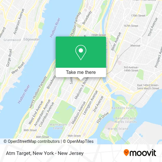
See Atm Target, Manhattan, on the map
Public Transit to Atm Target in Manhattan
Wondering how to get to Atm Target in Manhattan? Moovit helps you find the best way to get to Atm Target with step-by-step directions from the nearest public transit station.
Moovit provides free maps and live directions to help you navigate through your city. View schedules, routes, timetables, and find out how long does it take to get to Atm Target in real time.
Looking for the nearest stop or station to Atm Target? Check out this list of stops closest to your destination: Adam C Powell Blvd/W 125 St; W 125 St/Adam C Powell Blvd; Malcolm X Blvd/W 127 St; W 125 St/Malcolm X Blvd; Lenox Ave & W 125th St; 125 St; Harlem-125th St..
Bus: M2, M60-SBS, M7, M101, M125, M102.Train: 1, 2, 3, 4, 5.Subway: 2, 3, A, D, B, C.
Want to see if there’s another route that gets you there at an earlier time? Moovit helps you find alternative routes or times. Get directions from and directions to Atm Target easily from the Moovit App or Website.
We make riding to Atm Target easy, which is why over 1.5 million users, including users in Manhattan, trust Moovit as the best app for public transit. You don’t need to download an individual bus app or train app, Moovit is your all-in-one transit app that helps you find the best bus time or train time available.
For information on prices of subway, bus and train, costs and ride fares to Atm Target, please check the Moovit app.
Use the app to navigate to popular places including to the airport, hospital, stadium, grocery store, mall, coffee shop, school, college, and university.
Atm Target Address: 123 W 125th St street in Manhattan
- Harlem, New York City,
- Verizon FiOS Store (LPC) Harlem,
- Trader Joe's,
- Vocational & Educational Service,
- Fedcap Rehabilitation Services,
- Spirit Halloween,
- Snipes,
- Panda Express,
- New York City Job Center,
- Sephora,
- Hra Income Support,
- Victoria's Secret & Pink,
- W. Franklyn Richardson Graduate Center, Virginia Union University-Harlem,
- Pandora Jewelry,
- Gnc,
- Cyber Legal Abogados,
- Acces-Vr Harlem Satellite Office,
- Raising Cane's,
- Melba's 125th,
- Victoria’S Secret 125th
Places Near Atm Target (Manhattan)
- Hudson Yards, Manhattan,
- 3 Stone St, Manhattan,
- Katz's Deli, Manhattan,
- 66 John Street, Manhattan,
- 111 Centre New York City Supreme Court, Manhattan,
- Times Square, Manhattan,
- qqqq, Manhattan,
- 376 Hudson Street, Manhattan,
- SoHo, Manhattan,
- Pier 83, Manhattan,
- Mountainside Hospital, Glen Ridge,
- 26 Federal Plaza, Manhattan,
- 911 Memorial, Manhattan,
- Queens Center Mall, Queens,
- 1 Police Plaza, Manhattan,
- San Gennaro Feast, Manhattan,
- Rockefeller Center, Manhattan,
- Bellevue Hospital, Manhattan,
- Chinatown, Manhattan,
- Wall Street, Manhattan
How to get to popular places in New York - New Jersey with public transit
Get around Manhattan by public transit!
Traveling around Manhattan has never been so easy. See step by step directions as you travel to any attraction, street or major public transit station. View bus and train schedules, arrival times, service alerts and detailed routes on a map, so you know exactly how to get to anywhere in Manhattan.
When traveling to any destination around Manhattan use Moovit's Live Directions with Get Off Notifications to know exactly where and how far to walk, how long to wait for your line, and how many stops are left. Moovit will alert you when it's time to get off — no need to constantly re-check whether yours is the next stop.
Wondering how to use public transit in Manhattan or how to pay for public transit in Manhattan? Moovit public transit app can help you navigate your way with public transit easily, and at minimum cost. It includes public transit fees, ticket prices, and costs. Looking for a map of Manhattan public transit lines? Moovit public transit app shows all public transit maps in Manhattan with all Bus, Train, Subway, Light Rail, Ferry and Cable Car routes and stops on an interactive map.
New York - New Jersey has 6 transit type(s), including: Bus, Train, Subway, Light Rail, Ferry and Cable Car, operated by several transit agencies, including MTA Subway, Metro-North Railroad, LIRR, PATH, MTA New York City Transit - Express routes, MTA Bus, NJ Transit, NYC Ferry, NICE bus, Bee-Line Bus, NJ Transit Rail, Norwalk Transit District, Hartford Line, River Valley Transit and HART