How to get to Audio Sensitive by bus?
Click on the bus route to see step by step directions with maps, line arrival times and updated time schedules.
From Ex-Viñedos Guadalupe, Aguascalientes
38 minFrom Auditorio Paula Briones, Aguascalientes
33 minFrom Quintas Miguel Gerónimo, Aguascalientes
49 minFrom Sam's Club Santa Monica, Aguascalientes
34 minFrom Minth, Aguascalientes
52 minFrom Imeco, Aguascalientes
49 minFrom Aeropuerto de Aguascalientes S.A. de C.V., Aguascalientes
47 minFrom Nissan Planta Powertrain, Aguascalientes
46 minFrom Fraccionamiento Viñedos Del Sur Javer Aguascalientes, Aguascalientes
52 min
Bus stops near Audio Sensitive in Aguascalientes
Bus lines to Audio Sensitive in Aguascalientes
- RUTA 04, Mahatma Gandhi - Jesús María,VIEW
- RUTA 08, Utma,VIEW
- RUTA 06, Jesús María - Mahatma Gandhi,VIEW
- RUTA 10, UAA Sur - Paseos de Aguascalientes,VIEW
- RUTA 11, Mahatma Gandhi - Chichimeco,VIEW
- RUTA 38, Vicente Guerrero - Paso Blanco,VIEW
- RUTA 01, Vicente Guerrero - Margaritas,VIEW
- RUTA 05, Vicente Guerrero - La Ribera,VIEW
- RUTA 09, Cumbres III - Mahatma Gandhi,VIEW
- RUTA 09, Mahatma Gandhi - Los Laureles,VIEW
- RUTA 34, Villa Montaña - UPA,VIEW
- RUTA 37, Utma,VIEW
- RUTA 03, La Ribera,VIEW
- RUTA 47, Clínica 10,VIEW
- RUTA 02, Centro (Jardín Carpio),VIEW
What are the closest stations to Audio Sensitive?
The closest stations to Audio Sensitive are:
- Valladolid, 308 is 80 meters away, 2 min walk.
- Sin Nombre Número 662, 102a is 264 meters away, 4 min walk.
- Petróleos Mexicanos, 326 is 329 meters away, 5 min walk.
- Petróleos Mexicanos, 215 is 335 meters away, 5 min walk.
- 5 De Mayo, 655(Int) is 342 meters away, 5 min walk.
- Centro (Jardín Carpio) is 357 meters away, 5 min walk.
Which bus lines stop near Audio Sensitive?
These bus lines stop near Audio Sensitive: RUTA 01, RUTA 03, RUTA 05, RUTA 06, RUTA 10, RUTA 34, RUTA 37, RUTA 43.
What’s the nearest bus station to Audio Sensitive in Aguascalientes?
The nearest bus station to Audio Sensitive in Aguascalientes is Valladolid, 308. It’s a 2 min walk away.
What time is the first bus to Audio Sensitive in Aguascalientes?
The RUTA 08 is the first bus that goes to Audio Sensitive in Aguascalientes. It stops nearby at 6:11 AM.
What time is the last bus to Audio Sensitive in Aguascalientes?
The RUTA 02 is the last bus that goes to Audio Sensitive in Aguascalientes. It stops nearby at 10:26 PM.
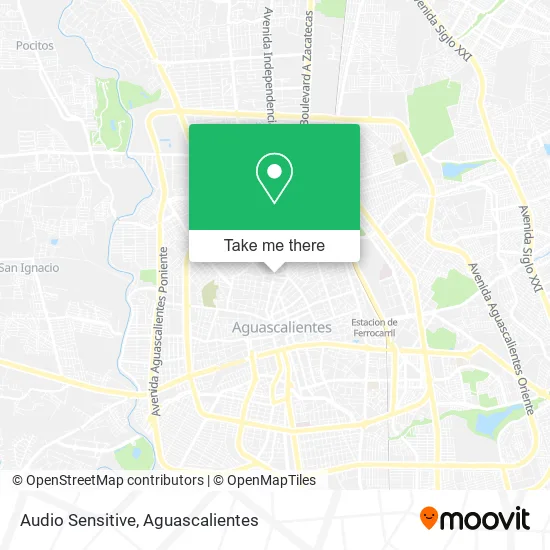
See Audio Sensitive, Aguascalientes, on the map
Public Transit to Audio Sensitive in Aguascalientes
Wondering how to get to Audio Sensitive in Aguascalientes? Moovit helps you find the best way to get to Audio Sensitive with step-by-step directions from the nearest public transit station.
Moovit provides free maps and live directions to help you navigate through your city. View schedules, routes, timetables, and find out how long does it take to get to Audio Sensitive in real time.
Looking for the nearest stop or station to Audio Sensitive? Check out this list of stops closest to your destination: Valladolid; Sin Nombre Número 662; Petróleos Mexicanos; Petróleos Mexicanos; 5 De Mayo; Centro (Jardín Carpio).
Bus: RUTA 01, RUTA 03, RUTA 05, RUTA 06, RUTA 10, RUTA 34, RUTA 37, RUTA 43, RUTA 04, RUTA 08, RUTA 11, RUTA 38, RUTA 09, RUTA 09, RUTA 47, RUTA 02.
Want to see if there’s another route that gets you there at an earlier time? Moovit helps you find alternative routes or times. Get directions from and directions to Audio Sensitive easily from the Moovit App or Website.
We make riding to Audio Sensitive easy, which is why over 1.5 million users, including users in Aguascalientes, trust Moovit as the best app for public transit. You don’t need to download an individual bus app or train app, Moovit is your all-in-one transit app that helps you find the best bus time or train time available.
For information on prices of bus, costs and ride fares to Audio Sensitive, please check the Moovit app.
Use the app to navigate to popular places including to the airport, hospital, stadium, grocery store, mall, coffee shop, school, college, and university.
Audio Sensitive Address: Avenida Petróleos Mexicanos 142, Aguascalientes Centro, 20000 Aguascalientes, Aguascalientes street in Aguascalientes
- Audio Sensitive Consultorio Audioprotesista,
- Audio Centro,
- Tecate Expendio de Cervezas,
- Six,
- Peluquería,
- Autoestereos,
- Av. Petroleos Mexicanos,
- Taqueria El Gallito,
- Electrónica El Sound,
- Cocina Economica,
- Cremeria y Abarrotes Karla,
- Johana Nail's,
- El Menudazo Por Excelencia,
- Refaccionari Tipo Yonke,
- Domos y Policarbonato,
- Mueblería La Morita,
- Consultorio Odontologico Alta Odontología Ags,
- Dj Shop Tienda de Audio e Iluminación,
- Autoelectrico Piturrin Jr,
- Tapizados San Marcos
Places Near Audio Sensitive (Aguascalientes)
- Centro, Aguascalientes,
- Nuevo Hospital Hidalgo, Aguascalientes,
- Universidad Autónoma de Aguascalientes, Aguascalientes,
- Central De Autobuses, Aguascalientes,
- Terminal De Combis, Aguascalientes,
- clinica 3 uaa, Aguascalientes,
- Villas de Nuestra Señora de la Asunción, Aguascalientes,
- Aeropuerto de Aguascalientes S.A. de C.V., Aguascalientes,
- Parque Las Tres Centurias, Aguascalientes,
- Villasuncion, Aguascalientes,
- La Isla San Marcos, Aguascalientes,
- Isla San Marcos, Aguascalientes,
- Ciudad industrial, Aguascalientes,
- Centro Comercial Altaria, Aguascalientes,
- Imss Clinica 1, Aguascalientes,
- Jesús María, Aguascalientes,
- ESPACIOS, Aguascalientes,
- Agropecuario, Aguascalientes,
- Blvd. Luis Donaldo Colosio, Aguascalientes,
- Hospital Imss No. 3, Aguascalientes
How to get to popular places in Aguascalientes with public transit
Get around Aguascalientes by public transit!
Traveling around Aguascalientes has never been so easy. See step by step directions as you travel to any attraction, street or major public transit station. View bus and train schedules, arrival times, service alerts and detailed routes on a map, so you know exactly how to get to anywhere in Aguascalientes.
When traveling to any destination around Aguascalientes use Moovit's Live Directions with Get Off Notifications to know exactly where and how far to walk, how long to wait for your line, and how many stops are left. Moovit will alert you when it's time to get off — no need to constantly re-check whether yours is the next stop.
Wondering how to use public transit in Aguascalientes or how to pay for public transit in Aguascalientes? Moovit public transit app can help you navigate your way with public transit easily, and at minimum cost. It includes public transit fees, ticket prices, and costs. Looking for a map of Aguascalientes public transit lines? Moovit public transit app shows all public transit maps in Aguascalientes with all bus routes and stops on an interactive map.
Aguascalientes has 1 transit type(s), including: bus, operated by several transit agencies, including Coordinación General de Movilidad