Directions to Augustus Design Digital Graphics (Queens) with public transportation
The following transit lines have routes that pass near Augustus Design Digital Graphics
 Bus: Q6, QM63.
- Train: BABYLON BRANCH, CITY TERMINAL ZONE, FAR ROCKAWAY BRANCH, LONG BEACH BRANCH, WEST HEMPSTEAD BRANCH.
- Subway: E, J, Z.
How to get to Augustus Design Digital Graphics by bus?
Click on the bus route to see step by step directions with maps, line arrival times and updated time schedules.
From 30-56 Whitestone Expwy, Queens
72 minFrom Queens Center Mall, Queens
67 minFrom North Shore Towers, Queens
84 minFrom Shea Stadium, Queens
76 minFrom Flushing, NY, Queens
67 minFrom Flushing Chinatown, Queens
57 minFrom Fresh Meadows, Queens
50 minFrom US Open Tennis, Queens
84 minFrom Long Island Jewish Hospital, Queens
71 min
How to get to Augustus Design Digital Graphics by train?
Click on the train route to see step by step directions with maps, line arrival times and updated time schedules.
How to get to Augustus Design Digital Graphics by subway?
Click on the subway route to see step by step directions with maps, line arrival times and updated time schedules.
Bus stops near Augustus Design Digital Graphics in Queens
Train stations near Augustus Design Digital Graphics in Queens
Subway station near Augustus Design Digital Graphics in Queens
- Sutphin Blvd-Archer Av-Jfk Airport, 33 min walk,VIEW
Bus lines to Augustus Design Digital Graphics in Queens
- Q6, JFK Cargo Area Via Sutphin Bl Via Rockaway Bl,VIEW
- QM63, Rosedale,VIEW
- QM21, Midtown 57 St Via Madison Av,VIEW
- Q51, Limited Cambria Heights,VIEW
- QM65, Laurelton,VIEW
- Q115, Springfield Gardens Via Brewer Bl,VIEW
- Q111, Rush Cedarhurst Peninsula Bl Via Brewer Bl Via 147 Av,VIEW
- Q113, Limited Far Rockaway Seagirt Bl Via Brewer Bl/Nassau Expwy,VIEW
- Q114, Rush Far Rockaway Seagirt Bl Via Brewer Bl,VIEW
What are the closest stations to Augustus Design Digital Graphics?
The closest stations to Augustus Design Digital Graphics are:
- Sutphin Blvd/116 Av is 351 yards away, 5 min walk.
- Linden Blvd/Sutphin Blvd is 466 yards away, 6 min walk.
- Guy R Brewer Blvd/116 Av is 745 yards away, 9 min walk.
- Guy R Brewer Blvd/Linden Blvd is 864 yards away, 11 min walk.
- Locust Manor is 1787 yards away, 21 min walk.
- St.Albans is 2229 yards away, 27 min walk.
- Jamaica is 2536 yards away, 30 min walk.
- Sutphin Blvd-Archer Av-Jfk Airport is 2725 yards away, 33 min walk.
Which bus line stops near Augustus Design Digital Graphics?
Q6 (JFK Cargo Area Via Sutphin Bl Via Rockaway Bl)
Which train lines stop near Augustus Design Digital Graphics?
These train lines stop near Augustus Design Digital Graphics: BABYLON BRANCH, CITY TERMINAL ZONE, FAR ROCKAWAY BRANCH, LONG BEACH BRANCH.
Which subway lines stop near Augustus Design Digital Graphics?
These subway lines stop near Augustus Design Digital Graphics: E, J.
What’s the nearest train station to Augustus Design Digital Graphics in Queens?
The nearest train station to Augustus Design Digital Graphics in Queens is Locust Manor. It’s a 21 min walk away.
What’s the nearest bus station to Augustus Design Digital Graphics in Queens?
The nearest bus station to Augustus Design Digital Graphics in Queens is Sutphin Blvd/116 Av. It’s a 5 min walk away.
What time is the first light rail to Augustus Design Digital Graphics in Queens?
The AIRTRAIN is the first light rail that goes to Augustus Design Digital Graphics in Queens. It stops nearby at 3:00 AM.
What time is the last light rail to Augustus Design Digital Graphics in Queens?
The AIRTRAIN is the last light rail that goes to Augustus Design Digital Graphics in Queens. It stops nearby at 3:06 AM.
What time is the first subway to Augustus Design Digital Graphics in Queens?
The E is the first subway that goes to Augustus Design Digital Graphics in Queens. It stops nearby at 3:06 AM.
What time is the last subway to Augustus Design Digital Graphics in Queens?
The J is the last subway that goes to Augustus Design Digital Graphics in Queens. It stops nearby at 3:49 AM.
What time is the first train to Augustus Design Digital Graphics in Queens?
The BABYLON BRANCH is the first train that goes to Augustus Design Digital Graphics in Queens. It stops nearby at 3:07 AM.
What time is the last train to Augustus Design Digital Graphics in Queens?
The BABYLON BRANCH is the last train that goes to Augustus Design Digital Graphics in Queens. It stops nearby at 3:07 AM.
What time is the first bus to Augustus Design Digital Graphics in Queens?
The Q6 is the first bus that goes to Augustus Design Digital Graphics in Queens. It stops nearby at 3:02 AM.
What time is the last bus to Augustus Design Digital Graphics in Queens?
The Q6 is the last bus that goes to Augustus Design Digital Graphics in Queens. It stops nearby at 3:07 AM.
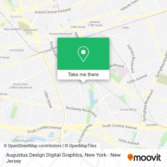
See Augustus Design Digital Graphics, Queens, on the map
Public Transit to Augustus Design Digital Graphics in Queens
Wondering how to get to Augustus Design Digital Graphics in Queens? Moovit helps you find the best way to get to Augustus Design Digital Graphics with step-by-step directions from the nearest public transit station.
Moovit provides free maps and live directions to help you navigate through your city. View schedules, routes, timetables, and find out how long does it take to get to Augustus Design Digital Graphics in real time.
Looking for the nearest stop or station to Augustus Design Digital Graphics? Check out this list of stops closest to your destination: Sutphin Blvd/116 Av; Linden Blvd/Sutphin Blvd; Guy R Brewer Blvd/116 Av; Guy R Brewer Blvd/Linden Blvd; Locust Manor; St.Albans; Jamaica; Sutphin Blvd-Archer Av-Jfk Airport.
Bus: Q6, QM63.Train: BABYLON BRANCH, CITY TERMINAL ZONE, FAR ROCKAWAY BRANCH, LONG BEACH BRANCH, WEST HEMPSTEAD BRANCH, AIRTRAIN, HEMPSTEAD BRANCH, MONTAUK BRANCH, OYSTER BAY BRANCH.Subway: E, J, Z.
Want to see if there’s another route that gets you there at an earlier time? Moovit helps you find alternative routes or times. Get directions from and directions to Augustus Design Digital Graphics easily from the Moovit App or Website.
We make riding to Augustus Design Digital Graphics easy, which is why over 1.5 million users, including users in Queens, trust Moovit as the best app for public transit. You don’t need to download an individual bus app or train app, Moovit is your all-in-one transit app that helps you find the best bus time or train time available.
For information on prices of bus, subway and train, costs and ride fares to Augustus Design Digital Graphics, please check the Moovit app.
Use the app to navigate to popular places including to the airport, hospital, stadium, grocery store, mall, coffee shop, school, college, and university.
Augustus Design Digital Graphics Address: 115-35 155th St street in Queens
- Nyc Building Violation Removal & Expediting,
- Keshan Distributor,
- Ishasparklingclean,
- Gifted Hands Daycare,
- Nyc Department Of Education, District 28,
- Susan Ching, Do,
- Oak Street Health South Jamaica Primary Care Clinic,
- Dr. Rosaanabela Tavares, Md Primary Care Physician,
- Dr. Susan Ching, Do,
- Paul Lane Funeral Home, Inc.,
- Triple A’S Tire Shop,
- Releasing Living Waters Ministries, Inc.,
- 155 St 114th,
- Happy Hour Day Care,
- Sutphin Blvd 115 Ave,
- Safety Zone Driving School,
- Secret Treasures,
- Joseph P. Addabbo Family Health Center,
- South Jamaica Infinity Garden,
- Faith Outreach Revival Center
Places Near Augustus Design Digital Graphics (Queens)
- Times Square, Manhattan,
- 3 Stone St, Manhattan,
- 26 Federal Plaza, Manhattan,
- Queens Center Mall, Queens,
- Hudson Yards, Manhattan,
- Katz's Deli, Manhattan,
- Wall Street, Manhattan,
- Bellevue Hospital, Manhattan,
- qqqq, Manhattan,
- 66 John Street, Manhattan,
- Mountainside Hospital, Glen Ridge,
- 911 Memorial, Manhattan,
- Pier 83, Manhattan,
- 1 Police Plaza, Manhattan,
- SoHo, Manhattan,
- 376 Hudson Street, Manhattan,
- Rockefeller Center, Manhattan,
- Chinatown, Manhattan,
- San Gennaro Feast, Manhattan,
- 111 Centre New York City Supreme Court, Manhattan
How to get to popular places in New York - New Jersey with public transit
Get around Queens by public transit!
Traveling around Queens has never been so easy. See step by step directions as you travel to any attraction, street or major public transit station. View bus and train schedules, arrival times, service alerts and detailed routes on a map, so you know exactly how to get to anywhere in Queens.
When traveling to any destination around Queens use Moovit's Live Directions with Get Off Notifications to know exactly where and how far to walk, how long to wait for your line, and how many stops are left. Moovit will alert you when it's time to get off — no need to constantly re-check whether yours is the next stop.
Wondering how to use public transit in Queens or how to pay for public transit in Queens? Moovit public transit app can help you navigate your way with public transit easily, and at minimum cost. It includes public transit fees, ticket prices, and costs. Looking for a map of Queens public transit lines? Moovit public transit app shows all public transit maps in Queens with all Bus, Train, Subway, Light Rail, Ferry and Cable Car routes and stops on an interactive map.
New York - New Jersey has 6 transit type(s), including: Bus, Train, Subway, Light Rail, Ferry and Cable Car, operated by several transit agencies, including MTA Subway, Metro-North Railroad, LIRR, PATH, MTA New York City Transit - Express routes, MTA Bus, NJ Transit, NYC Ferry, NICE bus, Bee-Line Bus, NJ Transit Rail, Norwalk Transit District, Hartford Line, River Valley Transit and HART