How to get to Auser by bus?
Click on the bus route to see step by step directions with maps, line arrival times and updated time schedules.
From Volturno Street 10/12, Sesto Fiorentino
65 minFrom Bricoman, Sesto Fiorentino
60 minFrom Campi Bisenzio, Campi Bisenzio
48 minFrom Sesto Fiorentino Station, Sesto Fiorentino
59 minFrom Nencini Sport 1, Calenzano
36 minFrom Osmannoro FS, Florence
83 minFrom Antonio Gramsci Street, Sesto Fiorentino
55 minFrom Antonio Gramsci Street, 561, Sesto Fiorentino
54 minFrom Sesto Fiorentino, Sesto Fiorentino
57 minFrom Scientific Pole, Sesto Fiorentino
86 min
How to get to Auser by train?
Click on the train route to see step by step directions with maps, line arrival times and updated time schedules.
Bus stops near Auser in Prato
Train stations near Auser in Prato
Bus lines to Auser in Prato
- SC, Prato City School Service,VIEW
- 1+, Centro Pecci - Maliseti/Hospital,VIEW
- 2+, Santa Lucia/Galceti - San Giorgio/Paperino,VIEW
- 3+, Station - Galciana,VIEW
- 207, Prato - Montemurlo/Montale/Agliana,VIEW
- 210, Prato - Montalbano,VIEW
- 212, Prato - Campi Bisenzio - Florence,VIEW
- 214, Prato - Val Di Bisenzio,VIEW
- 301 A, Monghidoro-Bruscoli-Barberino Di Mugello-Florence,VIEW
- 301 A, Barberino Piazza Cavour,VIEW
- R1, Florence T2 Guidoni,VIEW
- 4, Prato Railway Station,VIEW
- 9, Iolo Via Longobarda,VIEW
- 5, Reggiana Street Schools,VIEW
What are the closest stations to Auser?
The closest stations to Auser are:
- Mercatale 1 is 160 meters away, 3 min walk.
- Mercatale Square is 160 meters away, 3 min walk.
- Via Ceppo Vecchio is 361 meters away, 5 min walk.
- San Marco 2 is 498 meters away, 7 min walk.
- Prato Porta Al Serraglio is 2850 meters away, 37 min walk.
- Prato Central is 3542 meters away, 46 min walk.
Which bus lines stop near Auser?
These bus lines stop near Auser: 1+, 212, 4, R1.
Which train line stops near Auser?
R (Pistoia/Pisa)
What’s the nearest bus station to Auser in Prato?
The nearest bus stations to Auser in Prato are Mercatale 1 and Mercatale Square. The closest one is a 3 min walk away.
What time is the first train to Auser in Prato?
The R is the first train that goes to Auser in Prato. It stops nearby at 4:57 AM.
What time is the last train to Auser in Prato?
The R is the last train that goes to Auser in Prato. It stops nearby at 1:00 AM.
What time is the first bus to Auser in Prato?
The 210 is the first bus that goes to Auser in Prato. It stops nearby at 5:51 AM.
What time is the last bus to Auser in Prato?
The 214 is the last bus that goes to Auser in Prato. It stops nearby at 10:05 PM.
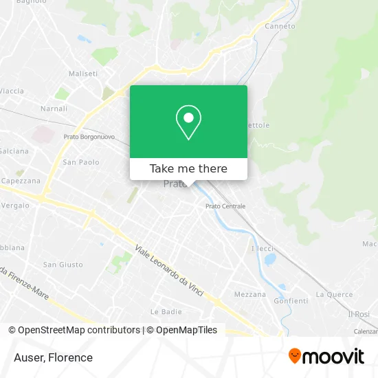
See Auser, Prato, on the map
Public Transit to Auser in Prato
Wondering how to get to Auser in Prato? Moovit helps you find the best way to get to Auser with step-by-step directions from the nearest public transit station.
Moovit provides free maps and live directions to help you navigate through your city. View schedules, routes, timetables, and find out how long does it take to get to Auser in real time.
Looking for the nearest stop or station to Auser? Check out this list of stops closest to your destination: Mercatale 1; Mercatale Square; Via Ceppo Vecchio; San Marco 2; Prato Porta Al Serraglio; Prato Central.
Bus: 1+, 212, 4, R1, SC, 2+, 3+, 207, 301 A, 9, 5.Train: R.
Want to see if there’s another route that gets you there at an earlier time? Moovit helps you find alternative routes or times. Get directions from and directions to Auser easily from the Moovit App or Website.
We make riding to Auser easy, which is why over 1.5 million users, including users in Prato, trust Moovit as the best app for public transit. You don’t need to download an individual bus app or train app, Moovit is your all-in-one transit app that helps you find the best bus time or train time available.
For information on prices of bus and train, costs and ride fares to Auser, please check the Moovit app.
Use the app to navigate to popular places including to the airport, hospital, stadium, grocery store, mall, coffee shop, school, college, and university.
Auser Address: Via dei Tintori, 35 59100 Prato street in Prato
- Complice by Neri Veronica & Co.,
- Lotti and Giannini Snc of Lotti Sergio and Giannini Giuseppe,
- Mercatale Copying by Giovanna Mori,
- Saint Ambrose Oratory,
- Hamrahi Tour by Muhammad Sajjad,
- Giuseppe Garibaldi Street 92 / 94,
- Ara Legero Shoes Italia GmbH,
- Zero Caffè "by Pino",
- Mercatale Square,
- Maico Hearing Center,
- Lab 59100,
- Pinguinsec Laundry Sandra by Gheri Piero,
- Estra,
- CGIL,
- Unipolsai Insurance,
- Politeama Theater,
- Tripe Sellers of Mercatale Square,
- Ridotto Del Metastasio,
- September Pratese,
- Vitafacile Shop
Places Near Auser (Prato)
- Cascine Park, Florence,
- Santa Maria Novella Station, Florence,
- I Gigli, Campi Bisenzio,
- Santa Maria Nuova Hospital, Florence,
- Visarno Hippodrome, Florence,
- Michelangelo Square, Florence,
- Mandela Forum (Nelson Mandela Forum), Florence,
- Piero Palagi Hospital Facility-Florence, Florence,
- Verdi Theater, Florence,
- Asmana, Campi Bisenzio,
- OOO, Florence,
- Visarno Arena, Florence,
- Michelangelo Square, Florence,
- Nelson Mandela Forum, Florence,
- Tobacco Manufacture, Florence,
- IKEA Florence, Sesto Fiorentino,
- Torregalli Hospital Scandicci *, Scandicci,
- Campi Bisenzio, Campi Bisenzio,
- Artemio Franchi Municipal Stadium, Florence,
- Field of Mars, Florence
How to get to popular places in Florence with public transit
Get around Prato by public transit!
Traveling around Prato has never been so easy. See step by step directions as you travel to any attraction, street or major public transit station. View bus and train schedules, arrival times, service alerts and detailed routes on a map, so you know exactly how to get to anywhere in Prato.
When traveling to any destination around Prato use Moovit's Live Directions with Get Off Notifications to know exactly where and how far to walk, how long to wait for your line, and how many stops are left. Moovit will alert you when it's time to get off — no need to constantly re-check whether yours is the next stop.
Wondering how to use public transit in Prato or how to pay for public transit in Prato? Moovit public transit app can help you navigate your way with public transit easily, and at minimum cost. It includes public transit fees, ticket prices, and costs. Looking for a map of Prato public transit lines? Moovit public transit app shows all public transit maps in Prato with all Bus, Train, Light Rail, Ferry and Funicular routes and stops on an interactive map.
Florence has 5 transit type(s), including: Bus, Train, Light Rail, Ferry and Funicular, operated by several transit agencies, including Florence Urban - Tuscan Bus Lines, GEST, Livorno and Province - Tuscan Bus Lines, Arezzo, Florence and Provinces - Tuscan Bus Lines, Prato and Province - Tuscan Bus Lines, Lucca and Province - Tuscan Bus Lines, Massa, Carrara and Province - Tuscan Bus Lines, Pisa and Province - Tuscan Bus Lines, Grosseto, Siena and Provinces - Tuscan Bus Lines, Arezzo, Siena and Provinces - Tuscan Bus Lines, Florence and Province - Tuscan Bus Lines, Pistoia and Province - Tuscan Bus Lines, Siena and Province - Tuscan Bus Lines, Arezzo and Province - Tuscan Bus Lines and Trenitalia