How to get to Autel by bus?
Click on the bus route to see step by step directions with maps, line arrival times and updated time schedules.
From Halkalı 212 Avm, Küçükçekmece
100 minFrom İstanbul Bölge İdare Mahkemesi, Bagcilar
94 minFrom Avcılar Metrobüs Durağı, Avcilar
81 minFrom Murat Kölük Devlet Hastanesi, Avcilar
90 minFrom Mahmutbey Metro İstasyonu, Bagcilar
93 minFrom Esenyurt Minibüsü, Esenyurt
90 minFrom AVCILAR MINIBUS DURAGI, Avcilar
83 minFrom City Center Avm, Esenyurt
88 min
Bus stops near Autel in Avcilar
Dolmus & Minibus stations near Autel in Avcilar
Bus lines to Autel in Avcilar
- 76V, Bakırköy-Vaditepe 1. Bölge,VIEW
- MK14, Vaditepe 1.Bölge-Olimpiyatköy Metro,VIEW
- MR51, Gümrük-Şehit Ömer Halisdemir,VIEW
- MR54, Halkalı Marmaray-İgtot,VIEW
- E-56, Gümüşsuyu Peron-Saray Patı Sokak,VIEW
- E-58, Saray Patı Sokak-Mecidiyeköy Metrobüs,VIEW
- 147, Cihangir Mahallesi-İgtot,VIEW
- 142F, Şehit Şerife Bacı Çok Programlı Anadolu Lisesi-Milli Egemenlik Parkı,VIEW
- MK13, Şahintepe İgtot - Olimpiyatköy Metro / Ring,VIEW
- HT20, Aşık Veysel Caddesi-Yenibosna Metro,VIEW
- 78Ş, Aşık Veysel Caddesi-Fenertepe Peronlar,VIEW
- 79Ş, Dolapdere Sanayi Sitesi-İgtot,VIEW
What are the closest stations to Autel?
The closest stations to Autel are:
- Yahya Kemal Beyatlı Caddesi - Esenyurt Yönü is 196 meters away, 3 min walk.
- Yahya Kemal Beyatlı Caddesi - Ispartakule Yönü is 239 meters away, 4 min walk.
- Ziya Gökalp Caddesi - Bakırköy Yönü is 710 meters away, 10 min walk.
- Şahintepesi is 1194 meters away, 16 min walk.
- Şahintepesi - İ.Koçarslan İöo Yönü is 1277 meters away, 17 min walk.
- Pehlivan Sokak - Olimpiyatköy Yönü is 3165 meters away, 41 min walk.
Which bus lines stop near Autel?
These bus lines stop near Autel: MK14, MR51, MR54.
What’s the nearest bus station to Autel in Avcilar?
The nearest bus station to Autel in Avcilar is Yahya Kemal Beyatlı Caddesi - Esenyurt Yönü. It’s a 3 min walk away.
What’s the nearest Dolmus & Minibus station to Autel in Avcilar?
The nearest Dolmus & Minibus station to Autel in Avcilar is Şahintepesi. It’s a 16 min walk away.
What time is the first bus to Autel in Avcilar?
The 147 is the first bus that goes to Autel in Avcilar. It stops nearby at 6:08 AM.
What time is the last bus to Autel in Avcilar?
The 147 is the last bus that goes to Autel in Avcilar. It stops nearby at 1:22 AM.
What time is the first Dolmus & Minibus to Autel in Avcilar?
The A49 is the first Dolmus & Minibus that goes to Autel in Avcilar. It stops nearby at 6:12 AM.
What time is the last Dolmus & Minibus to Autel in Avcilar?
The A36 is the last Dolmus & Minibus that goes to Autel in Avcilar. It stops nearby at 1:35 AM.
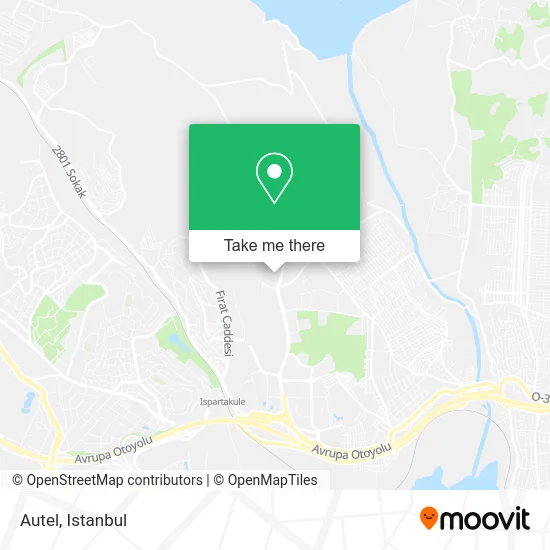
See Autel, Avcilar, on the map
Public Transit to Autel in Avcilar
Wondering how to get to Autel in Avcilar? Moovit helps you find the best way to get to Autel with step-by-step directions from the nearest public transit station.
Moovit provides free maps and live directions to help you navigate through your city. View schedules, routes, timetables, and find out how long does it take to get to Autel in real time.
Looking for the nearest stop or station to Autel? Check out this list of stops closest to your destination: Yahya Kemal Beyatlı Caddesi - Esenyurt Yönü; Yahya Kemal Beyatlı Caddesi - Ispartakule Yönü; Ziya Gökalp Caddesi - Bakırköy Yönü; Şahintepesi; Şahintepesi - İ.Koçarslan İöo Yönü; Pehlivan Sokak - Olimpiyatköy Yönü.
Bus: MK14, MR51, MR54, 76V, E-56, E-58, 142F, MK13, HT20, 78Ş, 79Ş.Dolmus & Minibus: A49, A36.
Want to see if there’s another route that gets you there at an earlier time? Moovit helps you find alternative routes or times. Get directions from and directions to Autel easily from the Moovit App or Website.
We make riding to Autel easy, which is why over 1.5 million users, including users in Avcilar, trust Moovit as the best app for public transit. You don’t need to download an individual bus app or train app, Moovit is your all-in-one transit app that helps you find the best bus time or train time available.
For information on prices of bus, Metrobus and Dolmus & Minibus, costs and ride fares to Autel, please check the Moovit app.
Use the app to navigate to popular places including to the airport, hospital, stadium, grocery store, mall, coffee shop, school, college, and university.
Autel Address: Ispartakule Bulvarı, 25R 34320 Tahtakale, Avcılar street in Avcilar
- Bahçeşehir 1. Kısım Mahallesi,
- Ispartakule Evleri Adem Aslan,
- Ova Fırın,
- İstanbul Bahçeşehir Spor Kulübü,
- Akgünler Nalbur,
- Saraypatı Sokak,
- Voltrun,
- Meydan Market,
- Saray Pati Sok.,
- Yahya Kemal Beyatli Cad.,
- Galata Market,
- Yeni Hayat Sitesi Sosyal Tesisleri,
- Ispartakule,
- Balpa Ispartakule evleri emlak Konut,
- Emlak Konut Ispartakule Şantiyesi,
- Tanıtım Filmi Çekimi,
- Yeni Hayat Evleri,
- Yeni Hayat Sitesi,
- Toger,
- Yenı Hayat Sıte Yonetı
Places Near Autel (Avcilar)
- Hz. Yuşa Tepesi, Beykoz,
- Tersane İstanbul, Beyoğlu,
- Şehit Prof. Dr. İlhan Varank Eğitim Ve Araştırma Hastanesi, Sancaktepe,
- Başakşehir Çam Ve Sakura Şehir Hastanesi, Basaksehir,
- 2 Nolu Minibüss, Beylikduzu,
- 212 AVM, Bagcilar,
- VİALAND AVM, Eyüp,
- Beylikdüzü - 4 Nolu Minibüs Hattı, Beylikduzu,
- Topkule Kışlası 47.Komando Tugay Komutanlığı, Esenler,
- Gebze Koop Durağı, Gebze,
- Karaköy Genelevi, Karaköy, Beyoğlu,
- Hilltown AVM, Maltepe,
- Gebze-Harem Minibüs Hattı, Gebze,
- 41 Burda AVM, Kocaeli Merkezi,
- İstanbul,
- İstinye Park, Sariyer,
- METROPOL IsTaNBuL, Ataşehir,
- Mall Of İstanbul, Basaksehir,
- Mehmet Emin Tokadî Hz. Türbesi, Fatih,
- Bakırköy Sosyete Pazarı, Bakirköy
How to get to popular places in Istanbul with public transit
Get around Avcilar by public transit!
Traveling around Avcilar has never been so easy. See step by step directions as you travel to any attraction, street or major public transit station. View bus and train schedules, arrival times, service alerts and detailed routes on a map, so you know exactly how to get to anywhere in Avcilar.
When traveling to any destination around Avcilar use Moovit's Live Directions with Get Off Notifications to know exactly where and how far to walk, how long to wait for your line, and how many stops are left. Moovit will alert you when it's time to get off — no need to constantly re-check whether yours is the next stop.
Wondering how to use public transit in Avcilar or how to pay for public transit in Avcilar? Moovit public transit app can help you navigate your way with public transit easily, and at minimum cost. It includes public transit fees, ticket prices, and costs. Looking for a map of Avcilar public transit lines? Moovit public transit app shows all public transit maps in Avcilar with all Bus, Train, Metro, Tram, Ferry, Metrobus and Dolmus & Minibus routes and stops on an interactive map.
Istanbul has 7 transit type(s), including: Bus, Train, Metro, Tram, Ferry, Metrobus and Dolmus & Minibus, operated by several transit agencies, including Marmaray, Metro İstanbul, Metrobüs, UAB, İETT, İETT ÇIFT KATLI HATLAR, İETT BÖLGESEL HATLAR, TCDD, Şehir Hatları, Dentur Avrasya, Beyden, Turyol, Mavi Marmara, Havaist and Prenstur
