Directions to Auto Band Veiculos Multimarcas (Cic) with public transportation
The following transit lines have routes that pass near Auto Band Veiculos Multimarcas
How to get to Auto Band Veiculos Multimarcas by bus?
Click on the bus route to see step by step directions with maps, line arrival times and updated time schedules.
From Rua Doutor Bley Zornig, Boqueirão
60 minFrom Supercenter Angeloni Água Verde, Vila Izabel
34 minFrom Av Vicente Machado, Centro
64 minFrom Copel - Agência de Atendimento, Boqueirão
49 minFrom Faculdades Opet, Rebouças
45 minFrom Rua Vereador Angelo Burbello, Umbará
40 minFrom Rebouças, Rebouças
41 minFrom Avenida Presidente Arthur Bernardes, Portão
28 minFrom Rebouças, Rebouças
47 minFrom Volvo do Brasil, Cic
29 min
Bus stops near Auto Band Veiculos Multimarcas in Cic
Bus lines to Auto Band Veiculos Multimarcas in Cic
- H01 ARAUCÁRIA / GUADALUPE, Terminal Araucária → Terminal Guadalupe,VIEW
- H12 ARAUCÁRIA / PORTÃO, Terminal Portão → Terminal Araucária,VIEW
- X55 REFORÇO CIC / AV. J.K., Av. JK (Viaduto Eduardo Sprada) → Terminal CIC ,VIEW
- H97 ANGÉLICA / GUADALUPE, Terminal Guadalupe → Terminal Angélica,VIEW
- 627 BOSCH, Terminal Capão Raso → Bosch (Vila Verde),VIEW
- 709 VILA TIRADENTES / CIC, Terminal CIC → Vila Tiradentes (Recolhe),VIEW
- 773 VIZINHANÇA / SANTA RITA, Terminal Tatuquara → Terminal CIC,VIEW
- 826 CAMPO COMPRIDO / CIC, Terminal CIC → Terminal Campo Comprido,VIEW
- F05 FAZENDA / CIC, Terminal Fazenda → Terminal CIC,VIEW
- 040 INTERBAIRROS IV, Terminal Pinheirinho → Terminal Santa Felicidade,VIEW
- 619 SANTA RITA / CIC, Terminal Tatuquara → Terminal CIC,VIEW
- 628 CARBOMAFRA, Carbomafra → Terminal Capão Raso,VIEW
- 652 VILA VERDE, Vila Verde → Terminal CIC,VIEW
- 653 SABARÁ, Moradias Corbélia → Terminal CIC,VIEW
- 685 RIO BONITO / CIC, Terminal CIC → Rio Bonito,VIEW
- 712 JARDIM INDEPENDÊNCIA / CIC, Terminal CIC → Terminal Fazendinha,VIEW
- 723 EMÍLIO ROMANI, Terminal CIC ↺ Emílio Romani (Circular),VIEW
- 609 MAD. CIC, Terminal CIC → Praça Rui Barbosa,VIEW
- 545 TRABALHADOR, Terminal Boqueirão → Terminal Fazendinha,VIEW
What are the closest stations to Auto Band Veiculos Multimarcas?
The closest stations to Auto Band Veiculos Multimarcas are:
- R. João Bettega, 6474 is 262 meters away, 4 min walk.
- R. Pedro Gusso, 4311 is 326 meters away, 5 min walk.
- R. Pedro Gusso, 4216 is 329 meters away, 5 min walk.
- R. Desembargador Cid Campelo, 3690 is 467 meters away, 7 min walk.
Which bus lines stop near Auto Band Veiculos Multimarcas?
These bus lines stop near Auto Band Veiculos Multimarcas: 040 INTERBAIRROS IV, 545 TRABALHADOR, 628 CARBOMAFRA, 826 CAMPO COMPRIDO / CIC, F05 FAZENDA / CIC, H01 ARAUCÁRIA / GUADALUPE.
What’s the nearest bus station to Auto Band Veiculos Multimarcas in Cic?
The nearest bus station to Auto Band Veiculos Multimarcas in Cic is R. João Bettega, 6474. It’s a 4 min walk away.
What time is the first bus to Auto Band Veiculos Multimarcas in Cic?
The 609 MAD. CIC is the first bus that goes to Auto Band Veiculos Multimarcas in Cic. It stops nearby at 3:00 AM.
What time is the last bus to Auto Band Veiculos Multimarcas in Cic?
The 609 MAD. CIC is the last bus that goes to Auto Band Veiculos Multimarcas in Cic. It stops nearby at 3:00 AM.
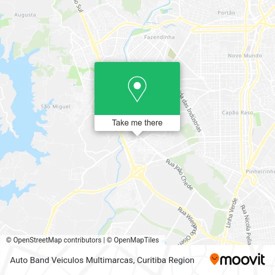
See Auto Band Veiculos Multimarcas, Cic, on the map
Public Transit to Auto Band Veiculos Multimarcas in Cic
Wondering how to get to Auto Band Veiculos Multimarcas in Cic? Moovit helps you find the best way to get to Auto Band Veiculos Multimarcas with step-by-step directions from the nearest public transit station.
Moovit provides free maps and live directions to help you navigate through your city. View schedules, routes, timetables, and find out how long does it take to get to Auto Band Veiculos Multimarcas in real time.
Looking for the nearest stop or station to Auto Band Veiculos Multimarcas? Check out this list of stops closest to your destination: R. João Bettega; R. Pedro Gusso; R. Pedro Gusso; R. Desembargador Cid Campelo.
Bus: 040 INTERBAIRROS IV, 545 TRABALHADOR, 628 CARBOMAFRA, 826 CAMPO COMPRIDO / CIC, F05 FAZENDA / CIC, H01 ARAUCÁRIA / GUADALUPE, H12 ARAUCÁRIA / PORTÃO, X55 REFORÇO CIC / AV. J.K., H97 ANGÉLICA / GUADALUPE, 627 BOSCH, 619 SANTA RITA / CIC, 652 VILA VERDE, 609 MAD. CIC.
Want to see if there’s another route that gets you there at an earlier time? Moovit helps you find alternative routes or times. Get directions from and directions to Auto Band Veiculos Multimarcas easily from the Moovit App or Website.
We make riding to Auto Band Veiculos Multimarcas easy, which is why over 1.5 million users, including users in Cic, trust Moovit as the best app for public transit. You don’t need to download an individual bus app or train app, Moovit is your all-in-one transit app that helps you find the best bus time or train time available.
For information on prices of bus, costs and ride fares to Auto Band Veiculos Multimarcas, please check the Moovit app.
Use the app to navigate to popular places including to the airport, hospital, stadium, grocery store, mall, coffee shop, school, college, and university.
Auto Band Veiculos Multimarcas Address: Rua João Bettega, 6211 Cidade Industrial de Curitiba Curitiba-PR 81350-274 street in Cic
- Global Loterias,
- Contorno Sul Veículos,
- Centro Automotivo Bettega,
- Casa de Carnes Ponto e,
- Jncar Multimarca,
- Belíssima Modas,
- Auto Peças Cvc,
- Furgopar Furgoes Paranaense,
- 3m Distribuidora de Bebidas,
- Laguna Gesso Drywall Decoracoes,
- Escola Cic Barigui,
- Aviario Nutri Mais,
- Aviario e Acessorios Shekinah,
- Cidade Industrial (CIC),
- Ferragens Costa,
- Escola Municipal Otto Bracarense Costa,
- Ohana Cantóia Espaço da Beleza,
- Rua João Bettega 6115,
- Mister Sheik,
- Shell SELECT
Places Near Auto Band Veiculos Multimarcas (Cic)
- Hospital Angelina Caron, Campina Grande Do Sul,
- Rua Martim Afonso 558, Mercês,
- Jockey Plaza Shopping Center, Tarumã,
- Hospital de Clínicas (HC - UFPR), Centro,
- Hospital Erasto Gaertner, Jardim Das Américas,
- Jardim Botânico de Curitiba PR, Centro,
- Hospital Da Cruz Vermelha, Batel,
- Hospital do Rocio, Campo,
- Hospital Universitário Evangélico de Curitiba, Bigorrilho,
- Park Shopping Barigüi, Mossunguê,
- Campo Largo, Campo,
- Shopping Estação, Rebouças,
- Pontifícia Universidade Católica do Paraná (PUCPR), Prado Velho,
- Shopping Palladium, Portão,
- Hospital Nossa Senhora Das Graças, Mercês,
- Arena Da Baixada - Curitiba,
- Parque Barigui, Mercês,
- Hhhhh, Fazendinha,
- Hospital Madalena Sofia, Bairro Alto,
- Rua General Mário Tourinho, Campina Do Siqueira
How to get to popular places in Curitiba Region with public transit
Get around Cic by public transit!
Traveling around Cic has never been so easy. See step by step directions as you travel to any attraction, street or major public transit station. View bus and train schedules, arrival times, service alerts and detailed routes on a map, so you know exactly how to get to anywhere in Cic.
When traveling to any destination around Cic use Moovit's Live Directions with Get Off Notifications to know exactly where and how far to walk, how long to wait for your line, and how many stops are left. Moovit will alert you when it's time to get off — no need to constantly re-check whether yours is the next stop.
Wondering how to use public transit in Cic or how to pay for public transit in Cic? Moovit public transit app can help you navigate your way with public transit easily, and at minimum cost. It includes public transit fees, ticket prices, and costs. Looking for a map of Cic public transit lines? Moovit public transit app shows all public transit maps in Cic with all Bus and Cable Car routes and stops on an interactive map.
Curitiba Region has 2 transit type(s), including: Bus and Cable Car, operated by several transit agencies, including Sistema Integrado de Mobilidade (URBS), Sistema Integrado de Mobilidade (AMEP), URBS (Cartões bancários e Dinheiro), URBS (Cartões bancários / Cartão URBS), AMEP (Cartões bancários / Cartão MetroCard), AMEP (Cartões bancários / Cartão MetroCard / Dinheiro), Viação Colombo (Dinheiro), TRIAR (Cartão TRIAR / Dinheiro), Empresa Curitiba Cerro Azul (Dinheiro), Expresso Nossa Senhora da Penha (Dinheiro), Empresa Campo Alto Tijucas (Dinheiro), Auto Viação São José (Cartão VEM / Dinheiro), BRT S/A (Cartão VEM / Dinheiro), TransPiedade (Cartão Cidadão / Dinheiro) and Oceânica Sul (Cartão Transporte / Dinheiro)