How to get to Auto Land by bus?
Click on the bus route to see step by step directions with maps, line arrival times and updated time schedules.
Bus stop near Auto Land in Virginia Beach
- Independence & Tulip, 2 min walk,VIEW
Bus lines to Auto Land in Virginia Beach
What are the closest stations to Auto Land?
The closest stations to Auto Land are:
- Independence & Tulip is 81 yards away, 2 min walk.
Which bus line stops near Auto Land?
036 (Tcc Virginia Beach)
What’s the nearest bus station to Auto Land in Virginia Beach?
The nearest bus station to Auto Land in Virginia Beach is Independence & Tulip. It’s a 2 min walk away.
What time is the first bus to Auto Land in Virginia Beach?
The 022 is the first bus that goes to Auto Land in Virginia Beach. It stops nearby at 5:50 AM.
What time is the last bus to Auto Land in Virginia Beach?
The 036 is the last bus that goes to Auto Land in Virginia Beach. It stops nearby at 12:40 AM.
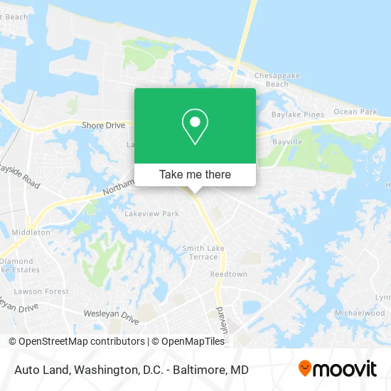
See Auto Land, Virginia Beach, on the map
Public Transit to Auto Land in Virginia Beach
Wondering how to get to Auto Land in Virginia Beach? Moovit helps you find the best way to get to Auto Land with step-by-step directions from the nearest public transit station.
Moovit provides free maps and live directions to help you navigate through your city. View schedules, routes, timetables, and find out how long does it take to get to Auto Land in real time.
Looking for the nearest stop or station to Auto Land? Check out this list of stops closest to your destination: Independence & Tulip.
Bus: 036, 022.
Want to see if there’s another route that gets you there at an earlier time? Moovit helps you find alternative routes or times. Get directions from and directions to Auto Land easily from the Moovit App or Website.
We make riding to Auto Land easy, which is why over 1.5 million users, including users in Virginia Beach, trust Moovit as the best app for public transit. You don’t need to download an individual bus app or train app, Moovit is your all-in-one transit app that helps you find the best bus time or train time available.
For information on prices of bus, costs and ride fares to Auto Land, please check the Moovit app.
Use the app to navigate to popular places including to the airport, hospital, stadium, grocery store, mall, coffee shop, school, college, and university.
Auto Land Address: 1608 Independence Blvd Virginia Beach, VA 23455 street in Virginia Beach
- Wells Fargo Home Mortgage,
- Mrs Sophia Egyptian Reader,
- Independence & Smokey,
- Big al's Mufflers and Brakes - Independence Blvd, Virginia Beach,
- American Transmission Centers,
- Big al's Mufflers & Brakes,
- Jeff Ward Appraisals,
- Armed Services YMCA Hampton Roads,
- Marco's Pizza,
- Richard W Setzer Electrical & Mechanical Contractor,
- Things Unlimited Bazaar,
- VA Beach Zen Tree House Style Studio F,
- Mike Straddeck & Associates,
- Safelite Autoglass,
- Word and Worship Center,
- Smoke Shack,
- Minuteman Press,
- Kingdom Investing Outreach Center,
- Instrumental Coffee,
- Asahi Restaurant
Places Near Auto Land (Virginia Beach)
- Marriott Marquis Washington, DC, Washington,
- Washington National Cathedral, Washington,
- Capital One Arena, Washington,
- Amazon Hq2, Arlington County,
- Westfield Montgomery Mall, Montgomery County,
- M&T Bank Stadium, Baltimore,
- Washington DC VA Medical Center, Washington,
- Pennsylvania Ave NW (3rd st and pennsylvania), Washington,
- Museum Of The Bible, Washington,
- National Theatre, Washington,
- Camden Yards, Baltimore,
- Warner Theatre, Washington,
- National Zoo, Washington,
- PG Mall, Prince George's County,
- Rock Creek Tennis Center, Washington,
- Basilica of the National Shrine, Washington,
- Georgetown, Washington,
- The Anthem, Washington,
- Sibley Memorial Hospital, Washington,
- National Museum of African American History and Culture, Washington
How to get to popular places in Washington, D.C. - Baltimore, MD with public transit
Get around Virginia Beach by public transit!
Traveling around Virginia Beach has never been so easy. See step by step directions as you travel to any attraction, street or major public transit station. View bus and train schedules, arrival times, service alerts and detailed routes on a map, so you know exactly how to get to anywhere in Virginia Beach.
When traveling to any destination around Virginia Beach use Moovit's Live Directions with Get Off Notifications to know exactly where and how far to walk, how long to wait for your line, and how many stops are left. Moovit will alert you when it's time to get off — no need to constantly re-check whether yours is the next stop.
Wondering how to use public transit in Virginia Beach or how to pay for public transit in Virginia Beach? Moovit public transit app can help you navigate your way with public transit easily, and at minimum cost. It includes public transit fees, ticket prices, and costs. Looking for a map of Virginia Beach public transit lines? Moovit public transit app shows all public transit maps in Virginia Beach with all Bus, Train, Metro, Light Rail and Ferry routes and stops on an interactive map.
Washington, D.C. - Baltimore, MD has 5 transit type(s), including: Bus, Train, Metro, Light Rail and Ferry, operated by several transit agencies, including WMATA, Montgomery County Ride On, Fairfax Connector, TheBus, PRTC, DASH - Alexandria, Arlington Transit (ART), RTA of Central Maryland, MDOT MTA, MDOT MTA Light RailLink, MDOT MTA Commuter Bus, MDOT MTA Local Bus, FXBGO!, Virginia Railway Express (VRE) and MARC