How to get to Auto Locksmith by bus?
Click on the bus route to see step by step directions with maps, line arrival times and updated time schedules.
From Alexandria, VA, Alexandria
51 minFrom King St Metro - Kiss And Ride Lot, Alexandria
56 minFrom Politics and Prose, Washington
48 minFrom Hillwood Estate, Museum & Gardens, Washington
50 minFrom William Hg Fitzgerald Tennis Center, Washington
45 minFrom Alexandria Station - AMTRAK/VRE (ALX), Alexandria
58 minFrom Holy Cross Hospital, Montgomery County
69 minFrom Foreign Service Institute, Arlington County
54 minFrom Walmart, Washington
68 minFrom Hilton Alexandria Old Town, Alexandria
56 min
How to get to Auto Locksmith by train?
Click on the train route to see step by step directions with maps, line arrival times and updated time schedules.
How to get to Auto Locksmith by metro?
Click on the metro route to see step by step directions with maps, line arrival times and updated time schedules.
From Alexandria, VA, Alexandria
42 minFrom King St Metro - Kiss And Ride Lot, Alexandria
32 minFrom Politics and Prose, Washington
51 minFrom Hillwood Estate, Museum & Gardens, Washington
49 minFrom Alexandria Station - AMTRAK/VRE (ALX), Alexandria
35 minFrom Holy Cross Hospital, Montgomery County
51 minFrom Walmart, Washington
47 minFrom Hilton Alexandria Old Town, Alexandria
32 min
Bus stops near Auto Locksmith in Washington
- F St Nw+22 St NW, 2 min walk,VIEW
- F St Nw+21 St NW, 2 min walk,VIEW
- 23rd St & I St NW Sb, 3 min walk,VIEW
- Virginia Ave @ 21st St Nw, 6 min walk,VIEW
- Virginia Ave NW @ 21st St NW, 6 min walk,VIEW
- Virginia Ave & 21st St - State Dept, 6 min walk,VIEW
- 19th St & F St, 6 min walk,VIEW
- 20th St & E St NW Nb, 7 min walk,VIEW
- 19th St & E St, 7 min walk,VIEW
Metro stations near Auto Locksmith in Washington
Bus lines to Auto Locksmith in Washington
- D74, East To Rhode Island Av,VIEW
- D82, North To Friendship Hts,VIEW
- D96, South To Potomac Park,VIEW
- 220, 220/5 Washington Dc,VIEW
- 240, 240/2 Washington Dc,VIEW
- 260, 260/1 Washington Dc,VIEW
- 620, 620/6 Washington Dc,VIEW
- 640, 640/5 Washington Dc,VIEW
- 650, 650/2 Washington Dc,VIEW
- 725, 725/2 Washington Dc,VIEW
- 541, Stafford to Washington DC/State Dpt,VIEW
- 611, Gainesville Washington DC Express,VIEW
- 611-FR, Front Royal to Washington DC,VIEW
- 971, Dale City Washington DC Express,VIEW
- 972-M, Eastern Lot Connector,VIEW
- 981, Lake Ridge Washington Express,VIEW
- 699, 699 Downtown D.C.,VIEW
- 281, H ST & 4TH ST - Stone Ridge II,VIEW
- 481, H ST & 4TH ST - Leesburg P&R,VIEW
- 483, H ST & 4TH ST - Harmony Park and Ride,VIEW
What are the closest stations to Auto Locksmith?
The closest stations to Auto Locksmith are:
- F St Nw+22 St NW is 112 yards away, 2 min walk.
- F St Nw+21 St NW is 140 yards away, 2 min walk.
- 23rd St & I St NW Sb is 198 yards away, 3 min walk.
- Dupont Circle Metro Station is 367 yards away, 5 min walk.
- Virginia Ave @ 21st St Nw is 422 yards away, 6 min walk.
- Virginia Ave NW @ 21st St NW is 430 yards away, 6 min walk.
- Virginia Ave & 21st St - State Dept is 446 yards away, 6 min walk.
- 19th St & F St is 466 yards away, 6 min walk.
- 20th St & E St NW Nb is 505 yards away, 7 min walk.
- 19th St & E St is 560 yards away, 7 min walk.
- Farragut West is 1658 yards away, 20 min walk.
Which bus lines stop near Auto Locksmith?
These bus lines stop near Auto Locksmith: A49, D74, F19.
Which train lines stop near Auto Locksmith?
These train lines stop near Auto Locksmith: MANASSAS LINE, MARC.
Which metro lines stop near Auto Locksmith?
These metro lines stop near Auto Locksmith: BLUE, ORANGE.
What’s the nearest metro station to Auto Locksmith in Washington?
The nearest metro station to Auto Locksmith in Washington is Dupont Circle Metro Station. It’s a 5 min walk away.
What’s the nearest bus station to Auto Locksmith in Washington?
The nearest bus stations to Auto Locksmith in Washington are F St Nw+22 St NW and F St Nw+21 St NW. The closest one is a 2 min walk away.
What time is the first metro to Auto Locksmith in Washington?
The BLUE is the first metro that goes to Auto Locksmith in Washington. It stops nearby at 5:23 AM.
What time is the last metro to Auto Locksmith in Washington?
The RED is the last metro that goes to Auto Locksmith in Washington. It stops nearby at 12:10 AM.
What time is the first bus to Auto Locksmith in Washington?
The 725 is the first bus that goes to Auto Locksmith in Washington. It stops nearby at 5:42 AM.
What time is the last bus to Auto Locksmith in Washington?
The D96 is the last bus that goes to Auto Locksmith in Washington. It stops nearby at 12:18 AM.
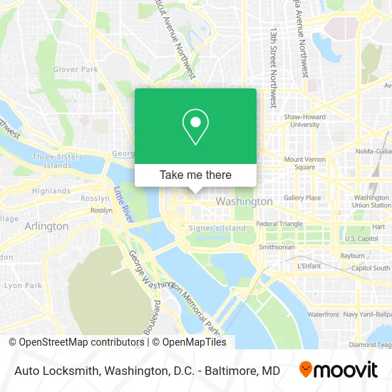
See Auto Locksmith, Washington, on the map
Public Transit to Auto Locksmith in Washington
Wondering how to get to Auto Locksmith in Washington? Moovit helps you find the best way to get to Auto Locksmith with step-by-step directions from the nearest public transit station.
Moovit provides free maps and live directions to help you navigate through your city. View schedules, routes, timetables, and find out how long does it take to get to Auto Locksmith in real time.
Looking for the nearest stop or station to Auto Locksmith? Check out this list of stops closest to your destination: F St Nw+22 St NW; F St Nw+21 St NW; 23rd St & I St NW Sb; Dupont Circle Metro Station; Virginia Ave @ 21st St Nw; Virginia Ave NW @ 21st St NW; Virginia Ave & 21st St - State Dept; 19th St & F St; 20th St & E St NW Nb; 19th St & E St; Farragut West.
Bus: A49, D74, F19, D82, D96, 220, 240, 260, 620, 640, 541, 611, 611-FR, 971, 972-M.Train: MANASSAS LINE, MARC.Metro: BLUE, ORANGE, RED, SILVER.
Want to see if there’s another route that gets you there at an earlier time? Moovit helps you find alternative routes or times. Get directions from and directions to Auto Locksmith easily from the Moovit App or Website.
We make riding to Auto Locksmith easy, which is why over 1.5 million users, including users in Washington, trust Moovit as the best app for public transit. You don’t need to download an individual bus app or train app, Moovit is your all-in-one transit app that helps you find the best bus time or train time available.
For information on prices of bus, metro and train, costs and ride fares to Auto Locksmith, please check the Moovit app.
Use the app to navigate to popular places including to the airport, hospital, stadium, grocery store, mall, coffee shop, school, college, and university.
Auto Locksmith Address: 2140 F St NW street in Washington
- State Plaza Hotel,
- Washington Surgi-Clinic (Washington Surgical Clinic),
- Paho / Who Federal Credit Union ,
- Johns Hopkins,
- Charles E. Smith Center,
- Metro Bus 31,32,36,80,
- GW Engineering,
- Mr Catlins Room,
- The School Without Walls of Washington, DC,
- State Plaza Hotel Washington,
- School Without Walls High School,
- Hotel Hive,
- Hotel Hive Washington,
- Paho,
- Paho (Paho Emergencies),
- Hattie M. Strong Residence Hall,
- Virginia Ave NW & E St NW,
- Emerg (Emergency Medical Response Group),
- DCFD Engine 23,
- Tonic
Places Near Auto Locksmith (Washington)
- Amazon Hq2, Arlington County,
- Westfield Montgomery Mall, Montgomery County,
- Pennsylvania Ave NW (3rd st and pennsylvania), Washington,
- National Mall, Washington,
- Georgetown, Washington,
- The Anthem, Washington,
- Basilica of the National Shrine, Washington,
- National Museum of African American History and Culture, Washington,
- Rock Creek Tennis Center, Washington,
- PG Mall, Prince George's County,
- Washington DC VA Medical Center, Washington,
- Washington National Cathedral, Washington,
- Museum Of The Bible, Washington,
- M&T Bank Stadium, Baltimore,
- Warner Theatre, Washington,
- Marriott Marquis Washington, DC, Washington,
- Camden Yards, Baltimore,
- Sibley Memorial Hospital, Washington,
- National Zoo, Washington,
- Capital One Arena, Washington
How to get to popular places in Washington, D.C. - Baltimore, MD with public transit
Get around Washington by public transit!
Traveling around Washington has never been so easy. See step by step directions as you travel to any attraction, street or major public transit station. View bus and train schedules, arrival times, service alerts and detailed routes on a map, so you know exactly how to get to anywhere in Washington.
When traveling to any destination around Washington use Moovit's Live Directions with Get Off Notifications to know exactly where and how far to walk, how long to wait for your line, and how many stops are left. Moovit will alert you when it's time to get off — no need to constantly re-check whether yours is the next stop.
Wondering how to use public transit in Washington or how to pay for public transit in Washington? Moovit public transit app can help you navigate your way with public transit easily, and at minimum cost. It includes public transit fees, ticket prices, and costs. Looking for a map of Washington public transit lines? Moovit public transit app shows all public transit maps in Washington with all Bus, Train, Metro, Light Rail and Ferry routes and stops on an interactive map.
Washington, D.C. - Baltimore, MD has 5 transit type(s), including: Bus, Train, Metro, Light Rail and Ferry, operated by several transit agencies, including WMATA, Montgomery County Ride On, Fairfax Connector, TheBus, PRTC, DASH - Alexandria, Arlington Transit (ART), RTA of Central Maryland, MDOT MTA, MDOT MTA Light RailLink, MDOT MTA Commuter Bus, MDOT MTA Local Bus, FXBGO!, Virginia Railway Express (VRE) and MARC