How to get to Auto Miami Locksmith by bus?
Click on the bus route to see step by step directions with maps, line arrival times and updated time schedules.
From Ziff Ballet Opera House
49 minFrom Consulate General of the Federal Republic of Germany
46 minFrom COURTYARD by Marriott
51 minFrom Vizcaya Museum and Gardens
64 minFrom SW 7th St
33 minFrom Consulado Colombiano
46 minFrom Miami Dade College-Wolfson
44 minFrom Adrienne Arsht Center for the Performing Arts
49 minFrom Target (Target Store Dadeland)
71 minFrom Holiday Inn Hotel Port of Miami Downtown an IHG Hotel
44 min
Bus stops near Auto Miami Locksmith
Bus lines to Auto Miami Locksmith
What are the closest stations to Auto Miami Locksmith?
The closest stations to Auto Miami Locksmith are:
- Sw 57 Av & W Flagler St is 24 yards away, 1 min walk.
- Nw 57 Av & W Flagler St is 34 yards away, 1 min walk.
- W Flagler St & Sw 57 Av is 60 yards away, 1 min walk.
Which bus lines stop near Auto Miami Locksmith?
These bus lines stop near Auto Miami Locksmith: 11, 211.
What’s the nearest bus station to Auto Miami Locksmith?
The nearest bus stations to Auto Miami Locksmith are Sw 57 Av & W Flagler St, Nw 57 Av & W Flagler St and W Flagler St & Sw 57 Av. The closest one is a 1 min walk away.
What time is the first bus to Auto Miami Locksmith?
The 11 is the first bus that goes to Auto Miami Locksmith. It stops nearby at 3:22 AM.
What time is the last bus to Auto Miami Locksmith?
The 11 is the last bus that goes to Auto Miami Locksmith. It stops nearby at 2:29 AM.
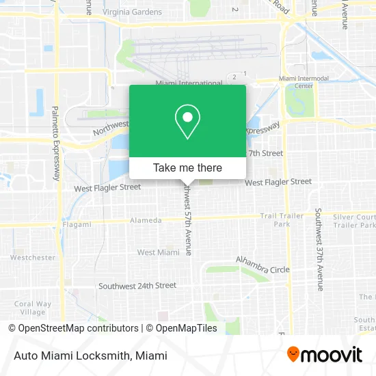
See Auto Miami Locksmith on the map
Public Transportation to Auto Miami Locksmith
Wondering how to get to Auto Miami Locksmith? Moovit helps you find the best way to get to Auto Miami Locksmith with step-by-step directions from the nearest public transit station.
Moovit provides free maps and live directions to help you navigate through your city. View schedules, routes, timetables, and find out how long does it take to get to Auto Miami Locksmith in real time.
Looking for the nearest stop or station to Auto Miami Locksmith? Check out this list of stops closest to your destination: Sw 57 Av & W Flagler St; Nw 57 Av & W Flagler St; W Flagler St & Sw 57 Av.
Bus: 11, 211, 57, MIAFLAG.
Want to see if there’s another route that gets you there at an earlier time? Moovit helps you find alternative routes or times. Get directions from and directions to Auto Miami Locksmith easily from the Moovit App or Website.
We make riding to Auto Miami Locksmith easy, which is why over 1.5 million users, including users in Miami, trust Moovit as the best app for public transit. You don’t need to download an individual bus app or train app, Moovit is your all-in-one transit app that helps you find the best bus time or train time available.
For information on prices of bus, light rail and train, costs and ride fares to Auto Miami Locksmith, please check the Moovit app.
Use the app to navigate to popular places including to the airport, hospital, stadium, grocery store, mall, coffee shop, school, college, and university.
Auto Miami Locksmith Address: 5700 W Flagler St Miami, FL 33144 street in Miami
- La Mas Barato,
- MZ Miami,
- W Flagler St / NW 57th Ave,
- West Flagler Street & Northwest 57th Avenue,
- Flagler & 57 Ave,
- ATM,
- Picara Fashion,
- Latin Dreams,
- Univida Medical Center,
- Fundacion Perla de Esperanza,
- Jorbell USA,
- Bien Barato,
- Car in Cuba Booking,
- 5601 Flagler,
- Tropical Used Cars,
- Miami 24 Hours Locksmith LLP,
- West Flagler Street & West 58th Avenue,
- 5716 NW 2nd St Parking,
- West Flagler Street & West 56th Avenue,
- Westar Flagler Center
Places Near Auto Miami Locksmith
- Zoo Miami, Miami,
- Miami-Dade County Courthouse, Miami,
- Sawgrass mall ( FL ), Miami Beach,
- Keiser University Flagship Campus, West Palm Beach,
- Aventura Mall, Miami Beach,
- Marlins Park, Miami,
- Wynwood, Miami,
- Little Havana, Miami,
- Port of Miami Cruise Terminal, Miami,
- Dolphin Mall Bus, Miami,
- Sawgrass Mall, Miami,
- Bayside Marketplace, Miami,
- Miami Design District, Miami,
- Miami Freedom Park, Miami,
- Aventura Mall, Miami,
- Richard E. Gerstein Justice Building, Miami,
- Dolphin Mall, Miami,
- 1351 NW 12th St, Miami,
- Hard Rock Stadium, Miami Gardens,
- Brickell City Centre, Miami
How to get to popular places in Miami with public transit
Get around Miami by public transit!
Traveling around Miami has never been so easy. See step by step directions as you travel to any attraction, street or major public transit station. View bus and train schedules, arrival times, service alerts and detailed routes on a map, so you know exactly how to get to anywhere in Miami.
When traveling to any destination around Miami use Moovit's Live Directions with Get Off Notifications to know exactly where and how far to walk, how long to wait for your line, and how many stops are left. Moovit will alert you when it's time to get off — no need to constantly re-check whether yours is the next stop.
Wondering how to use public transit in Miami or how to pay for public transit in Miami? Moovit public transit app can help you navigate your way with public transit easily, and at minimum cost. It includes public transit fees, ticket prices, and costs. Looking for a map of Miami public transit lines? Moovit public transit app shows all public transit maps in Miami with all Bus, Train, Light Rail and Ferry routes and stops on an interactive map.
Miami has 4 transit type(s), including: Bus, Train, Light Rail and Ferry, operated by several transit agencies, including Broward County Transit, Miami-Dade Transit, Metrorail, Palm Tran, Tri-Rail, Brightline, MARTY, City of Homestead Trolley, Key West Transit, Treasure Coast Connector, GoLine IRT, Amtrak, Greyhound-us, FlixBus-us and Aventura Express Shuttle Bus