Directions to Auto Posto Esal (Angra Dos Reis) with public transportation
The following transit lines have routes that pass near Auto Posto Esal
 Bus: 106, 230, T11, T21, C05.
- Ferry: ANGRA DOS REIS - ILHA GRANDE, ANGRA DOS REIS - ILHA GRANDE.
How to get to Auto Posto Esal by bus?
Click on the bus route to see step by step directions with maps, line arrival times and updated time schedules.
From Delivery Acai, Jacuecanga
44 minFrom Rod. Governador Mário Covas, Km 115 s/n, Cunhambebe
84 minFrom Rua da Paz 42, Jacuecanga
44 minFrom Pousada das Bromélias, Jacuecanga
71 minFrom Pousada Ponta do Leste, Jacuecanga
56 minFrom Morro Do Martelo, Jacuecanga
61 minFrom Condominio Praia do Engenho, Cunhambebe
67 minFrom Praia das eguas, Jacuecanga
54 minFrom Praia do Objetivo, Jacuecanga
62 minFrom Samba Angra dos Reis, Cunhambebe
84 min
Bus stops near Auto Posto Esal in Angra Dos Reis
Ferry station near Auto Posto Esal in Angra Dos Reis
- Estação Santa Luzia (Angra Dos Reis) ⛴, 7 min walk,VIEW
Bus lines to Auto Posto Esal in Angra Dos Reis
- C05, Retiro,VIEW
- T11, Ponta Leste (via Jacuecanga),VIEW
- B106, Jacuecanga (via Morro da Cruz),VIEW
- 206, Banqueta,VIEW
- 207, Japuíba (via Morro da Cruz - Circular),VIEW
- B207, Japuíba (via Rio-Santos / Circular),VIEW
- 224, Vila Nova,VIEW
- 225, Campo Belo,VIEW
- C04, Vila Velha,VIEW
- C04B, Vila Velha (via Heliponto),VIEW
- 204, Centro,VIEW
- T10, Centro (Direto),VIEW
- C01, Centro (Circular),VIEW
- C01B, Circular (via Pestalozzi),VIEW
- C03, Marinas,VIEW
- C03B, Marinas (via Balneário),VIEW
- C05B, Retiro (via Balneário),VIEW
- T20, Parque Mambucaba (via Praia Brava / Vila Histórica),VIEW
- T21, Frade,VIEW
- T21B, Praia Brava,VIEW
What are the closest stations to Auto Posto Esal?
The closest stations to Auto Posto Esal are:
- Rua Coronel Carvalho, 230a is 245 meters away, 4 min walk.
- Rua Oswaldo Neves Martins, 168 is 377 meters away, 5 min walk.
- Avenida Oswaldo Neves Martins, 132-328 is 402 meters away, 6 min walk.
- Centro / Santa Luzia is 449 meters away, 6 min walk.
- Estação Santa Luzia (Angra Dos Reis) ⛴ is 483 meters away, 7 min walk.
- Desembarque Centro / Largo Da Lapa is 491 meters away, 7 min walk.
- Centro / Praça Do Porto is 526 meters away, 7 min walk.
Which bus lines stop near Auto Posto Esal?
These bus lines stop near Auto Posto Esal: 106, 230, T11, T21.
What’s the nearest bus station to Auto Posto Esal in Angra Dos Reis?
The nearest bus station to Auto Posto Esal in Angra Dos Reis is Rua Coronel Carvalho, 230a. It’s a 4 min walk away.
What’s the nearest ferry station to Auto Posto Esal in Angra Dos Reis?
The nearest ferry station to Auto Posto Esal in Angra Dos Reis is Estação Santa Luzia (Angra Dos Reis) ⛴. It’s a 7 min walk away.
What time is the first bus to Auto Posto Esal in Angra Dos Reis?
The T20 is the first bus that goes to Auto Posto Esal in Angra Dos Reis. It stops nearby at 4:50 AM.
What time is the last bus to Auto Posto Esal in Angra Dos Reis?
The T11 is the last bus that goes to Auto Posto Esal in Angra Dos Reis. It stops nearby at 2:01 AM.
What time is the first ferry to Auto Posto Esal in Angra Dos Reis?
The ANGRA DOS REIS - ILHA GRANDE is the first ferry that goes to Auto Posto Esal in Angra Dos Reis. It stops nearby at 8:35 AM.
What time is the last ferry to Auto Posto Esal in Angra Dos Reis?
The ANGRA DOS REIS - ILHA GRANDE is the last ferry that goes to Auto Posto Esal in Angra Dos Reis. It stops nearby at 6:30 PM.
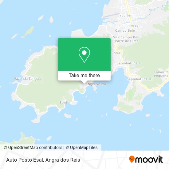
See Auto Posto Esal, Angra Dos Reis, on the map
Public Transit to Auto Posto Esal in Angra Dos Reis
Wondering how to get to Auto Posto Esal in Angra Dos Reis? Moovit helps you find the best way to get to Auto Posto Esal with step-by-step directions from the nearest public transit station.
Moovit provides free maps and live directions to help you navigate through your city. View schedules, routes, timetables, and find out how long does it take to get to Auto Posto Esal in real time.
Looking for the nearest stop or station to Auto Posto Esal? Check out this list of stops closest to your destination: Rua Coronel Carvalho; Rua Oswaldo Neves Martins; Avenida Oswaldo Neves Martins; Centro / Santa Luzia; Estação Santa Luzia (Angra Dos Reis) ⛴; Desembarque Centro / Largo Da Lapa; Centro / Praça Do Porto.
Bus: 106, 230, T11, T21, C05, B106, 206, 207, C04, C04B, 204, T10, C01, C01B, C03, C03B, C05B.Ferry: ANGRA DOS REIS - ILHA GRANDE, ANGRA DOS REIS - ILHA GRANDE.
Want to see if there’s another route that gets you there at an earlier time? Moovit helps you find alternative routes or times. Get directions from and directions to Auto Posto Esal easily from the Moovit App or Website.
We make riding to Auto Posto Esal easy, which is why over 1.5 million users, including users in Angra Dos Reis, trust Moovit as the best app for public transit. You don’t need to download an individual bus app or train app, Moovit is your all-in-one transit app that helps you find the best bus time or train time available.
For information on prices of bus, costs and ride fares to Auto Posto Esal, please check the Moovit app.
Use the app to navigate to popular places including to the airport, hospital, stadium, grocery store, mall, coffee shop, school, college, and university.
Auto Posto Esal Address: Rua Vereador de Brito, Centro Angra dos Reis-RJ street in Angra Dos Reis
- Salão do Reino das Testemunhas de Jeová,
- Secretaria Especial de Defesa Civil e Trânsito,
- Condomínio Chácara São Bento,
- Rua Doutor Álvaro Pessoa s/n,
- São Bento,
- C. E. Conde Pereira Carneiro,
- 116 Zona Eleitoral,
- Morro do Abel,
- Avenida Almirante Júlio César de Noronha 13,
- R. Osvaldo Neves Martins 142,
- Dentista Dr. Neida A. Vieira,
- Centro Cultural Theóphilo Massad,
- Vara do Trabalho de Angra dos Reis,
- Rua Oswaldo Neves Martins,
- Delegacia da Capitania dos Portos em Angra Dos Reis,
- teatro municipal camara torres,
- Secretaria De Assistência Social E Direitos Humanos,
- Rua Honório Lima 1,
- Praça Almirante Tamandaré 156,
- Quadrifromaggio Restaurante
Places Near Auto Posto Esal (Angra Dos Reis)
- Avenida Antônio Bertholdo da Silva Jordão 7346, Jacuecanga,
- Vila Residencial De Mambucaba, Mambucaba,
- Cachoeira do Tobogã, Parati,
- Praia de Paraty Mirim, Parati,
- Avenida Almirante Jair Carneiro Toscano de Brito 110, Angra Dos Reis,
- Vila Galé Eco Resort De Angra, Angra Dos Reis,
- Mambucaba, Mambucaba,
- BR 101, Km 508 s/n, Cunhambebe,
- Rodovia Procurador Haroldo Fernandes Duarte, Km 513,5 s / n, Cunhambebe,
- Centro Histórico de Paraty, Parati,
- Condominio Laranjeiras, Parati Mirim,
- Alambique Engenho D'Ouro, Parati,
- Rua Prefeito João Gregório Galindo 2487, Angra Dos Reis,
- Verolme, Jacuecanga,
- praia jabaquara - parati, Parati,
- Rodovia BR 101, Km 533 s/n, Mambucaba,
- Rua Cônegos Bittencourt, Angra Dos Reis,
- Praia do Laboratório, Angra Dos Reis,
- Rua Prefeito João Gregório Galindo, Cunhambebe,
- Garatucaia, Angra Dos Reis
How to get to popular places in Angra dos Reis with public transit
Get around Angra Dos Reis by public transit!
Traveling around Angra Dos Reis has never been so easy. See step by step directions as you travel to any attraction, street or major public transit station. View bus and train schedules, arrival times, service alerts and detailed routes on a map, so you know exactly how to get to anywhere in Angra Dos Reis.
When traveling to any destination around Angra Dos Reis use Moovit's Live Directions with Get Off Notifications to know exactly where and how far to walk, how long to wait for your line, and how many stops are left. Moovit will alert you when it's time to get off — no need to constantly re-check whether yours is the next stop.
Wondering how to use public transit in Angra Dos Reis or how to pay for public transit in Angra Dos Reis? Moovit public transit app can help you navigate your way with public transit easily, and at minimum cost. It includes public transit fees, ticket prices, and costs. Looking for a map of Angra Dos Reis public transit lines? Moovit public transit app shows all public transit maps in Angra Dos Reis with all Bus and Ferry routes and stops on an interactive map.
Angra dos Reis has 2 transit type(s), including: Bus and Ferry, operated by several transit agencies, including Viação Senhor do Bonfim, Colitur Transportes Rodoviários, Cooparatyense (Vans), Costa Verde Transportes, Barcas Rio, Objetiva Tour, Vilanova Tour, Rodoviário Oceano, BusUFF and Colitur (Tarifa Zero - Paraty)