Directions to Auto Posto Estrelas (Piên) with public transportation
The following transit lines have routes that pass near Auto Posto Estrelas
How to get to Auto Posto Estrelas by bus?
Click on the bus route to see step by step directions with maps, line arrival times and updated time schedules.
From Areia Branca dos Assis, Mandirituba
66 minFrom puteiro da katlin, Fazenda Rio Grande
107 minFrom Fazenda Rio Grande, Fazenda Rio Grande
92 minFrom Rua Vereador Domingos Benvenuto Moletta, São José Dos Pinhais
192 minFrom Mandirituba, Fazenda Rio Grande
84 minFrom Campo Redondo, Araucária
379 minFrom Bairro Estados, Fazenda Rio Grande
110 minFrom Tijucas Do Sul, Tijucas Do Sul
266 minFrom Mandirituba, Mandirituba
82 minFrom Rua Tenente Sandro Luiz Kampa 182, Fazenda Rio Grande
94 min
Bus stop near Auto Posto Estrelas in Piên
- Terminal Rodoviário De Piên, 7 min walk,VIEW
Bus lines to Auto Posto Estrelas in Piên
- I21 PIÊN / FAZENDA RIO GRANDE (VIA AGUDOS DO SUL), Fazenda Rio Grande → Piên,VIEW
What are the closest stations to Auto Posto Estrelas?
The closest stations to Auto Posto Estrelas are:
- Terminal Rodoviário De Piên is 489 meters away, 7 min walk.
Which bus line stops near Auto Posto Estrelas?
I21 PIÊN / FAZENDA RIO GRANDE (VIA AGUDOS DO SUL) (Fazenda Rio Grande → Piên)
What’s the nearest bus station to Auto Posto Estrelas in Piên?
The nearest bus station to Auto Posto Estrelas in Piên is Terminal Rodoviário De Piên. It’s a 7 min walk away.
What time is the first bus to Auto Posto Estrelas in Piên?
The I21 PIÊN / FAZENDA RIO GRANDE (VIA AGUDOS DO SUL) is the first bus that goes to Auto Posto Estrelas in Piên. It stops nearby at 5:30 AM.
What time is the last bus to Auto Posto Estrelas in Piên?
The I21 PIÊN / FAZENDA RIO GRANDE (VIA AGUDOS DO SUL) is the last bus that goes to Auto Posto Estrelas in Piên. It stops nearby at 8:25 PM.
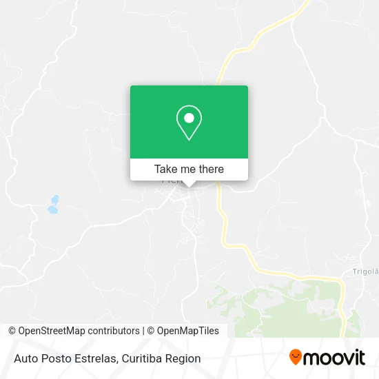
See Auto Posto Estrelas, Piên, on the map
Public Transit to Auto Posto Estrelas in Piên
Wondering how to get to Auto Posto Estrelas in Piên? Moovit helps you find the best way to get to Auto Posto Estrelas with step-by-step directions from the nearest public transit station.
Moovit provides free maps and live directions to help you navigate through your city. View schedules, routes, timetables, and find out how long does it take to get to Auto Posto Estrelas in real time.
Looking for the nearest stop or station to Auto Posto Estrelas? Check out this list of stops closest to your destination: Terminal Rodoviário De Piên.
Bus: I21 PIÊN / FAZENDA RIO GRANDE (VIA AGUDOS DO SUL).
Want to see if there’s another route that gets you there at an earlier time? Moovit helps you find alternative routes or times. Get directions from and directions to Auto Posto Estrelas easily from the Moovit App or Website.
We make riding to Auto Posto Estrelas easy, which is why over 1.5 million users, including users in Piên, trust Moovit as the best app for public transit. You don’t need to download an individual bus app or train app, Moovit is your all-in-one transit app that helps you find the best bus time or train time available.
For information on prices of bus, costs and ride fares to Auto Posto Estrelas, please check the Moovit app.
Use the app to navigate to popular places including to the airport, hospital, stadium, grocery store, mall, coffee shop, school, college, and university.
Auto Posto Estrelas Address: Rua Acre, Piên Piên-PR 83860-000 street in Piên
- Bella Moça,
- Auto Posto Três Estrelas,
- Jt Distribuidora,
- Honório Transportes,
- 10 Air Camp Kuque,
- Auto Pecas Tureck,
- Retocar Funilaria e Pintura,
- Vibe Hooka,
- Auto Top Multimarcas,
- Ferramentas e Ferragens Camargo,
- Hiperfarma Piên,
- Streit Mudas e Flores,
- Fiepp's Centro Automotivo,
- Super Sul Piên.Supermercados,
- Companhia da Beleza Infinity,
- Pizzaria Padaria Mendes,
- Panificadora Mendes,
- Kadiany Enxovais e Presentes,
- Farmed,
- Mc Style Modas
Places Near Auto Posto Estrelas (Piên)
- Hospital de Clínicas (HC - UFPR), Centro,
- Hospital Madalena Sofia, Bairro Alto,
- Hospital Nossa Senhora Das Graças, Mercês,
- Parque Barigui, Mercês,
- Hospital do Rocio, Campo,
- Shopping Estação, Rebouças,
- Jardim Botânico de Curitiba PR, Centro,
- Hospital Erasto Gaertner, Jardim Das Américas,
- Hospital Da Cruz Vermelha, Batel,
- Campo Largo, Campo,
- Hhhhh, Fazendinha,
- Hospital Angelina Caron, Campina Grande Do Sul,
- Arena Da Baixada - Curitiba,
- Jockey Plaza Shopping Center, Tarumã,
- Rua Martim Afonso 558, Mercês,
- Park Shopping Barigüi, Mossunguê,
- Pontifícia Universidade Católica do Paraná (PUCPR), Prado Velho,
- Rua General Mário Tourinho, Campina Do Siqueira,
- Shopping Palladium, Portão,
- Hospital Universitário Evangélico de Curitiba, Bigorrilho
How to get to popular places in Curitiba Region with public transit
Get around Piên by public transit!
Traveling around Piên has never been so easy. See step by step directions as you travel to any attraction, street or major public transit station. View bus and train schedules, arrival times, service alerts and detailed routes on a map, so you know exactly how to get to anywhere in Piên.
When traveling to any destination around Piên use Moovit's Live Directions with Get Off Notifications to know exactly where and how far to walk, how long to wait for your line, and how many stops are left. Moovit will alert you when it's time to get off — no need to constantly re-check whether yours is the next stop.
Wondering how to use public transit in Piên or how to pay for public transit in Piên? Moovit public transit app can help you navigate your way with public transit easily, and at minimum cost. It includes public transit fees, ticket prices, and costs. Looking for a map of Piên public transit lines? Moovit public transit app shows all public transit maps in Piên with all Bus and Cable Car routes and stops on an interactive map.
Curitiba Region has 2 transit type(s), including: Bus and Cable Car, operated by several transit agencies, including Sistema Integrado de Mobilidade (URBS), Sistema Integrado de Mobilidade (AMEP), URBS (Cartões bancários e Dinheiro), URBS (Cartões bancários / Cartão URBS), AMEP (Cartões bancários / Cartão MetroCard), AMEP (Cartões bancários / Cartão MetroCard / Dinheiro), Viação Colombo (Dinheiro), TRIAR (Cartão TRIAR / Dinheiro), Empresa Curitiba Cerro Azul (Dinheiro), Expresso Nossa Senhora da Penha (Dinheiro), Empresa Campo Alto Tijucas (Dinheiro), Auto Viação São José (Cartão VEM / Dinheiro), BRT S/A (Cartão VEM / Dinheiro), TransPiedade (Cartão Cidadão / Dinheiro) and Oceânica Sul (Cartão Transporte / Dinheiro)