How to get to Auto Praise by bus?
Click on the bus route to see step by step directions with maps, line arrival times and updated time schedules.
From JP Taravella High School, Coral Springs-Margate
60 minFrom Tri-Rail-Pompano Beach Station, Pompano Beach
44 minFrom Lynn University, Boca Raton
75 minFrom Blanche Ely High School, Pompano Beach
93 minFrom Walmart Supercenter, Pompano Beach
75 minFrom Coral Square Mall Shopping Center, Coral Springs-Margate
61 minFrom Butterfly World, Pompano Beach
40 minFrom Harrah's Pompano Beach, Pompano Beach
79 minFrom Cam Transfer, Coral Springs-Margate
41 min
Bus stops near Auto Praise in Deerfield Beach
Bus lines to Auto Praise in Deerfield Beach
What are the closest stations to Auto Praise?
The closest stations to Auto Praise are:
- Hillsboro Boulevard/US 441 is 106 yards away, 2 min walk.
- US 441/Hillsboro Boulevard is 124 yards away, 2 min walk.
Which bus lines stop near Auto Praise?
These bus lines stop near Auto Praise: 19, 31, 48.
What’s the nearest bus station to Auto Praise in Deerfield Beach?
The nearest bus stations to Auto Praise in Deerfield Beach are Hillsboro Boulevard/US 441 and US 441/Hillsboro Boulevard. The closest one is a 2 min walk away.
What time is the first bus to Auto Praise in Deerfield Beach?
The 19 is the first bus that goes to Auto Praise in Deerfield Beach. It stops nearby at 4:52 AM.
What time is the last bus to Auto Praise in Deerfield Beach?
The 19 is the last bus that goes to Auto Praise in Deerfield Beach. It stops nearby at 1:30 AM.
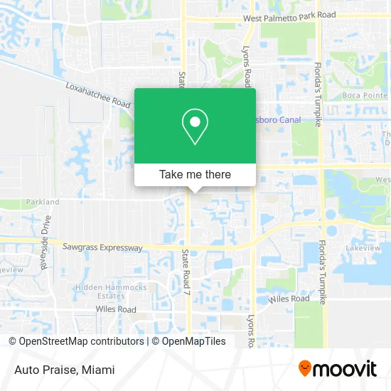
See Auto Praise, Deerfield Beach, on the map
Public Transit to Auto Praise in Deerfield Beach
Wondering how to get to Auto Praise in Deerfield Beach? Moovit helps you find the best way to get to Auto Praise with step-by-step directions from the nearest public transit station.
Moovit provides free maps and live directions to help you navigate through your city. View schedules, routes, timetables, and find out how long does it take to get to Auto Praise in real time.
Looking for the nearest stop or station to Auto Praise? Check out this list of stops closest to your destination: Hillsboro Boulevard/US 441; US 441/Hillsboro Boulevard.
Bus: 19, 31, 48.
Want to see if there’s another route that gets you there at an earlier time? Moovit helps you find alternative routes or times. Get directions from and directions to Auto Praise easily from the Moovit App or Website.
We make riding to Auto Praise easy, which is why over 1.5 million users, including users in Deerfield Beach, trust Moovit as the best app for public transit. You don’t need to download an individual bus app or train app, Moovit is your all-in-one transit app that helps you find the best bus time or train time available.
For information on prices of bus and train, costs and ride fares to Auto Praise, please check the Moovit app.
Use the app to navigate to popular places including to the airport, hospital, stadium, grocery store, mall, coffee shop, school, college, and university.
Auto Praise Address: 6574 N State Road 7 Pompano Beach, FL 33073 street in Deerfield Beach
- Gentlemen's,
- Value Painting and Flooring,
- Shred Nations,
- North Broward Wellness Center,
- Perfect Touch Painting,
- Umair Jawaid - TD Wealth Financial Advisors,
- The Salvation Army Family Store & Donation Center,
- Clark Financial Planning Services LLC,
- US-441 / Johnson Rd,
- Players Place Association, Inc,
- Luvyduvy Corporation,
- Yourlife of Coconut Creek,
- Yalla,
- Holmberg Rd / US-441,
- Beiruty Sea & Grill,
- Tomalty Dental Care of Parkland and Coconut Creek,
- Landlubber's Raw Bar & Grill,
- Select Homes Realty Group,
- Wse Monitoring,
- AB Insurance Group
Places Near Auto Praise (Deerfield Beach)
- Brickell City Centre, Miami,
- Miami Freedom Park, Miami,
- Zoo Miami, Miami,
- Richard E. Gerstein Justice Building, Miami,
- Aventura Mall, Miami Beach,
- Aventura Mall, Miami,
- Miami-Dade County Courthouse, Miami,
- Keiser University Flagship Campus, West Palm Beach,
- Miami VA Hospital, Miami,
- Bayside Marketplace, Miami,
- Sawgrass Mall, Miami,
- Dolphin Mall Bus, Miami,
- Little Havana, Miami,
- Dolphin Mall, Miami,
- Marlins Park, Miami,
- Wynwood, Miami,
- Miami Design District, Miami,
- Sawgrass mall ( FL ), Miami Beach,
- Port of Miami Cruise Terminal, Miami,
- Hard Rock Stadium, Miami Gardens
How to get to popular places in Miami with public transit
Get around Deerfield Beach by public transit!
Traveling around Deerfield Beach has never been so easy. See step by step directions as you travel to any attraction, street or major public transit station. View bus and train schedules, arrival times, service alerts and detailed routes on a map, so you know exactly how to get to anywhere in Deerfield Beach.
When traveling to any destination around Deerfield Beach use Moovit's Live Directions with Get Off Notifications to know exactly where and how far to walk, how long to wait for your line, and how many stops are left. Moovit will alert you when it's time to get off — no need to constantly re-check whether yours is the next stop.
Wondering how to use public transit in Deerfield Beach or how to pay for public transit in Deerfield Beach? Moovit public transit app can help you navigate your way with public transit easily, and at minimum cost. It includes public transit fees, ticket prices, and costs. Looking for a map of Deerfield Beach public transit lines? Moovit public transit app shows all public transit maps in Deerfield Beach with all Bus, Train, Light Rail and Ferry routes and stops on an interactive map.
Miami has 4 transit type(s), including: Bus, Train, Light Rail and Ferry, operated by several transit agencies, including Broward County Transit, Miami-Dade Transit, Metrorail, Palm Tran, Tri-Rail, Brightline, MARTY, City of Homestead Trolley, Key West Transit, Treasure Coast Connector, GoLine IRT, Amtrak, Greyhound-us, FlixBus-us and Aventura Express Shuttle Bus