Directions to Auto Sign (Torrões) with public transportation
The following transit lines have routes that pass near Auto Sign
 Bus: 207, 2421 TORRÕES / TI GETÚLIO VARGAS, 346, 424, 2416 RODA DE FOGO / TI GETÚLIO VARGAS.
- Subway: GIB, JAB.
How to get to Auto Sign by bus?
Click on the bus route to see step by step directions with maps, line arrival times and updated time schedules.
From Estação Rodoviária do Recife, Várzea
51 minFrom Parque Dona Lindu, Boa Viagem
61 minFrom Ultra-Diagnóstico Dr. Eduardo Jurema, Santo Amaro
42 minFrom BR-101, Km 57 s/n, Guabiraba
51 minFrom Rua Doutor Raul Lafayette 191, Boa Viagem
50 minFrom Rua Professor Augusto Lins e Silva, Boa Viagem
63 minFrom Memorial Guararapes - Cemitério E Crematório, Jaboatão Dos Guararapes
93 minFrom Hospital Eduardo Campus Da Pessoa Idosa, Areias
37 minFrom Praia do Pina, Pina
43 min
How to get to Auto Sign by subway?
Click on the subway route to see step by step directions with maps, line arrival times and updated time schedules.
Bus stops near Auto Sign in Torrões
Subway station near Auto Sign in Torrões
- Estação Afogados - Metrorec, 38 min walk,VIEW
Bus lines to Auto Sign in Torrões
What are the closest stations to Auto Sign?
The closest stations to Auto Sign are:
- Rua Ocidental, 346-384 is 143 meters away, 2 min walk.
- Rua Jardim Do Forte 88 is 188 meters away, 3 min walk.
- Avenida Forte Do Arraial Do Novo Bom Jesus 1131 is 438 meters away, 6 min walk.
- Estação Afogados - Metrorec is 2953 meters away, 38 min walk.
Which bus lines stop near Auto Sign?
These bus lines stop near Auto Sign: 207, 2421 TORRÕES / TI GETÚLIO VARGAS, 346, 424.
Which subway line stops near Auto Sign?
GIB (Camaragibe)
What’s the nearest bus station to Auto Sign in Torrões?
The nearest bus station to Auto Sign in Torrões is Rua Ocidental, 346-384. It’s a 2 min walk away.
What time is the first subway to Auto Sign in Torrões?
The JAB is the first subway that goes to Auto Sign in Torrões. It stops nearby at 5:03 AM.
What time is the last subway to Auto Sign in Torrões?
The GIB is the last subway that goes to Auto Sign in Torrões. It stops nearby at 11:37 PM.
What time is the first bus to Auto Sign in Torrões?
The 2462 LOTEAMENTO SANTOS COSME E DAMIÃO (BACURAU) is the first bus that goes to Auto Sign in Torrões. It stops nearby at 3:22 AM.
What time is the last bus to Auto Sign in Torrões?
The 2462 LOTEAMENTO SANTOS COSME E DAMIÃO (BACURAU) is the last bus that goes to Auto Sign in Torrões. It stops nearby at 4:00 AM.
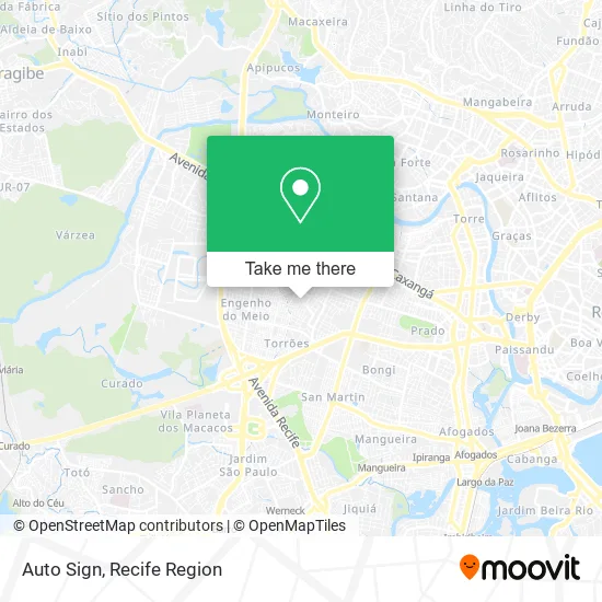
See Auto Sign, Torrões, on the map
Public Transit to Auto Sign in Torrões
Wondering how to get to Auto Sign in Torrões? Moovit helps you find the best way to get to Auto Sign with step-by-step directions from the nearest public transit station.
Moovit provides free maps and live directions to help you navigate through your city. View schedules, routes, timetables, and find out how long does it take to get to Auto Sign in real time.
Looking for the nearest stop or station to Auto Sign? Check out this list of stops closest to your destination: Rua Ocidental; Rua Jardim Do Forte 88; Avenida Forte Do Arraial Do Novo Bom Jesus 1131; Estação Afogados - Metrorec.
Bus: 207, 2421 TORRÕES / TI GETÚLIO VARGAS, 346, 424, 2416 RODA DE FOGO / TI GETÚLIO VARGAS, 2462 LOTEAMENTO SANTOS COSME E DAMIÃO (BACURAU).Subway: GIB, JAB.
Want to see if there’s another route that gets you there at an earlier time? Moovit helps you find alternative routes or times. Get directions from and directions to Auto Sign easily from the Moovit App or Website.
We make riding to Auto Sign easy, which is why over 1.5 million users, including users in Torrões, trust Moovit as the best app for public transit. You don’t need to download an individual bus app or train app, Moovit is your all-in-one transit app that helps you find the best bus time or train time available.
For information on prices of bus and subway, costs and ride fares to Auto Sign, please check the Moovit app.
Use the app to navigate to popular places including to the airport, hospital, stadium, grocery store, mall, coffee shop, school, college, and university.
Auto Sign Address: Rua Antônio Valdevino da Costa, 867 Torrões Recife-PE street in Torrões
- Varejao Todo Dia,
- Af Informatica,
- Mundo das Cestas,
- R G Refrigeracao,
- Extinchamas Comercio e Serviços de Extintores,
- Sedinor,
- Migui,
- Jp Comercial,
- R2 Toner,
- Jc Comércio de Gas Ltd,
- Juniorinfo,
- Recanto das Frutas,
- Merchandising,
- Ar Puro Comercio,
- Eloi Modas,
- Nutripet Clube,
- Condomínio do Edificio Itaparica,
- Lh Treinamentos Gerencias,
- Almeida Transportes Com Responsabilidad,
- Praia do Sossego Em Itamaracá
Places Near Auto Sign (Torrões)
- Hospital Universitário Oswaldo Cruz, Santo Amaro,
- Imbiribeira, Imbiribeira,
- Hospital Altino Ventura, Iputinga,
- Hospital Maria Lucinda, Parnamirim,
- Parque da Jaqueira, Jaqueira,
- SHOPPING GUARARAPES, Jaboatão Dos Guararapes,
- Marco Zero, Bairro Do Recife,
- Hospital Agamenon Magalhães, Tamarineira,
- Centro de Convenções de Pernambuco, Olinda,
- tuuuuu, Olinda,
- SHOPPING TACARUNA, Santo Amaro,
- Shopping RioMar Recife, Pina,
- Shopping Recife, Boa Viagem,
- Arena de Pernambuco, São Lourenço Da Mata,
- Hospital Geral De Areias, Areias,
- llll, Fundão,
- hospital otavio de freitas - UTI, Tejipió,
- Imip (Instituto Materno-Infantil De Pernambuco), Coelhos,
- Shopping Patteo Olinda, Olinda,
- Hospital Eduardo Campus Da Pessoa Idosa, Areias
How to get to popular places in Recife Region with public transit
Get around Torrões by public transit!
Traveling around Torrões has never been so easy. See step by step directions as you travel to any attraction, street or major public transit station. View bus and train schedules, arrival times, service alerts and detailed routes on a map, so you know exactly how to get to anywhere in Torrões.
When traveling to any destination around Torrões use Moovit's Live Directions with Get Off Notifications to know exactly where and how far to walk, how long to wait for your line, and how many stops are left. Moovit will alert you when it's time to get off — no need to constantly re-check whether yours is the next stop.
Wondering how to use public transit in Torrões or how to pay for public transit in Torrões? Moovit public transit app can help you navigate your way with public transit easily, and at minimum cost. It includes public transit fees, ticket prices, and costs. Looking for a map of Torrões public transit lines? Moovit public transit app shows all public transit maps in Torrões with all Bus, Train and Subway routes and stops on an interactive map.
Recife Region has 3 transit type(s), including: Bus, Train and Subway, operated by several transit agencies, including CBTU (Metrorec), BRT (Via Livre), Grande Recife, BORBOREMA IMPERIAL (TIP), BORBOREMA IMPERIAL (B.V), RODOVIÁRIA POTENGY, EMPRESA METROPOLITANA, CONSÓRCIO RECIFE, SÃO JUDAS TADEU, Expresso 1002, Rodotur Turismo, Complementar Recife, Sistema Municipal - Jaboatão, Sistema Municipal - Cabo and Sistema Municipal - Ipojuca