How to get to Autogaz Service by bus?
Click on the bus route to see step by step directions with maps, line arrival times and updated time schedules.
How to get to Autogaz Service by train?
Click on the train route to see step by step directions with maps, line arrival times and updated time schedules.
Bus stops near Autogaz Service in Warsaw
Train stations near Autogaz Service in Warsaw
Cable Car stations near Autogaz Service in Warsaw
- Tychy Dworzec PKP, 21 min walk,VIEW
Bus lines to Autogaz Service in Warsaw
- R, Tychy Szpital Wojewódzki - Czułów Fabryka,VIEW
- R, Tychy Rybna - Czułów Fabryka,VIEW
- R, Czułów Fabryka - Tychy Rybna,VIEW
- R, Czułów Fabryka - Tychy Szpital Wojewódzki,VIEW
- 272, 272,VIEW
- 137, Wilkowyje Dojazdowa - Tychy Towarowa,VIEW
- 137, Wilkowyje Dojazdowa - Tychy Osiedle "Z1",VIEW
- 137, Wilkowyje Murarska - Tychy Sikorskiego Wiadukt,VIEW
- 137, Wilkowyje Dojazdowa - Tychy Centrum Handlowe,VIEW
- 137, Wilkowyje Murarska - Tychy Centrum Handlowe,VIEW
- 137, Wilkowyje Murarska - Tychy Towarowa,VIEW
- 137, Wilkowyje Murarska - Tychy Osiedle "Z1",VIEW
- 21, Wilkowyje Murarska - Tychy Towarowa,VIEW
- 21, Wilkowyje Murarska - Cielmice Pętla,VIEW
- 245, Mikołów Dworzec - Tychy Towarowa,VIEW
- 268, Mikołów Dworzec - Tychy Sikorskiego Wiadukt,VIEW
- 268, Mikołów Dworzec - Tychy Zajezdnia,VIEW
- 268, Mikołów Dworzec - Tychy Towarowa,VIEW
- 273, Mąkołowiec Pętla - Tychy Zajezdnia,VIEW
- 273, Mąkołowiec Pętla - Tychy Towarowa,VIEW
What are the closest stations to Autogaz Service?
The closest stations to Autogaz Service are:
- Tychy Powstańców is 80 meters away, 2 min walk.
- Tychy Plac Wolności is 533 meters away, 8 min walk.
- Tychy Radziejówka is 546 meters away, 8 min walk.
- Tychy Zachodnie is 603 meters away, 8 min walk.
- Tychy Rynek is 611 meters away, 9 min walk.
- Tychy Dworzec PKP is 1601 meters away, 21 min walk.
- Tychy is 1618 meters away, 22 min walk.
Which bus lines stop near Autogaz Service?
These bus lines stop near Autogaz Service: 1, 4, 75, 82.
Which train lines stop near Autogaz Service?
These train lines stop near Autogaz Service: IC 1422, S5, S6.
What’s the nearest train station to Autogaz Service in Warsaw?
The nearest train station to Autogaz Service in Warsaw is Tychy Zachodnie. It’s a 8 min walk away.
What’s the nearest bus station to Autogaz Service in Warsaw?
The nearest bus station to Autogaz Service in Warsaw is Tychy Powstańców. It’s a 2 min walk away.
What’s the nearest cable car station to Autogaz Service in Warsaw?
The nearest cable car station to Autogaz Service in Warsaw is Tychy Dworzec PKP. It’s a 21 min walk away.
What time is the first train to Autogaz Service in Warsaw?
The S4 is the first train that goes to Autogaz Service in Warsaw. It stops nearby at 4:21 AM.
What time is the last train to Autogaz Service in Warsaw?
The S5 is the last train that goes to Autogaz Service in Warsaw. It stops nearby at 11:46 PM.
What time is the first bus to Autogaz Service in Warsaw?
The 82 is the first bus that goes to Autogaz Service in Warsaw. It stops nearby at 4:14 AM.
What time is the last bus to Autogaz Service in Warsaw?
The 75 is the last bus that goes to Autogaz Service in Warsaw. It stops nearby at 11:55 PM.
What time is the first cable car to Autogaz Service in Warsaw?
The A is the first cable car that goes to Autogaz Service in Warsaw. It stops nearby at 3:35 AM.
What time is the last cable car to Autogaz Service in Warsaw?
The A is the last cable car that goes to Autogaz Service in Warsaw. It stops nearby at 12:01 AM.
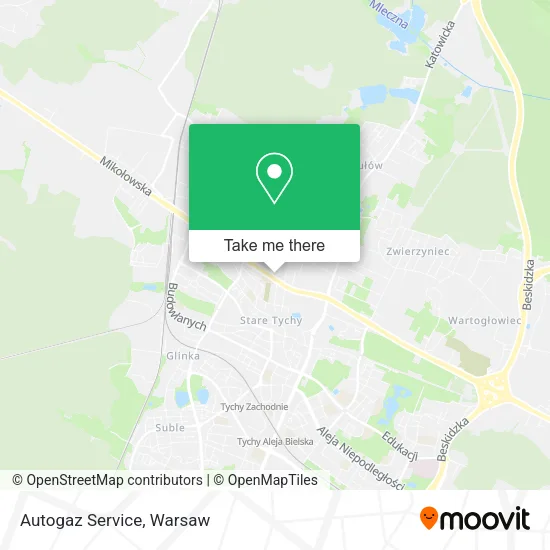
See Autogaz Service, Warsaw, on the map
Public Transit to Autogaz Service in Warsaw
Wondering how to get to Autogaz Service in Warsaw? Moovit helps you find the best way to get to Autogaz Service with step-by-step directions from the nearest public transit station.
Moovit provides free maps and live directions to help you navigate through your city. View schedules, routes, timetables, and find out how long does it take to get to Autogaz Service in real time.
Looking for the nearest stop or station to Autogaz Service? Check out this list of stops closest to your destination: Tychy Powstańców; Tychy Plac Wolności; Tychy Radziejówka; Tychy Zachodnie; Tychy Rynek; Tychy Dworzec PKP; Tychy.
Bus: 1, 4, 75, 82, R, R, R, R, 272.Train: IC 1422, S5, S6, S4, EIP 1400, EIC 1410, IC 1428, EIC 4110.Cable Car: B, B, D, D, D.
Want to see if there’s another route that gets you there at an earlier time? Moovit helps you find alternative routes or times. Get directions from and directions to Autogaz Service easily from the Moovit App or Website.
We make riding to Autogaz Service easy, which is why over 1.7 million users, including users in Warsaw, trust Moovit as the best app for public transit. You don’t need to download an individual bus app or train app, Moovit is your all-in-one transit app that helps you find the best bus time or train time available.
For information on prices of train and bus, costs and ride fares to Autogaz Service, please check the Moovit app.
Use the app to navigate to popular places including to the airport, hospital, stadium, grocery store, mall, coffee shop, school, college, and university.
Autogaz Service Address: ulica Mikołowska 40, 43-100 Tychy street in Warsaw
- Auto Ziobrowski,
- Excellent,
- Abc,
- Chowaniec Jerzy Zarząd Nieruchomości,
- Cj BHP Karolina Kozłowska,
- Mleczarenka sp. z o.o.,
- Dotkom,
- Kasy Fiskalne Dotkom,
- Osrodek Szkolenia i Doskonalenia Kadr,
- Duoprint Dorota Bendkowska,
- Animal Sport,
- Poczta Polska,
- Marczyk Linda. Reklama,
- Architektnet Michał Kryjak,
- Indywidualna Specjalistyczna Praktyka Lekarska Monika Dzięciołowska,
- Artem Mykhailo,
- Prezenterzy Marcin Witański,
- Łebski Dizajn,
- Sklep Ogrodniczy Pomona Trzaska,
- Frydzia2009 -Soutache
Places Near Autogaz Service (Warsaw)
- PGE Narodowy, Warsaw,
- Banacha - Szpital Kliniczny, Warsaw,
- Galeria Północna, Warsaw,
- Galeria Mokotów, Warsaw,
- Stare Miasto, Warsaw,
- Cmentarz Bródnowski, Warsaw,
- Wołoska-Szpital 01, Warsaw,
- Instytut Kardiologii w Aninie, Warsaw,
- Postępu, Warsaw,
- Szpital Bielański, Warsaw,
- Sejm Rp, Warsaw,
- Szpital Spartanska, Warsaw,
- Torwar, Warsaw,
- CH Arkadia, Warsaw,
- Domaniewska, Warsaw,
- Szpital Orłowskiego, Warsaw,
- Szaserów - Szpital, Warsaw,
- Centralny Szpital Kliniczny MSWiA ul. Wołoska, Warsaw,
- Szpital Czerniakowski, Warsaw,
- Wołoska, Warsaw
How to get to popular places in Warsaw with public transit
Get around Warsaw by public transit!
Traveling around Warsaw has never been so easy. See step by step directions as you travel to any attraction, street or major public transit station. View bus and train schedules, arrival times, service alerts and detailed routes on a map, so you know exactly how to get to anywhere in Warsaw.
When traveling to any destination around Warsaw use Moovit's Live Directions with Get Off Notifications to know exactly where and how far to walk, how long to wait for your line, and how many stops are left. Moovit will alert you when it's time to get off — no need to constantly re-check whether yours is the next stop.
Wondering how to use public transit in Warsaw or how to pay for public transit in Warsaw? Moovit public transit app can help you navigate your way with public transit easily, and at minimum cost. It includes public transit fees, ticket prices, and costs. Looking for a map of Warsaw public transit lines? Moovit public transit app shows all public transit maps in Warsaw with all Bus, Train, Metro, Light Rail, Ferry and Cable Car routes and stops on an interactive map.
Warsaw has 6 transit type(s), including: Bus, Train, Metro, Light Rail, Ferry and Cable Car, operated by several transit agencies, including Warszawski Transport Publiczny, Warszawska Kolej Dojazdowa, Koleje Mazowieckie, ZTP Kraków, Miasto Piastów, Miasto Ząbki, Koleje Małopolskie, Komunikacja Miejska Łomianki, Gmina Pruszków, MPK Wrocław, MZDiK Radom, UM w Grodzisku Mazowieckim, UM w Nowym Dworze Mazowieckim, UM Płońsk and Koleje Dolnośląskie