How to get to Autolinee Toscane by bus?
Click on the bus route to see step by step directions with maps, line arrival times and updated time schedules.
From Antica Querciolaia Thermal Baths, Rapolano Terme
114 minFrom Arezzo Equestrian Center, Arezzo
120 minFrom Valdichiana Outlet Village, Foiano Della Chiana
87 minFrom Abbadia San Salvatore, Union of Municipalities of Amiata Val d'Orcia
72 minFrom San Donato-Emergency Room, Arezzo
126 minFrom San Zeno, Arezzo
126 minFrom Piancastagnaio, Piancastagnaio
78 minFrom Rapolano Terme, Rapolano Terme
100 minFrom Radicofani, Union of Municipalities of Amiata Val d'Orcia
85 min
Bus stops near Autolinee Toscane in Montepulciano
Bus lines to Autolinee Toscane in Montepulciano
- FT1, Bus Station,VIEW
- FN1, Bus Station,VIEW
- FN1, Montepulciano Railway Station,VIEW
- FT2, Dante Square,VIEW
- ST3, Bus Station,VIEW
- ST3, Bettolle People's Square,VIEW
- T4B, Dante Square,VIEW
- ST5, Capezzine (Agricultural Institute),VIEW
- ST5, Bus Station,VIEW
- 139, Bus Station,VIEW
- 139, Rigomagno Junction,VIEW
- ST3, Sinalunga Station,VIEW
- ST1, Madonnino Dei Monti (Terminal) SP57,VIEW
- ST2, Sinalunga Town,VIEW
- FT4, Dante Square,VIEW
- FT5, Via Risorgimento at Piazza Garibaldi,VIEW
- FT5, Traversa Del Saracino Sarteano,VIEW
- B22, Piancastagnaio Center,VIEW
- 53A, Largo Verdi,VIEW
- 112, Buonconvento,VIEW
What are the closest stations to Autolinee Toscane?
The closest stations to Autolinee Toscane are:
- 95 Gracciano Street is 63 meters away, 1 min walk.
- Montepulciano-Via Calamandrei is 307 meters away, 5 min walk.
- Calamandrei Street 21 is 329 meters away, 5 min walk.
- Montepulciano-1st May Ave Opposite Schools is 337 meters away, 5 min walk.
- 1st May Avenue (Hunters Bar) is 357 meters away, 5 min walk.
Which bus lines stop near Autolinee Toscane?
These bus lines stop near Autolinee Toscane: B22, FT4, FT5, ST3, T4B.
What’s the nearest bus station to Autolinee Toscane in Montepulciano?
The nearest bus station to Autolinee Toscane in Montepulciano is 95 Gracciano Street. It’s a 1 min walk away.
What time is the first bus to Autolinee Toscane in Montepulciano?
The T4B is the first bus that goes to Autolinee Toscane in Montepulciano. It stops nearby at 9:42 AM.
What time is the last bus to Autolinee Toscane in Montepulciano?
The FT1 is the last bus that goes to Autolinee Toscane in Montepulciano. It stops nearby at 7:15 PM.
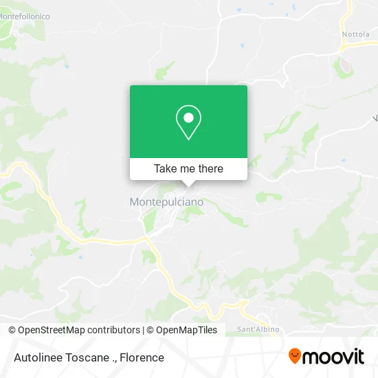
See Autolinee Toscane, Montepulciano, on the map
Public Transit to Autolinee Toscane in Montepulciano
Wondering how to get to Autolinee Toscane in Montepulciano? Moovit helps you find the best way to get to Autolinee Toscane with step-by-step directions from the nearest public transit station.
Moovit provides free maps and live directions to help you navigate through your city. View schedules, routes, timetables, and find out how long does it take to get to Autolinee Toscane in real time.
Looking for the nearest stop or station to Autolinee Toscane? Check out this list of stops closest to your destination: 95 Gracciano Street; Montepulciano-Via Calamandrei; Calamandrei Street 21; Montepulciano-1st May Ave Opposite Schools; 1st May Avenue (Hunters Bar).
Bus: B22, FT4, FT5, ST3, T4B, FT1, FN1, FN1, FT2, 139, 139, ST1, ST2, 112.
Want to see if there’s another route that gets you there at an earlier time? Moovit helps you find alternative routes or times. Get directions from and directions to Autolinee Toscane easily from the Moovit App or Website.
We make riding to Autolinee Toscane easy, which is why over 1.5 million users, including users in Montepulciano, trust Moovit as the best app for public transit. You don’t need to download an individual bus app or train app, Moovit is your all-in-one transit app that helps you find the best bus time or train time available.
For information on prices of bus and train, costs and ride fares to Autolinee Toscane, please check the Moovit app.
Use the app to navigate to popular places including to the airport, hospital, stadium, grocery store, mall, coffee shop, school, college, and university.
Autolinee Toscane Address: Piazzale dello Sterro, 7 53045 Montepulciano street in Montepulciano
- Land of Piadina,
- Morgantini Francesco Morgantini Francesco,
- The Excavation Tobacco Shop Newsstand Stationery,
- Carabinieri,
- Popular Bruscello Company Association of Montepulciano,
- Popular Company Bruscello Montepulciano,
- Bus Station - Lfi,
- LFI-Montepulciano Bus Station,
- Tuscany Carabinieri Region,
- Charming House in the Heart of Montepulciano,
- San Girolamo Conservatory Foundation,
- Cultural Association Griffin and Lion,
- Labor Chamber of Siena,
- Stilviaggi,
- Il Marzocco,
- Hong Kong Chinese Market,
- Civico34 by Ivan Pelle,
- Campa Cavallo,
- Dr. Alfonso Notaio - Doctor Amorosa,
- Visual by Elisa Cherubini
Places Near Autolinee Toscane (Montepulciano)
- Asmana, Campi Bisenzio,
- Artemio Franchi Municipal Stadium, Florence,
- Mandela Forum (Nelson Mandela Forum), Florence,
- Cascine Park, Florence,
- Santa Maria Nuova Hospital, Florence,
- Campi Bisenzio, Campi Bisenzio,
- Nelson Mandela Forum, Florence,
- Visarno Hippodrome, Florence,
- Visarno Arena, Florence,
- I Gigli, Campi Bisenzio,
- Santa Maria Novella Station, Florence,
- Torregalli Hospital Scandicci *, Scandicci,
- Piero Palagi Hospital Facility-Florence, Florence,
- Michelangelo Square, Florence,
- IKEA Florence, Sesto Fiorentino,
- Verdi Theater, Florence,
- Michelangelo Square, Florence,
- Tobacco Manufacture, Florence,
- OOO, Florence,
- Field of Mars, Florence
How to get to popular places in Florence with public transit
Get around Montepulciano by public transit!
Traveling around Montepulciano has never been so easy. See step by step directions as you travel to any attraction, street or major public transit station. View bus and train schedules, arrival times, service alerts and detailed routes on a map, so you know exactly how to get to anywhere in Montepulciano.
When traveling to any destination around Montepulciano use Moovit's Live Directions with Get Off Notifications to know exactly where and how far to walk, how long to wait for your line, and how many stops are left. Moovit will alert you when it's time to get off — no need to constantly re-check whether yours is the next stop.
Wondering how to use public transit in Montepulciano or how to pay for public transit in Montepulciano? Moovit public transit app can help you navigate your way with public transit easily, and at minimum cost. It includes public transit fees, ticket prices, and costs. Looking for a map of Montepulciano public transit lines? Moovit public transit app shows all public transit maps in Montepulciano with all Bus, Train, Light Rail, Ferry and Funicular routes and stops on an interactive map.
Florence has 5 transit type(s), including: Bus, Train, Light Rail, Ferry and Funicular, operated by several transit agencies, including Florence Urban - Tuscan Bus Lines, GEST, Livorno and Province - Tuscan Bus Lines, Arezzo, Florence and Provinces - Tuscan Bus Lines, Prato and Province - Tuscan Bus Lines, Lucca and Province - Tuscan Bus Lines, Massa, Carrara and Province - Tuscan Bus Lines, Pisa and Province - Tuscan Bus Lines, Grosseto, Siena and Provinces - Tuscan Bus Lines, Arezzo, Siena and Provinces - Tuscan Bus Lines, Florence and Province - Tuscan Bus Lines, Pistoia and Province - Tuscan Bus Lines, Siena and Province - Tuscan Bus Lines, Arezzo and Province - Tuscan Bus Lines and Trenitalia