How to get to Avenida Brasilândia by bus?
Click on the bus route to see step by step directions with maps, line arrival times and updated time schedules.
From PAM Neves, São Gonçalo
23 minFrom Neves, São Gonçalo
23 minFrom Centro, Niterói
40 minFrom camboinhas, Niterói
81 minFrom Ônibus Rio Minho ( Niteroi X Nova Iguaçu), Niterói
31 minFrom niterói x itaipuaçu Viação Nossa Senhora Do Amparo, Niterói
41 minFrom Rua Ataíde Parreiras 266, Niterói
44 minFrom Avenida Roberto Silveira, Niterói
46 minFrom Hospital Estadual Azevedo Lima, Niterói
48 minFrom Campo de São Bento, Niterói
46 min
Bus stops near Avenida Brasilândia in São Gonçalo
Bus lines to Avenida Brasilândia in São Gonçalo
- 43, Jardim República X Forum,VIEW
- 02, Circular CEASA (via Água Mineral),VIEW
- 07, Guaxindiba x Centro,VIEW
- 21, Jardim Bom Retiro x Centro,VIEW
- 40, Apolo III x Fazenda dos Mineiros,VIEW
- 125Q, Aldeia da Prata - São Gonçalo,VIEW
- 403M, Niterói - Trindade ( Via Porto Velho ),VIEW
- 515M, Mutuá x Niterói (Via Porto Velho),VIEW
- 516M, Mutuapira - Niterói ( Via Dr. March ),VIEW
- 517M, Fazenda dos Mineiros - Niterói ( Via Porto Velho ),VIEW
- 587M, São Gonçalo - Venda das Pedras,VIEW
- 1931D, São Gonçalo - Duque de Caxias ( Via B. Constant/porto Velho ),VIEW
- 01, Santa Izabel - Centro,VIEW
- 06, Largo da Ideia - Coroado (Via Alcântara),VIEW
- 07, Guaxindiba - Centro (via Alcântara),VIEW
- 10, Circular CEASA - Centro,VIEW
- 11, Luiz Caçador - Centro,VIEW
- 12, Jardim Catarina - Covanca (Via Santa Luzia),VIEW
- 12A, Santa Luzia - Venda da Cruz,VIEW
- 13, Jardim Catarina - Neves,VIEW
What are the closest stations to Avenida Brasilândia?
The closest stations to Avenida Brasilândia are:
- Rua Coronel Moreira Casar 2008 Centro São Gonçalo - Rio De Janeiro 24440 Brasil is 20 meters away, 1 min walk.
- Rua Coronel Moreira César, 36-190 | Linhas Municipais is 74 meters away, 2 min walk.
- Alameda Pio XII 86 Centro São Gonçalo - Rio De Janeiro 24440 Brasil is 173 meters away, 3 min walk.
Which bus lines stop near Avenida Brasilândia?
These bus lines stop near Avenida Brasilândia: 110, 423, 515M, 535, 56, 58A.
What’s the nearest bus station to Avenida Brasilândia in São Gonçalo?
The nearest bus station to Avenida Brasilândia in São Gonçalo is Rua Coronel Moreira Casar 2008 Centro São Gonçalo - Rio De Janeiro 24440 Brasil. It’s a 1 min walk away.
What time is the first bus to Avenida Brasilândia in São Gonçalo?
The 409 is the first bus that goes to Avenida Brasilândia in São Gonçalo. It stops nearby at 3:04 AM.
What time is the last bus to Avenida Brasilândia in São Gonçalo?
The 409 is the last bus that goes to Avenida Brasilândia in São Gonçalo. It stops nearby at 3:05 AM.
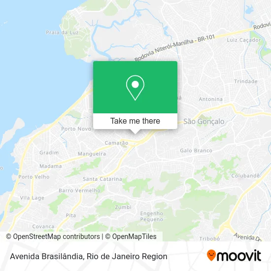
See Avenida Brasilândia, São Gonçalo, on the map
Public Transit to Avenida Brasilândia in São Gonçalo
Wondering how to get to Avenida Brasilândia in São Gonçalo? Moovit helps you find the best way to get to Avenida Brasilândia with step-by-step directions from the nearest public transit station.
Moovit provides free maps and live directions to help you navigate through your city. View schedules, routes, timetables, and find out how long does it take to get to Avenida Brasilândia in real time.
Looking for the nearest stop or station to Avenida Brasilândia? Check out this list of stops closest to your destination: Rua Coronel Moreira Casar 2008 Centro São Gonçalo - Rio De Janeiro 24440 Brasil; Rua Coronel Moreira César; Alameda Pio XII 86 Centro São Gonçalo - Rio De Janeiro 24440 Brasil.
Bus: 110, 423, 515M, 535, 56, 58A, 43, 02, 07, 21, 40, 01, 06, 07, 10, 11, 428, 545.
Want to see if there’s another route that gets you there at an earlier time? Moovit helps you find alternative routes or times. Get directions from and directions to Avenida Brasilândia easily from the Moovit App or Website.
We make riding to Avenida Brasilândia easy, which is why over 1.5 million users, including users in São Gonçalo, trust Moovit as the best app for public transit. You don’t need to download an individual bus app or train app, Moovit is your all-in-one transit app that helps you find the best bus time or train time available.
For information on prices of bus, costs and ride fares to Avenida Brasilândia, please check the Moovit app.
Use the app to navigate to popular places including to the airport, hospital, stadium, grocery store, mall, coffee shop, school, college, and university.
Avenida Brasilândia Address: Brasilândia I São Gonçalo-RJ street in São Gonçalo
- The Cat Pet Shop,
- Instituto De Educação Clelia Nanci,
- Praça do Clélia Nanci,
- Rua Professor Oscar Clark,
- Camoc-Centro de Atendimento Multidisciplinar Oscar Clark,
- Rua General Barcelos,
- Churrasco do Jairo,
- Desapego São Gonçalo, Alcântara e Niterói.,
- auto escola estrela rosa,
- Peixelandia Primos Comercio de Peixes,
- Rua Espírito Santo 16,
- Ie Clelia Nanci,
- Loja da Cyclone,
- Bar Point do Videokê,
- Brasilândia,
- Avenida Presidente Kennedy Próximo ao 241-279,
- Clínica Fórum Sg,
- Clinica Icarai,
- Elvidio de Luca Me,
- Aldeia Velha
Places Near Avenida Brasilândia (São Gonçalo)
- Shopping RioSul, Botafogo,
- Feira Livre da Gloria, Glória,
- Avenida Rio Branco, Centro,
- Niterói, Niterói,
- Rua Licínio Cardoso, São Francisco Xavier,
- Shopping Downtown, Barra Da Tijuca,
- Hospital Federal Do Andaraí, Andaraí,
- Hospital Pedro Ernesto, Vila Isabel,
- Feirão De Malhas, Duque De Caxias,
- Avenida Venezuela 134, Saúde,
- Shopping Nova América, Del Castilho,
- Rua Ulysses Guimarães 16, Cidade Nova,
- Shopping Rio Sul, Botafogo,
- Hospital Federal Cardoso Fontes, Jacarepaguá,
- Praia do Arpoador, Ipanema,
- Rodoviária Novo Rio (Rodoviária do Rio de Janeiro), Santo Cristo,
- Rio De Janeiro,
- Hospital Municipal Ronaldo Gazolla, Acari,
- Museu Do Amanhã, Centro,
- Norte Shopping, Cachambi
How to get to popular places in Rio de Janeiro Region with public transit
Get around São Gonçalo by public transit!
Traveling around São Gonçalo has never been so easy. See step by step directions as you travel to any attraction, street or major public transit station. View bus and train schedules, arrival times, service alerts and detailed routes on a map, so you know exactly how to get to anywhere in São Gonçalo.
When traveling to any destination around São Gonçalo use Moovit's Live Directions with Get Off Notifications to know exactly where and how far to walk, how long to wait for your line, and how many stops are left. Moovit will alert you when it's time to get off — no need to constantly re-check whether yours is the next stop.
Wondering how to use public transit in São Gonçalo or how to pay for public transit in São Gonçalo? Moovit public transit app can help you navigate your way with public transit easily, and at minimum cost. It includes public transit fees, ticket prices, and costs. Looking for a map of São Gonçalo public transit lines? Moovit public transit app shows all public transit maps in São Gonçalo with all Bus, Train, Metro, Light Rail, Ferry, Cable Car, Gondola and Funicular routes and stops on an interactive map.
Rio de Janeiro Region has 8 transit type(s), including: Bus, Train, Metro, Light Rail, Ferry, Cable Car, Gondola and Funicular, operated by several transit agencies, including TrensRJ, Metrô Rio, VLT Carioca, Barcas Rio, BRT MOBI-Rio, Auto Viação Alpha, Auto Viação Tijuca, Gire Transportes, Transurb, Viação Nossa Senhora das Graças, Consórcio INTERSUL, Braso Lisboa (Municipal), Caprichosa Auto Ônibus, Auto Viação Três Amigos and Rodoviária Âncora Matias