Avenida Brasil | Batan stop - Monday schedule
| Line | Direction | Time |
|---|---|---|
| 397 | Campo Grande | 3:01 AM |
| 765 | Carobinha | 3:04 AM |
| SN 790 | Campo Grande | 3:11 AM |
| SN 397 | Campo Grande (via Lapa) | 3:21 AM |
| 397 | Campo Grande | 3:31 AM |
| 765 | Carobinha | 3:34 AM |
| 853 | Terminal Mato Alto | 3:45 AM |
| 397 | Campo Grande | 3:46 AM |
| SV 790 | Campo Grande | 3:58 AM |
| 765 | Carobinha | 4:04 AM |
| 853 | Terminal Mato Alto | 4:05 AM |
| SN 790 | Campo Grande | 4:11 AM |
| 791 | Padre Miguel | 4:14 AM |
| SN 397 | Campo Grande (via Lapa) | 4:21 AM |
| SV 853 | Terminal Mato Alto | 4:25 AM |
| 853 | Terminal Mato Alto | 4:25 AM |
| SN 790 | Campo Grande | 4:31 AM |
| 397 | Campo Grande | 4:31 AM |
| 765 | Carobinha | 4:34 AM |
| 853 | Terminal Mato Alto | 4:35 AM |
| SV 790 | Campo Grande | 4:38 AM |
| SN 388 | Cesarão (via Lapa) | 4:41 AM |
| 397 | Campo Grande | 4:41 AM |
| 754 | Santa Cruz | 4:45 AM |
| SV 853 | Terminal Mato Alto | 4:45 AM |
Directions to Avenida Brasil | Batan stop (Realengo) with public transit
The following transit lines have routes that pass near Avenida Brasil | Batan
 Bus: 397, 442L, 451T, 754, 765.
- Train: RAMAL SANTA CRUZ.
How to get to Avenida Brasil | Batan stop by bus?
Click on the bus route to see step by step directions with maps, line arrival times and updated time schedules.
How to get to Avenida Brasil | Batan stop by train?
Click on the train route to see step by step directions with maps, line arrival times and updated time schedules.
Bus stops near Avenida Brasil | Batan stop in Realengo
- Batan, 2 min walk,
- Avenida Brasil | Batan / Clínica Da Família, 3 min walk,
- Avenida Brasil - Batan (2), 3 min walk,
- Avenida Brasil, 28400, 5 min walk,
- Avenida Brasil, 28421-28779, 6 min walk,
- Fumacê/Estrada Da Água Branca, 1030, 6 min walk,
- Esie (Escola De Instrução Especializada), 12 min walk,
Train stations near Avenida Brasil | Batan station in Realengo
- Magalhães Bastos, 31 min walk,
Bus lines to Avenida Brasil | Batan stop in Realengo
- 67, Terminal Deodoro,
- 121T, Caxias - Itaguaí (Via Estrada do Campinho / Santa Cruz),
- 369, Bangu - Candelária (Brs 5 - Expresso),
- 388, Cesarão - Candelária (Brs 5 - Via Santa Cruz - Parador),
- SN 388, Cesarão - Candelária (BRS 5 - via Terminal Deodoro / Lapa),
- SR 388, Cesarão - Candelária (Brs 5 - Via Santa Cruz - Expresso),
- SP 389, Vila Aliança - Terminal Deodoro (via Bangu),
- 397, Terminal Campo Grande - Candelária (Brs 5 - Via Bangu - Parador),
- SN 397, Terminal Campo Grande - Candelária (via Bangu / Terminal Deodoro),
- SR 397, Terminal Campo Grande - Candelária (Brs 5 - Expresso - Via Bangu),
- 424D, Alcântara - Campo Grande (Via Água Branca),
- 441B, Seropédica / Santa Sofia - Central (Via Candelária),
- 442L, Itaguaí - Coelho Neto,
- 451T, Caxias - Campo Grande (Via Éden / Anchieta),
- VAN M521, Itaguaí - Rio de Janeiro (Central),
- 712L, Seropédica - Coelho Neto,
- 713B, Cabuçu - Coelho Neto,
- 753, Santa Cruz - Coelho Neto (Via Urucânia / Estr. do Tinguí),
- 754, Santa Cruz - Terminal Deodoro (Via Jardim Palmares),
- 756, Santa Cruz - Metrô Coelho Neto (Via Vila Kennedy),
What are the closest stations to Avenida Brasil | Batan?
The closest stations to Avenida Brasil | Batan are:
- Batan stop is 148 meters away, 2 min walk.
- Avenida Brasil | Batan / Clínica Da Família stop is 166 meters away, 3 min walk.
- Avenida Brasil - Batan (2) stop is 181 meters away, 3 min walk.
- Avenida Brasil, 28400 stop is 359 meters away, 5 min walk.
- Avenida Brasil, 28421-28779 stop is 421 meters away, 6 min walk.
- Fumacê/Estrada Da Água Branca, 1030 stop is 423 meters away, 6 min walk.
- Esie (Escola De Instrução Especializada) stop is 878 meters away, 12 min walk.
- Magalhães Bastos station is 2460 meters away, 31 min walk.
Which bus lines stop near Avenida Brasil | Batan?
These bus lines stop near Avenida Brasil | Batan: 397, 442L, 451T, 754, 765, 790.
Which train line stops near Avenida Brasil | Batan?
RAMAL SANTA CRUZ (Central Do Brasil (Expresso))
What’s the nearest bus station to Avenida Brasil | Batan in Realengo?
The nearest bus station to Avenida Brasil | Batan in Realengo is Batan. It’s a 2 min walk away.
What time is the first train to Avenida Brasil | Batan in Realengo?
The RAMAL SANTA CRUZ is the first train that goes to Avenida Brasil | Batan in Realengo. It stops nearby at 4:30 AM.
What time is the last train to Avenida Brasil | Batan in Realengo?
The RAMAL SANTA CRUZ is the last train that goes to Avenida Brasil | Batan in Realengo. It stops nearby at 11:22 PM.
What time is the first bus to Avenida Brasil | Batan in Realengo?
The 397 is the first bus that goes to Avenida Brasil | Batan in Realengo. It stops nearby at 3:00 AM.
What time is the last bus to Avenida Brasil | Batan in Realengo?
The 388 is the last bus that goes to Avenida Brasil | Batan in Realengo. It stops nearby at 3:58 AM.
Avenida Brasil | Batan station
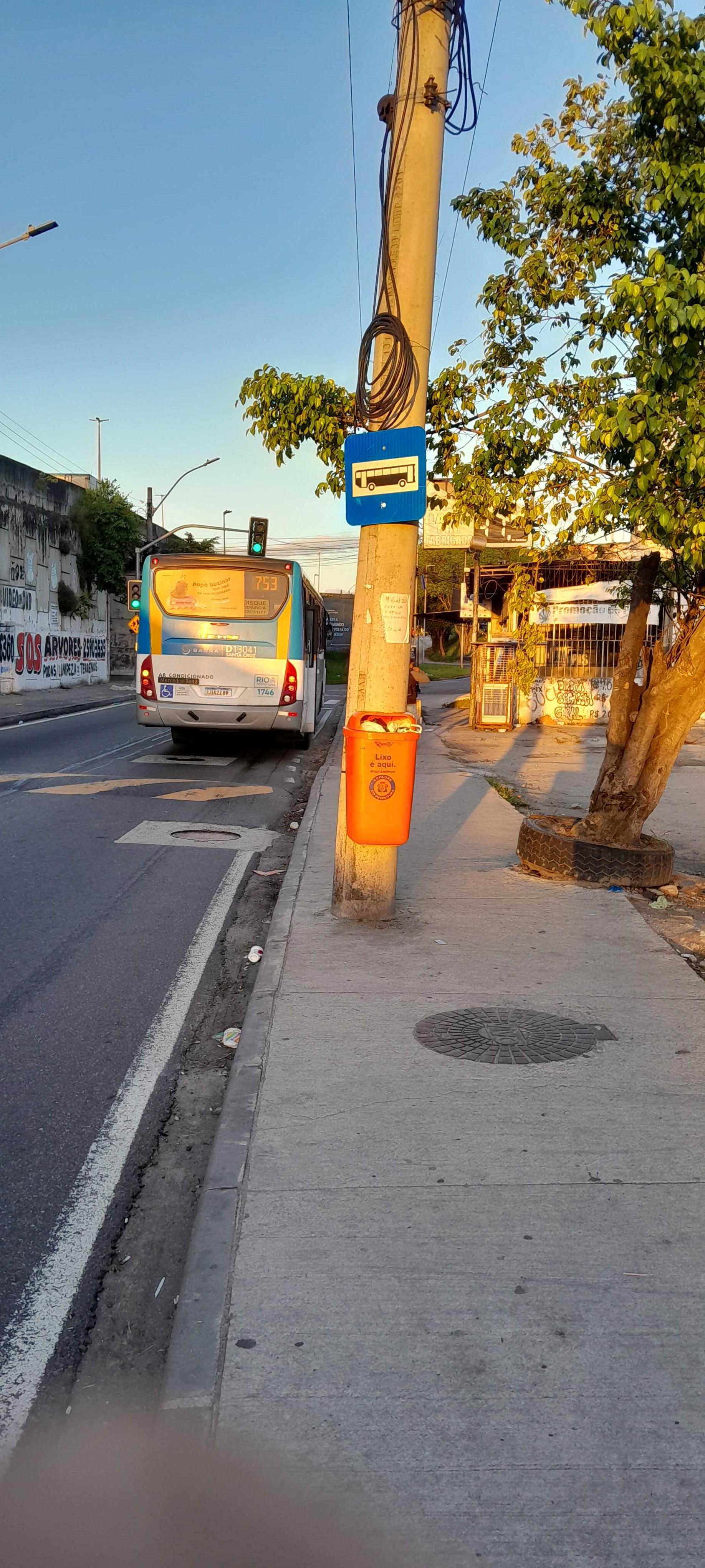 Taken by Anonymous
See Avenida Brasil | Batan stop, Realengo, on the map
Public transit to Avenida Brasil | Batan stop in Realengo
Looking for directions to Avenida Brasil | Batan in Realengo, Brazil?
Download the Moovit App to find the current schedule and step-by-step directions for Bus or Train routes that pass through Avenida Brasil | Batan.
Looking for the nearest stops closest to Avenida Brasil | Batan ? Check out this list of closest stops to your destination: Batan; Avenida Brasil | Batan / Clínica Da Família; Avenida Brasil - Batan (2); Avenida Brasil; Avenida Brasil; Fumacê/Estrada Da Água Branca; Esie (Escola De Instrução Especializada); Magalhães Bastos.
Bus: 397, 442L, 451T, 754, 765, 790, 67, 121T, 369, 388, SN 388, SR 388, 112B, 113D, 564T, 764, 1901T, 444B, SC460S, 2381.Train: RAMAL SANTA CRUZ.
We make riding on public transit to Avenida Brasil | Batan easy, which is why over 1.7 billion users, including users in Realengo trust Moovit as the best app for public transit.
Use the app to navigate to popular places including to the airport, hospital, stadium, grocery store, mall, coffee shop, school, college, and university.
The first line to this stop is 397, at 3:01 AM, and the last line is SN 388 at 2:51 AM.
28800 Avenida Brasil, Rio de Janeiro, Brazil
This stop serves Transportes Campo Grande, SOU Rio de Janeiro, Expresso Recreio, Auto Viação Jabour, Expresso Real Rio, Auto Viação Reginas, Serviço de Transporte Complementar (Vans Intermunicipais), Transportes Flores, Consórcio SANTA CRUZ (Frescão), Viação Mauá and Auto Viação Jabour GPS’s lines
- Batan,
- Avenida Brasil | Batan / Clínica Da Família,
- Avenida Brasil - Batan (2),
- Avenida Brasil, 28400,
- Avenida Brasil, 28421-28779,
- Fumacê/Estrada Da Água Branca, 1030,
- Esie (Escola De Instrução Especializada)
Bus stops near Avenida Brasil | Batan stop
- Magalhães Bastos
Train station near Avenida Brasil | Batan station
- Rede Globo,
- Rua Barão De Mesquita | Mundial Santo Afonso,
- Rua Senador Bernardo Monteiro, 120,
- Shopping Via Brasil,
- Terminal Estação Pavuna (Vila Rica / São José),
- Guanabara Maxwell (Vila Isabel),
- Rua Mena Barreto, 8,
- Ponto Final - Nova Iguaçu (Vera Cruz - Municipal),
- Prezunic Benfica,
- Estrada Da Covanca, 1838,
- Avenida Washington Luís, 1587,
- Estação De Belford Roxo,
- Avenida Brasil | Passarela 27 / Assaí Ceasa,
- Sahy,
- Estrada Federal De Tinguá / Campo Do Marambaia,
- BRS 3 I - Avenida Lauro Sodre | Shopping Rio Sul,
- Avenida Macário Pinto Lopes 65,
- Campos Elíseos,
- Riocentro,
- Rua Miguel Lemos, 53
Popular public transit stations in Realengo
Get around Realengo by public transit!
Traveling around Realengo has never been so easy. See step by step directions as you travel to any attraction, street or major public transit station. View bus and train schedules, arrival times, service alerts and detailed routes on a map, so you know exactly how to get to anywhere in Realengo.
When traveling to any destination around Realengo use Moovit's Live Directions with Get Off Notifications to know exactly where and how far to walk, how long to wait for your line, and how many stops are left. Moovit will alert you when it's time to get off — no need to constantly re-check whether yours is the next stop.
Wondering how to use public transit in Realengo or how to pay for public transit in Realengo? Moovit public transit app can help you navigate your way with public transit easily, and at minimum cost. It includes public transit fees, ticket prices, and costs. Looking for a map of Realengo public transit lines? Moovit public transit app shows all public transit maps in Realengo with all Bus, Train, Metro, Light Rail, Ferry, Cable Car, Gondola and Funicular routes and stops on an interactive map.
Rio de Janeiro Region has 8 transit type(s), including: Bus, Train, Metro, Light Rail, Ferry, Cable Car, Gondola and Funicular, operated by several transit agencies, including TrensRJ, Metrô Rio, VLT Carioca, Barcas Rio, BRT MOBI-Rio, Auto Viação Alpha, Auto Viação Tijuca, Gire Transportes, Transurb, Viação Nossa Senhora das Graças, Consórcio INTERSUL, Braso Lisboa, Caprichosa Auto Ônibus, Auto Viação Três Amigos and Rodoviária Âncora Matias