How to get to Avenir by bus?
Click on the bus route to see step by step directions with maps, line arrival times and updated time schedules.
From 32/2 Mikhail Nagibin Avenue, Voroshilovsky District
53 minFrom Voroshilovsky District Court, Voroshilovsky District
51 minFrom Mikhail Nagibin Avenue 34, Voroshilovsky District
48 minFrom School No. 22, Proletarsky District
42 minFrom Hospital, Oktyabrsky District
49 minFrom Emergency Medical Care Hospital, Kirovsky District
40 minFrom Southern Federal University, Voroshilovsky District
45 minFrom Timoshenko Street 26 Building 1, Oktyabrsky District
43 min
Shuttle stations near Avenir in Sovetsky District
Bus stops near Avenir in Sovetsky District
Bus lines to Avenir in Sovetsky District
What are the closest stations to Avenir?
The closest stations to Avenir are:
- Malinovsky Street is 22 meters away, 1 min walk.
- Communist Ave is 208 meters away, 3 min walk.
- Stachki Avenue is 521 meters away, 7 min walk.
Which bus lines stop near Avenir?
These bus lines stop near Avenir: 34, 96, 98.
Which shuttle lines stop near Avenir?
These shuttle lines stop near Avenir: 25, 56, 93, 98.
What’s the nearest bus station to Avenir in Sovetsky District?
The nearest bus station to Avenir in Sovetsky District is Stachki Avenue. It’s a 7 min walk away.
What’s the nearest shuttle station to Avenir in Sovetsky District?
The nearest shuttle station to Avenir in Sovetsky District is Malinovsky Street. It’s a 1 min walk away.
What time is the first bus to Avenir in Sovetsky District?
The 34 is the first bus that goes to Avenir in Sovetsky District. It stops nearby at 5:00 AM.
What time is the last bus to Avenir in Sovetsky District?
The 34 is the last bus that goes to Avenir in Sovetsky District. It stops nearby at 11:55 PM.
What time is the first Trolleybus to Avenir in Sovetsky District?
The 8 is the first Trolleybus that goes to Avenir in Sovetsky District. It stops nearby at 5:59 AM.
What time is the last Trolleybus to Avenir in Sovetsky District?
The 12 is the last Trolleybus that goes to Avenir in Sovetsky District. It stops nearby at 7:26 PM.
What time is the first shuttle to Avenir in Sovetsky District?
The 44 is the first shuttle that goes to Avenir in Sovetsky District. It stops nearby at 5:20 AM.
What time is the last shuttle to Avenir in Sovetsky District?
The 44 is the last shuttle that goes to Avenir in Sovetsky District. It stops nearby at 12:03 AM.
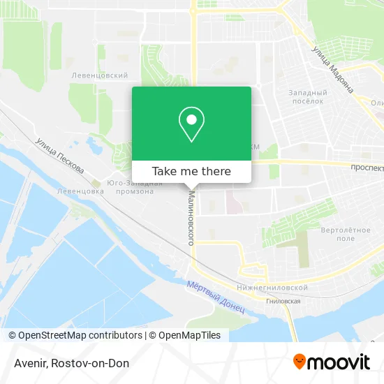
See Avenir, Sovetsky District, on the map
Public Transit to Avenir in Sovetsky District
Wondering how to get to Avenir in Sovetsky District? Moovit helps you find the best way to get to Avenir with step-by-step directions from the nearest public transit station.
Moovit provides free maps and live directions to help you navigate through your city. View schedules, routes, timetables, and find out how long does it take to get to Avenir in real time.
Looking for the nearest stop or station to Avenir? Check out this list of stops closest to your destination: Malinovsky Street; Communist Ave; Stachki Avenue.
Bus: 34, 96, 98, 16, 64, 44, 34A.Shuttle: 25, 56, 93, 98, 8, 20, 32, 34, 10, 12.
Want to see if there’s another route that gets you there at an earlier time? Moovit helps you find alternative routes or times. Get directions from and directions to Avenir easily from the Moovit App or Website.
We make riding to Avenir easy, which is why over 1.5 million users, including users in Sovetsky District, trust Moovit as the best app for public transit. You don’t need to download an individual bus app or train app, Moovit is your all-in-one transit app that helps you find the best bus time or train time available.
For information on prices of bus and shuttle, costs and ride fares to Avenir, please check the Moovit app.
Use the app to navigate to popular places including to the airport, hospital, stadium, grocery store, mall, coffee shop, school, college, and university.
Avenir Address: Avenir, улица Малиновского 9А/15, Ростов-на-Дону, Россия, 344000 street in Sovetsky District
- Canyon,
- White Bird,
- Servis Market,
- Department 8 of the Ministry of Internal Affairs of Russia for Rostov-on-Don,
- Police Department 8 of the Ministry of Internal Affairs of Russia for Rostov-on-Don,
- Ip Stjupan V S Shop,
- Migration Issues Department, Police Department 8 of the Ministry of Internal Affairs of Russia in Rostov-on-Don,
- UFMS Soviet District,
- TNK,
- Refrigeration Plant #3,
- Gulliver Development Center,
- Passport Office of Soviet District,
- Police Department #8,
- Dorc,
- Communist Prospect 48,
- Pharmacy #340,
- Sp Shaurma Dushevnaya,
- Profi Network of Trade and Service Centers,
- Bakery Kiosk,
- Communist Street 51
Places Near Avenir (Sovetsky District)
- City Clinical Hospital #20, Sovetsky District,
- Blagodatnaya Street 170, Sovetsky District,
- Shopping Center "Horizon", Voroshilovsky District,
- Temernik Market, Pervomaisky District,
- UFPS Military Unit 71609, Pervomaisky District,
- Regional Clinical Hospital #2, Pervomaisky District,
- Pervomayskaya Station, Sovetsky District,
- Sholokhov Avenue,
- Rostov Regional Clinical Hospital, Sovetsky District,
- CDC "Health", Pervomaisky District,
- Rostov-on-Don Embankment,
- Rostov Zoo, Oktyabrsky District,
- Rostov Research Oncology Institute, Proletarsky District,
- Pushkinskaya Street, 174, Kirovsky District,
- Central Market,
- Sailors Hospital, Pervomaisky District,
- BSMP-2, Voroshilovsky District,
- Gaidara Street, Leninsky District,
- 14 Line Street 63, Proletarsky District,
- Regional Hospital #2
How to get to popular places in Rostov-on-Don with public transit
Get around Sovetsky District by public transit!
Traveling around Sovetsky District has never been so easy. See step by step directions as you travel to any attraction, street or major public transit station. View bus and train schedules, arrival times, service alerts and detailed routes on a map, so you know exactly how to get to anywhere in Sovetsky District.
When traveling to any destination around Sovetsky District use Moovit's Live Directions with Get Off Notifications to know exactly where and how far to walk, how long to wait for your line, and how many stops are left. Moovit will alert you when it's time to get off — no need to constantly re-check whether yours is the next stop.
Wondering how to use public transit in Sovetsky District or how to pay for public transit in Sovetsky District? Moovit public transit app can help you navigate your way with public transit easily, and at minimum cost. It includes public transit fees, ticket prices, and costs. Looking for a map of Sovetsky District public transit lines? Moovit public transit app shows all public transit maps in Sovetsky District with all Bus, Light Rail, Trolleybus and Shuttle routes and stops on an interactive map.
Rostov-on-Don has 4 transit type(s), including: Bus, Light Rail, Trolleybus and Shuttle, operated by several transit agencies, including MUP MTK Rostovpassazhirtrans, MUP RTK, LLC RTK Ruseltrans and Minibuses