How to get to Avianca Express by bus?
Click on the bus route to see step by step directions with maps, line arrival times and updated time schedules.
From Yambo Restaurant, Miami
56 minFrom Ryder Trauma Center, Miami
67 minFrom Jackson Memorial Hospital, Miami
65 minFrom Rakachaka Grill, Miami
59 minFrom Tio Colo, Hialeah
46 minFrom Jackson Health System, Jackson Memorial Hospital, South Florida AIDS Network, Miami
65 minFrom The Ticket Clinic, Miami
71 minFrom 54th St And 22nd Ave, Miami
67 minFrom Miracle Mile & Downtown Coral Gables, Miami
60 minFrom nw 27 ave exit @ 836, Miami
49 min
Bus stops near Avianca Express in North Westside
Bus lines to Avianca Express in North Westside
What are the closest stations to Avianca Express?
The closest stations to Avianca Express are:
- NW 72 AV & NW 30 ST is 170 yards away, 3 min walk.
- Corporate Center is 171 yards away, 3 min walk.
Which bus lines stop near Avianca Express?
These bus lines stop near Avianca Express: 36, 73.
What’s the nearest bus station to Avianca Express in North Westside?
The nearest bus stations to Avianca Express in North Westside are NW 72 AV & NW 30 ST and Corporate Center. The closest one is a 3 min walk away.
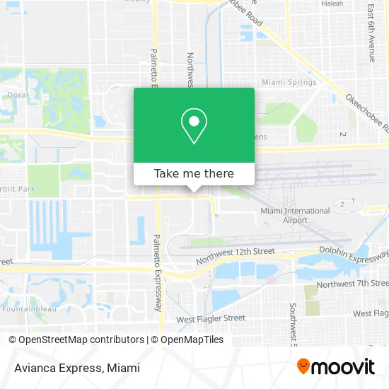
See Avianca Express, North Westside, on the map
Public Transit to Avianca Express in North Westside
Wondering how to get to Avianca Express in North Westside? Moovit helps you find the best way to get to Avianca Express with step-by-step directions from the nearest public transit station.
Moovit provides free maps and live directions to help you navigate through your city. View schedules, routes, timetables, and find out how long does it take to get to Avianca Express in real time.
Looking for the nearest stop or station to Avianca Express? Check out this list of stops closest to your destination: NW 72 AV & NW 30 ST; Corporate Center.
Bus: 36, 73, 115.
Want to see if there’s another route that gets you there at an earlier time? Moovit helps you find alternative routes or times. Get directions from and directions to Avianca Express easily from the Moovit App or Website.
We make riding to Avianca Express easy, which is why over 1.5 million users, including users in North Westside, trust Moovit as the best app for public transit. You don’t need to download an individual bus app or train app, Moovit is your all-in-one transit app that helps you find the best bus time or train time available.
For information on prices of bus, costs and ride fares to Avianca Express, please check the Moovit app.
Use the app to navigate to popular places including to the airport, hospital, stadium, grocery store, mall, coffee shop, school, college, and university.
Avianca Express Address: 2511 NW 72nd Ave Miami, FL 33122 street in North Westside
- Moneymex Services,
- G S Engers and Company,
- NW 72nd Ave / NW 25th St,
- Temple Israel, Mpls MN,
- Miami Premium Jeep and Bronco's Rentals,
- Ventana Cubana,
- Villain's Sanitation & Restoration Pros,
- Protege Insurance Group,
- Lacksmi LLC,
- SLM Insurance,
- CTE Property Preservation,
- Textile Trade USA,
- Elite,
- Great Variety of Machinery Parts,
- All Star Orchids Flowers,
- Luke Skybuilder,
- Guidance and Insight Inc,
- Hersol Cafe,
- Savy Therapy,
- Group Europrojects
Places Near Avianca Express (North Westside)
- Zoo Miami, Miami,
- Brickell City Centre, Miami,
- Little Havana, Miami,
- Richard E. Gerstein Justice Building, Miami,
- Miami Design District, Miami,
- Sawgrass mall ( FL ), Miami Beach,
- Dolphin Mall, Miami,
- Miami VA Hospital, Miami,
- Sawgrass Mall, Miami,
- Bayside Marketplace, Miami,
- Aventura Mall, Miami Beach,
- Miami Freedom Park, Miami,
- Keiser University Flagship Campus, West Palm Beach,
- Miami-Dade County Courthouse, Miami,
- Hard Rock Stadium, Miami Gardens,
- Marlins Park, Miami,
- Port of Miami Cruise Terminal, Miami,
- Dolphin Mall Bus, Miami,
- Wynwood, Miami,
- Aventura Mall, Miami
How to get to popular places in Miami with public transit
Get around North Westside by public transit!
Traveling around North Westside has never been so easy. See step by step directions as you travel to any attraction, street or major public transit station. View bus and train schedules, arrival times, service alerts and detailed routes on a map, so you know exactly how to get to anywhere in North Westside.
When traveling to any destination around North Westside use Moovit's Live Directions with Get Off Notifications to know exactly where and how far to walk, how long to wait for your line, and how many stops are left. Moovit will alert you when it's time to get off — no need to constantly re-check whether yours is the next stop.
Wondering how to use public transit in North Westside or how to pay for public transit in North Westside? Moovit public transit app can help you navigate your way with public transit easily, and at minimum cost. It includes public transit fees, ticket prices, and costs. Looking for a map of North Westside public transit lines? Moovit public transit app shows all public transit maps in North Westside with all Bus, Train, Light Rail and Ferry routes and stops on an interactive map.
Miami has 4 transit type(s), including: Bus, Train, Light Rail and Ferry, operated by several transit agencies, including Broward County Transit, Miami-Dade Transit, Metrorail, Palm Tran, Tri-Rail, Brightline, MARTY, City of Homestead Trolley, Key West Transit, Treasure Coast Connector, GoLine IRT, Amtrak, Greyhound-us, FlixBus-us and Aventura Express Shuttle Bus