Directions to Awi Logistica (Capão Raso) with public transportation
The following transit lines have routes that pass near Awi Logistica
How to get to Awi Logistica by bus?
Click on the bus route to see step by step directions with maps, line arrival times and updated time schedules.
From Rua maua, Alto Da Glória
47 minFrom Orleans, Orleans
74 minFrom Auditorio Mario Lobo, Centro Cívico
44 minFrom Rua Ubaldino do Amaral, Centro
37 minFrom Parque Barigui, Mercês
53 minFrom Avenida Vicente Machado, Batel
30 minFrom UPA 24h - Unidade de Pronto Atendimento Cajuru, Cajuru
62 minFrom Auto Shopping Curitiba, Tarumã
57 minFrom Rua Bispo Dom José, Seminário
26 minFrom Rua Padre Anchieta 2050, Água Verde
26 min
Bus stops near Awi Logistica in Capão Raso
Bus lines to Awi Logistica in Capão Raso
- F71 FAZENDA / GUADALUPE, Terminal Guadalupe → Terminal Fazenda,VIEW
- G72 AREIA BRANCA / GUADALUPE, Terminal Guadalupe → Areia Branca,VIEW
- G72 QUITANDINHA / GUADALUPE, Terminal Guadalupe → Quitandinha,VIEW
- 623 PARQUE INDUSTRIAL, Terminal Capão Raso → Parque Industrial,VIEW
- X08 REFORÇO PINHEIRINHO, Estação Coronel Dulcídio → Terminal Pinheirinho,VIEW
- X20 PORTÃO / SÍTIO CERCADO, Terminal Portão → Terminal Sítio Cercado,VIEW
- 602 CIRCULAR SUL (ANTI-HORÁRIO), Sentido Anti-Horário,VIEW
- 603 PINHEIRINHO / RUI BARBOSA, Praça Rui Barbosa → Terminal Pinheirinho,VIEW
- X11 SÍTIO CERCADO / CAPÃO RASO, Terminal Sítio Cercado → Terminal Capão Raso,VIEW
- 502 CIRCULAR SUL (HORÁRIO), Sentido Horário,VIEW
- 609 MAD. CIC, Praça Rui Barbosa → Terminal CIC,VIEW
What are the closest stations to Awi Logistica?
The closest stations to Awi Logistica are:
- R. Marechal Otávio Saldanha Mazza, 8300 is 297 meters away, 4 min walk.
- R. Laudelino Ferreira Lopes, 1140 is 376 meters away, 5 min walk.
- Santa Regina is 488 meters away, 7 min walk.
- Av. Winston Churchill, 846 is 505 meters away, 7 min walk.
Which bus lines stop near Awi Logistica?
These bus lines stop near Awi Logistica: 603 PINHEIRINHO / RUI BARBOSA, F71 FAZENDA / GUADALUPE, G72 AREIA BRANCA / GUADALUPE.
What’s the nearest bus station to Awi Logistica in Capão Raso?
The nearest bus station to Awi Logistica in Capão Raso is R. Marechal Otávio Saldanha Mazza, 8300. It’s a 4 min walk away.
What time is the first bus to Awi Logistica in Capão Raso?
The 609 MAD. CIC is the first bus that goes to Awi Logistica in Capão Raso. It stops nearby at 3:11 AM.
What time is the last bus to Awi Logistica in Capão Raso?
The 609 MAD. CIC is the last bus that goes to Awi Logistica in Capão Raso. It stops nearby at 3:12 AM.
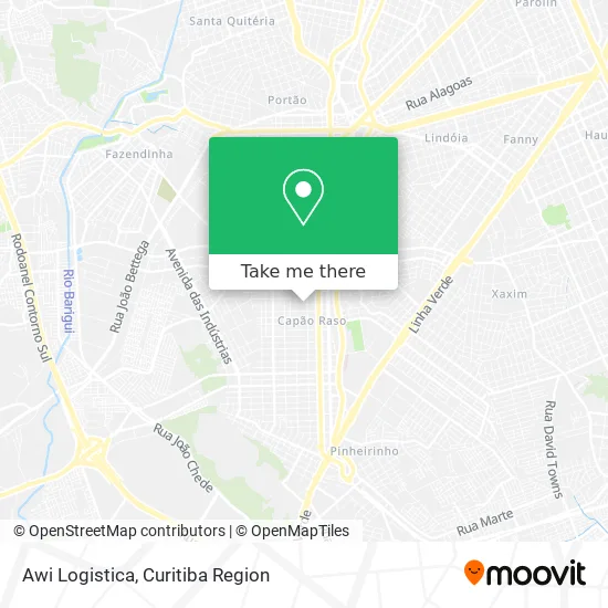
See Awi Logistica, Capão Raso, on the map
Public Transit to Awi Logistica in Capão Raso
Wondering how to get to Awi Logistica in Capão Raso? Moovit helps you find the best way to get to Awi Logistica with step-by-step directions from the nearest public transit station.
Moovit provides free maps and live directions to help you navigate through your city. View schedules, routes, timetables, and find out how long does it take to get to Awi Logistica in real time.
Looking for the nearest stop or station to Awi Logistica? Check out this list of stops closest to your destination: R. Marechal Otávio Saldanha Mazza; R. Laudelino Ferreira Lopes; Santa Regina; Av. Winston Churchill.
Bus: 603 PINHEIRINHO / RUI BARBOSA, F71 FAZENDA / GUADALUPE, G72 AREIA BRANCA / GUADALUPE, G72 QUITANDINHA / GUADALUPE, 623 PARQUE INDUSTRIAL, X08 REFORÇO PINHEIRINHO, X20 PORTÃO / SÍTIO CERCADO, 602 CIRCULAR SUL (ANTI-HORÁRIO), X11 SÍTIO CERCADO / CAPÃO RASO, 502 CIRCULAR SUL (HORÁRIO), 609 MAD. CIC.
Want to see if there’s another route that gets you there at an earlier time? Moovit helps you find alternative routes or times. Get directions from and directions to Awi Logistica easily from the Moovit App or Website.
We make riding to Awi Logistica easy, which is why over 1.5 million users, including users in Capão Raso, trust Moovit as the best app for public transit. You don’t need to download an individual bus app or train app, Moovit is your all-in-one transit app that helps you find the best bus time or train time available.
For information on prices of bus, costs and ride fares to Awi Logistica, please check the Moovit app.
Use the app to navigate to popular places including to the airport, hospital, stadium, grocery store, mall, coffee shop, school, college, and university.
Awi Logistica Address: Rua Frei Teófilo, 368 Capão Raso Curitiba-PR 81130-070 street in Capão Raso
- Fg Investimentos e Participacoes,
- Nd Brasil,
- Sistematizar Desenvolvimento de Sistemas,
- Comércio Em Geral,
- Jr-Advocacia,
- Comércio de Armarinhos Domiro Ltda,
- Salão Sonda,
- Salão Daa Rose,
- Sister S House II,
- Box Tribal Fit,
- CLIMEPAC,
- Mundimix,
- Climepac Clinica Medica e Psicologica de Avaliacao de Condu,
- Rua Frei Teófilo 325,
- Barracão da Costela Vôwosniak,
- Fashion 10 Machadinho,
- 3r's Incorporadora,
- Residencial Spazio Milano,
- Minimercado Compre Mais,
- Kitiko Kids Brinquedos e Acessorios Infantis
Places Near Awi Logistica (Capão Raso)
- Jockey Plaza Shopping Center, Tarumã,
- Hospital Da Cruz Vermelha, Batel,
- Jardim Botânico de Curitiba PR, Centro,
- Arena Da Baixada - Curitiba,
- Parque Barigui, Mercês,
- Hospital Universitário Evangélico de Curitiba, Bigorrilho,
- Shopping Palladium, Portão,
- Park Shopping Barigüi, Mossunguê,
- Rua Martim Afonso 558, Mercês,
- Shopping Estação, Rebouças,
- Hospital Angelina Caron, Campina Grande Do Sul,
- Hospital de Clínicas (HC - UFPR), Centro,
- Hospital Erasto Gaertner, Jardim Das Américas,
- Hospital Madalena Sofia, Bairro Alto,
- Campo Largo, Campo,
- Pontifícia Universidade Católica do Paraná (PUCPR), Prado Velho,
- Rua General Mário Tourinho, Campina Do Siqueira,
- Hospital Nossa Senhora Das Graças, Mercês,
- Hhhhh, Fazendinha,
- Hospital do Rocio, Campo
How to get to popular places in Curitiba Region with public transit
Get around Capão Raso by public transit!
Traveling around Capão Raso has never been so easy. See step by step directions as you travel to any attraction, street or major public transit station. View bus and train schedules, arrival times, service alerts and detailed routes on a map, so you know exactly how to get to anywhere in Capão Raso.
When traveling to any destination around Capão Raso use Moovit's Live Directions with Get Off Notifications to know exactly where and how far to walk, how long to wait for your line, and how many stops are left. Moovit will alert you when it's time to get off — no need to constantly re-check whether yours is the next stop.
Wondering how to use public transit in Capão Raso or how to pay for public transit in Capão Raso? Moovit public transit app can help you navigate your way with public transit easily, and at minimum cost. It includes public transit fees, ticket prices, and costs. Looking for a map of Capão Raso public transit lines? Moovit public transit app shows all public transit maps in Capão Raso with all Bus and Cable Car routes and stops on an interactive map.
Curitiba Region has 2 transit type(s), including: Bus and Cable Car, operated by several transit agencies, including Sistema Integrado de Mobilidade (URBS), Sistema Integrado de Mobilidade (AMEP), URBS (Cartões bancários e Dinheiro), URBS (Cartões bancários / Cartão URBS), AMEP (Cartões bancários / Cartão MetroCard), AMEP (Cartões bancários / Cartão MetroCard / Dinheiro), Viação Colombo (Dinheiro), TRIAR (Cartão TRIAR / Dinheiro), Empresa Curitiba Cerro Azul (Dinheiro), Expresso Nossa Senhora da Penha (Dinheiro), Empresa Campo Alto Tijucas (Dinheiro), Auto Viação São José (Cartão VEM / Dinheiro), BRT S/A (Cartão VEM / Dinheiro), TransPiedade (Cartão Cidadão / Dinheiro) and Oceânica Sul (Cartão Transporte / Dinheiro)