How to get to Axabrows by bus?
Click on the bus route to see step by step directions with maps, line arrival times and updated time schedules.
From Dolphin Mall, Miami, North Westside
66 minFrom Westland Hialeah Senior High School, Hialeah
152 minFrom Blue Lagoon, Miami
91 minFrom Trump National Doral Miami, North Westside
53 minFrom Miami-Dade County Fair and Exposition, South Westside
69 minFrom SW 8th St & 122 Ave, Kendale Lakes-Tamiami
79 minFrom SR 826 Palmetto Expressway South, Hialeah
139 minFrom Hialeah, FL, Hialeah
154 minFrom Sawgrass Mall, Miami
97 minFrom Conchitas Transit Express, Hialeah
129 min
Bus stops near Axabrows in North Westside
Bus lines to Axabrows in North Westside
What are the closest stations to Axabrows?
The closest stations to Axabrows are:
- Polynesian is 502 yards away, 7 min walk.
- Nw 107th Ave @ Nw 76th St is 1208 yards away, 15 min walk.
Which bus lines stop near Axabrows?
These bus lines stop near Axabrows: DLOOP1, DLOOP3, DLOOP4.
What’s the nearest bus station to Axabrows in North Westside?
The nearest bus station to Axabrows in North Westside is Polynesian. It’s a 7 min walk away.
What time is the first bus to Axabrows in North Westside?
The DLOOP1 is the first bus that goes to Axabrows in North Westside. It stops nearby at 6:06 AM.
What time is the last bus to Axabrows in North Westside?
The DLOOP4 is the last bus that goes to Axabrows in North Westside. It stops nearby at 10:52 PM.
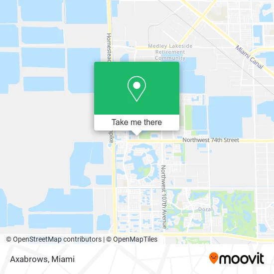
See Axabrows, North Westside, on the map
Public Transit to Axabrows in North Westside
Wondering how to get to Axabrows in North Westside? Moovit helps you find the best way to get to Axabrows with step-by-step directions from the nearest public transit station.
Moovit provides free maps and live directions to help you navigate through your city. View schedules, routes, timetables, and find out how long does it take to get to Axabrows in real time.
Looking for the nearest stop or station to Axabrows? Check out this list of stops closest to your destination: Polynesian; Nw 107th Ave @ Nw 76th St.
Bus: DLOOP1, DLOOP3, DLOOP4.
Want to see if there’s another route that gets you there at an earlier time? Moovit helps you find alternative routes or times. Get directions from and directions to Axabrows easily from the Moovit App or Website.
We make riding to Axabrows easy, which is why over 1.5 million users, including users in North Westside, trust Moovit as the best app for public transit. You don’t need to download an individual bus app or train app, Moovit is your all-in-one transit app that helps you find the best bus time or train time available.
For information on prices of bus and train, costs and ride fares to Axabrows, please check the Moovit app.
Use the app to navigate to popular places including to the airport, hospital, stadium, grocery store, mall, coffee shop, school, college, and university.
Axabrows Address: 11215 NW 75th Ter Doral, FL 33178 street in North Westside
- Miami-Dade Fire-Rescue Station 69,
- Mariachis en Miami,
- Ivm Spices,
- W&T International,
- Palm Gardens,
- Taco Stephanle,
- Pepiteria,
- Tropical Yachts,
- Exquisite Beauty Salons,
- Vicky Bakery - Doral,
- Arabito,
- Condor Logistics,
- Iki Omakase Experience,
- Islands at Doral,
- Atm,
- Florida's Tpke N Hialeah,
- 107th Ave Locksmith Company,
- Entrance SR-821 N,
- Northwest 107th Avenue & Northwest 74th Street,
- Homeinspectionshalley.Com
Places Near Axabrows (North Westside)
- Sawgrass mall ( FL ), Miami Beach,
- Zoo Miami, Miami,
- Miami-Dade County Courthouse, Miami,
- Little Havana, Miami,
- Keiser University Flagship Campus, West Palm Beach,
- Hard Rock Stadium, Miami Gardens,
- Sawgrass Mall, Miami,
- Brickell City Centre, Miami,
- Dolphin Mall, Miami,
- Richard E. Gerstein Justice Building, Miami,
- Wynwood, Miami,
- Aventura Mall, Miami,
- Aventura Mall, Miami Beach,
- Miami Design District, Miami,
- Dolphin Mall Bus, Miami,
- Bayside Marketplace, Miami,
- Miami Freedom Park, Miami,
- Port of Miami Cruise Terminal, Miami,
- Miami VA Hospital, Miami,
- Marlins Park, Miami
How to get to popular places in Miami with public transit
Get around North Westside by public transit!
Traveling around North Westside has never been so easy. See step by step directions as you travel to any attraction, street or major public transit station. View bus and train schedules, arrival times, service alerts and detailed routes on a map, so you know exactly how to get to anywhere in North Westside.
When traveling to any destination around North Westside use Moovit's Live Directions with Get Off Notifications to know exactly where and how far to walk, how long to wait for your line, and how many stops are left. Moovit will alert you when it's time to get off — no need to constantly re-check whether yours is the next stop.
Wondering how to use public transit in North Westside or how to pay for public transit in North Westside? Moovit public transit app can help you navigate your way with public transit easily, and at minimum cost. It includes public transit fees, ticket prices, and costs. Looking for a map of North Westside public transit lines? Moovit public transit app shows all public transit maps in North Westside with all Bus, Train, Light Rail and Ferry routes and stops on an interactive map.
Miami has 4 transit type(s), including: Bus, Train, Light Rail and Ferry, operated by several transit agencies, including Broward County Transit, Miami-Dade Transit, Metrorail, Palm Tran, Tri-Rail, Brightline, MARTY, City of Homestead Trolley, Key West Transit, Treasure Coast Connector, GoLine IRT, Amtrak, Greyhound-us, FlixBus-us and Aventura Express Shuttle Bus