How to get to Aycs Delivery Service by bus?
Click on the bus route to see step by step directions with maps, line arrival times and updated time schedules.
From Baptist Hospital, Kendall-Palmetto Bay
92 minFrom James L. Knight Center, Miami
56 minFrom Jackson Health System, Jackson Memorial Hospital, South Florida AIDS Network, Miami
59 minFrom Miami Palmetto Senior High School, Kendall-Palmetto Bay
94 minFrom Wynwood, Miami
87 minFrom Sunset Dr, Miami
33 minFrom Palmetto High School, Kendall-Palmetto Bay
93 minFrom 72nd Ave. & 25th St. @ Miami, North Westside
92 minFrom Doral Inn & Suites Miami Airport West, North Westside
86 minFrom Gate D60, Miami
73 min
How to get to Aycs Delivery Service by train?
Click on the train route to see step by step directions with maps, line arrival times and updated time schedules.
Bus stops near Aycs Delivery Service in Miami
Train station near Aycs Delivery Service in Miami
- Douglas Road, 41 min walk,VIEW
Bus lines to Aycs Delivery Service in Miami
What are the closest stations to Aycs Delivery Service?
The closest stations to Aycs Delivery Service are:
- Grand Av@commodore Pz is 253 yards away, 4 min walk.
- Sw 37 Av @ Grand Av is 684 yards away, 9 min walk.
- Douglas Road is 3460 yards away, 41 min walk.
Which bus lines stop near Aycs Delivery Service?
These bus lines stop near Aycs Delivery Service: 37, MIACOCO.
Which train lines stop near Aycs Delivery Service?
These train lines stop near Aycs Delivery Service: GREEN, ORANGE.
What’s the nearest bus station to Aycs Delivery Service in Miami?
The nearest bus station to Aycs Delivery Service in Miami is Grand Av@commodore Pz. It’s a 4 min walk away.
What time is the first train to Aycs Delivery Service in Miami?
The GREEN is the first train that goes to Aycs Delivery Service in Miami. It stops nearby at 5:06 AM.
What time is the last train to Aycs Delivery Service in Miami?
The GREEN is the last train that goes to Aycs Delivery Service in Miami. It stops nearby at 12:58 AM.
What time is the first bus to Aycs Delivery Service in Miami?
The 37 is the first bus that goes to Aycs Delivery Service in Miami. It stops nearby at 4:18 AM.
What time is the last bus to Aycs Delivery Service in Miami?
The 37 is the last bus that goes to Aycs Delivery Service in Miami. It stops nearby at 12:35 AM.
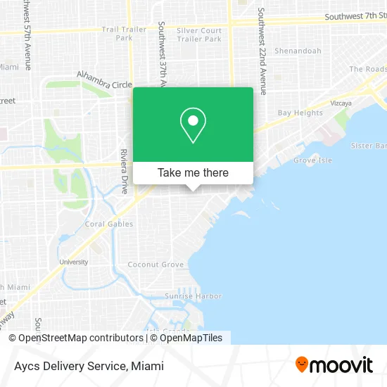
See Aycs Delivery Service, Miami, on the map
Public Transit to Aycs Delivery Service in Miami
Wondering how to get to Aycs Delivery Service in Miami? Moovit helps you find the best way to get to Aycs Delivery Service with step-by-step directions from the nearest public transit station.
Moovit provides free maps and live directions to help you navigate through your city. View schedules, routes, timetables, and find out how long does it take to get to Aycs Delivery Service in real time.
Looking for the nearest stop or station to Aycs Delivery Service? Check out this list of stops closest to your destination: Grand Av@commodore Pz; Sw 37 Av @ Grand Av; Douglas Road.
Bus: 37, MIACOCO, 136.Train: GREEN, ORANGE.
Want to see if there’s another route that gets you there at an earlier time? Moovit helps you find alternative routes or times. Get directions from and directions to Aycs Delivery Service easily from the Moovit App or Website.
We make riding to Aycs Delivery Service easy, which is why over 1.5 million users, including users in Miami, trust Moovit as the best app for public transit. You don’t need to download an individual bus app or train app, Moovit is your all-in-one transit app that helps you find the best bus time or train time available.
For information on prices of bus, train and light rail, costs and ride fares to Aycs Delivery Service, please check the Moovit app.
Use the app to navigate to popular places including to the airport, hospital, stadium, grocery store, mall, coffee shop, school, college, and university.
Aycs Delivery Service Address: 3375 Grand Ave Miami, FL 33133 street in Miami
- Grove Homes,
- Chase,
- Plant B Cafe,
- Arenita Y Playita,
- Coconut Grove Organic Market ,
- Warteg Bu Joko,
- Courtney's Cookies,
- Blue Boy Pizza,
- Culinary Alchemist,
- Grand Avenue & Margaret Street,
- Mi Pana Burger,
- Libertyx Bitcoin ATM,
- MoneyGram,
- Total Pest Control Coconut Grove,
- BMO Harris Bank,
- Soaring Scores,
- Navi Coffee & Flowers,
- Areas of Focus Client Resources,
- Fade Masters,
- ATM
Places Near Aycs Delivery Service (Miami)
- Aventura Mall, Miami,
- Dolphin Mall, Miami,
- 1351 NW 12th St, Miami,
- Sawgrass Mall, Miami,
- Miami Design District, Miami,
- Keiser University Flagship Campus, West Palm Beach,
- Miami Freedom Park, Miami,
- Marlins Park, Miami,
- Hard Rock Stadium, Miami Gardens,
- Miami-Dade County Courthouse, Miami,
- Dolphin Mall Bus, Miami,
- Zoo Miami, Miami,
- Richard E. Gerstein Justice Building, Miami,
- Port of Miami Cruise Terminal, Miami,
- Little Havana, Miami,
- Wynwood, Miami,
- Bayside Marketplace, Miami,
- Sawgrass mall ( FL ), Miami Beach,
- Aventura Mall, Miami Beach,
- Brickell City Centre, Miami
How to get to popular places in Miami with public transit
Get around Miami by public transit!
Traveling around Miami has never been so easy. See step by step directions as you travel to any attraction, street or major public transit station. View bus and train schedules, arrival times, service alerts and detailed routes on a map, so you know exactly how to get to anywhere in Miami.
When traveling to any destination around Miami use Moovit's Live Directions with Get Off Notifications to know exactly where and how far to walk, how long to wait for your line, and how many stops are left. Moovit will alert you when it's time to get off — no need to constantly re-check whether yours is the next stop.
Wondering how to use public transit in Miami or how to pay for public transit in Miami? Moovit public transit app can help you navigate your way with public transit easily, and at minimum cost. It includes public transit fees, ticket prices, and costs. Looking for a map of Miami public transit lines? Moovit public transit app shows all public transit maps in Miami with all Bus, Train, Light Rail and Ferry routes and stops on an interactive map.
Miami has 4 transit type(s), including: Bus, Train, Light Rail and Ferry, operated by several transit agencies, including Broward County Transit, Miami-Dade Transit, Metrorail, Palm Tran, Tri-Rail, Brightline, MARTY, City of Homestead Trolley, Key West Transit, Treasure Coast Connector, GoLine IRT, Amtrak, Greyhound-us, FlixBus-us and Aventura Express Shuttle Bus