How to get to Azala by bus?
Click on the bus route to see step by step directions with maps, line arrival times and updated time schedules.
From Orange Bowl Stadium, Miami
80 minFrom The Shops At Midtown Miami, Miami
98 minFrom 1351 NW 12th Ave, Miami
53 minFrom Port Of Miami - Carnival Cruise, Miami
84 minFrom Miami Escorts, Miami Beach
92 minFrom Bayside, Miami
63 minFrom Midtown Miami, Miami
98 minFrom Palmetto High School, Kendall-Palmetto Bay
95 minFrom SW 104th St / US-1, Kendall-Palmetto Bay
128 minFrom San Marco Island, Miami
87 min
How to get to Azala by train?
Click on the train route to see step by step directions with maps, line arrival times and updated time schedules.
Bus stop near Azala in Miami
- Grand Av@commodore Pz, 2 min walk,VIEW
Train station near Azala in Miami
- Coconut Grove, 14 min walk,VIEW
Bus lines to Azala in Miami
- MIACOCO, City Of Miami - Coconut Grove Route,VIEW
What are the closest stations to Azala?
The closest stations to Azala are:
- Grand Av@commodore Pz is 114 yards away, 2 min walk.
- Coconut Grove is 1161 yards away, 14 min walk.
Which bus lines stop near Azala?
These bus lines stop near Azala: 22, 37, MIABRK, MIACOCO.
Which train lines stop near Azala?
These train lines stop near Azala: GREEN, ORANGE.
What’s the nearest train station to Azala in Miami?
The nearest train station to Azala in Miami is Coconut Grove. It’s a 14 min walk away.
What’s the nearest bus station to Azala in Miami?
The nearest bus station to Azala in Miami is Grand Av@commodore Pz. It’s a 2 min walk away.
What time is the first train to Azala in Miami?
The GREEN is the first train that goes to Azala in Miami. It stops nearby at 5:06 AM.
What time is the last train to Azala in Miami?
The GREEN is the last train that goes to Azala in Miami. It stops nearby at 12:58 AM.
What time is the first bus to Azala in Miami?
The MIACOCO is the first bus that goes to Azala in Miami. It stops nearby at 6:38 AM.
What time is the last bus to Azala in Miami?
The MIACOCO is the last bus that goes to Azala in Miami. It stops nearby at 11:40 PM.
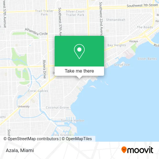
See Azala, Miami, on the map
Public Transit to Azala in Miami
Wondering how to get to Azala in Miami? Moovit helps you find the best way to get to Azala with step-by-step directions from the nearest public transit station.
Moovit provides free maps and live directions to help you navigate through your city. View schedules, routes, timetables, and find out how long does it take to get to Azala in real time.
Looking for the nearest stop or station to Azala? Check out this list of stops closest to your destination: Grand Av@commodore Pz; Coconut Grove.
Bus: 22, 37, MIABRK, MIACOCO.Train: GREEN, ORANGE.
Want to see if there’s another route that gets you there at an earlier time? Moovit helps you find alternative routes or times. Get directions from and directions to Azala easily from the Moovit App or Website.
We make riding to Azala easy, which is why over 1.5 million users, including users in Miami, trust Moovit as the best app for public transit. You don’t need to download an individual bus app or train app, Moovit is your all-in-one transit app that helps you find the best bus time or train time available.
For information on prices of bus, train and light rail, costs and ride fares to Azala, please check the Moovit app.
Use the app to navigate to popular places including to the airport, hospital, stadium, grocery store, mall, coffee shop, school, college, and university.
Azala Address: 3444 Main Hwy Miami, FL 33133 street in Miami
- Spa,
- Han Design,
- Avance International Salon,
- Chug's Diner,
- Red Farm,
- Parking Lot,
- Lionelrenardsalon,
- Lionel Renard,
- Fashionista Consignment Boutique,
- Agua Bendita,
- Terry Jacobs Make Up Studio,
- Moorish Ambiance,
- Mary Nails Salon,
- Pineda Covalin US,
- Fontisee Louis la L Jr Aty,
- The Wardrobe & More,
- La Louviere Chocolatier Belge,
- Meraki Greek Bistro,
- Avangarde Boutique,
- Flow Running Shop
Places Near Azala (Miami)
- Brickell City Centre, Miami,
- Miami Freedom Park, Miami,
- Aventura Mall, Miami Beach,
- Miami Design District, Miami,
- Dolphin Mall, Miami,
- Richard E. Gerstein Justice Building, Miami,
- Hard Rock Stadium, Miami Gardens,
- Wynwood, Miami,
- Miami-Dade County Courthouse, Miami,
- Marlins Park, Miami,
- Port of Miami Cruise Terminal, Miami,
- Aventura Mall, Miami,
- Sawgrass Mall, Miami,
- Little Havana, Miami,
- Dolphin Mall Bus, Miami,
- Sawgrass mall ( FL ), Miami Beach,
- Keiser University Flagship Campus, West Palm Beach,
- Zoo Miami, Miami,
- Bayside Marketplace, Miami,
- Miami VA Hospital, Miami
How to get to popular places in Miami with public transit
Get around Miami by public transit!
Traveling around Miami has never been so easy. See step by step directions as you travel to any attraction, street or major public transit station. View bus and train schedules, arrival times, service alerts and detailed routes on a map, so you know exactly how to get to anywhere in Miami.
When traveling to any destination around Miami use Moovit's Live Directions with Get Off Notifications to know exactly where and how far to walk, how long to wait for your line, and how many stops are left. Moovit will alert you when it's time to get off — no need to constantly re-check whether yours is the next stop.
Wondering how to use public transit in Miami or how to pay for public transit in Miami? Moovit public transit app can help you navigate your way with public transit easily, and at minimum cost. It includes public transit fees, ticket prices, and costs. Looking for a map of Miami public transit lines? Moovit public transit app shows all public transit maps in Miami with all Bus, Train, Light Rail and Ferry routes and stops on an interactive map.
Miami has 4 transit type(s), including: Bus, Train, Light Rail and Ferry, operated by several transit agencies, including Broward County Transit, Miami-Dade Transit, Metrorail, Palm Tran, Tri-Rail, Brightline, MARTY, City of Homestead Trolley, Key West Transit, Treasure Coast Connector, GoLine IRT, Amtrak, Greyhound-us, FlixBus-us and Aventura Express Shuttle Bus