How to get to Azalea Auto Tech by bus?
Click on the bus route to see step by step directions with maps, line arrival times and updated time schedules.
Bus stops near Azalea Auto Tech in Norfolk
Bus lines to Azalea Auto Tech in Norfolk
What are the closest stations to Azalea Auto Tech?
The closest stations to Azalea Auto Tech are:
- Johnstons & Military is 157 yards away, 3 min walk.
- Chesapeake & Johnstons is 780 yards away, 10 min walk.
- Little Creek & Moose is 1100 yards away, 14 min walk.
Which bus lines stop near Azalea Auto Tech?
These bus lines stop near Azalea Auto Tech: 015, 961.
What’s the nearest bus station to Azalea Auto Tech in Norfolk?
The nearest bus station to Azalea Auto Tech in Norfolk is Johnstons & Military. It’s a 3 min walk away.
What time is the first bus to Azalea Auto Tech in Norfolk?
The 015 is the first bus that goes to Azalea Auto Tech in Norfolk. It stops nearby at 5:39 AM.
What time is the last bus to Azalea Auto Tech in Norfolk?
The 015 is the last bus that goes to Azalea Auto Tech in Norfolk. It stops nearby at 1:17 AM.
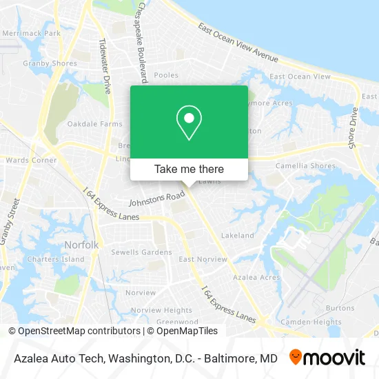
See Azalea Auto Tech, Norfolk, on the map
Public Transit to Azalea Auto Tech in Norfolk
Wondering how to get to Azalea Auto Tech in Norfolk? Moovit helps you find the best way to get to Azalea Auto Tech with step-by-step directions from the nearest public transit station.
Moovit provides free maps and live directions to help you navigate through your city. View schedules, routes, timetables, and find out how long does it take to get to Azalea Auto Tech in real time.
Looking for the nearest stop or station to Azalea Auto Tech? Check out this list of stops closest to your destination: Johnstons & Military; Chesapeake & Johnstons; Little Creek & Moose.
Bus: 015, 961, 003, 021.
Want to see if there’s another route that gets you there at an earlier time? Moovit helps you find alternative routes or times. Get directions from and directions to Azalea Auto Tech easily from the Moovit App or Website.
We make riding to Azalea Auto Tech easy, which is why over 1.5 million users, including users in Norfolk, trust Moovit as the best app for public transit. You don’t need to download an individual bus app or train app, Moovit is your all-in-one transit app that helps you find the best bus time or train time available.
For information on prices of bus, costs and ride fares to Azalea Auto Tech, please check the Moovit app.
Use the app to navigate to popular places including to the airport, hospital, stadium, grocery store, mall, coffee shop, school, college, and university.
Azalea Auto Tech Address: 7044 N Military Hwy Norfolk, VA 23518 street in Norfolk
- Jack's Auto Repair,
- Norfolk Air Conditioning Service 24 7,
- NTB National Tire & Battery,
- Mavis Discount Tire,
- Merchant's Tire & Auto Centers,
- Centura College,
- A&J Chem-Dry,
- Messiah Presbyterian Church,
- Light Years Child Development Center,
- Sharks Pizza,
- Wait Less Freight & Logistics,
- Full Gospel Outreach Ministries,
- Lion of Judah,
- Burrows Memorial Baptist Church,
- Bynum Welding and Repair,
- Five Star Auto Rental,
- Eclipse Window Tinting,
- 7 Cities Autos & Cycles,
- Bynum's Automotive,
- Anywhere Mobile Repair Car Electric
Places Near Azalea Auto Tech (Norfolk)
- PG Mall, Prince George's County,
- Camden Yards, Baltimore,
- Pennsylvania Ave NW (3rd st and pennsylvania), Washington,
- National Zoo, Washington,
- Amazon Hq2, Arlington County,
- National Mall, Washington,
- Museum Of The Bible, Washington,
- Marriott Marquis Washington, DC, Washington,
- Rock Creek Tennis Center, Washington,
- Warner Theatre, Washington,
- National Museum of African American History and Culture, Washington,
- Basilica of the National Shrine, Washington,
- Georgetown, Washington,
- Sibley Memorial Hospital, Washington,
- M&T Bank Stadium, Baltimore,
- The Anthem, Washington,
- Westfield Montgomery Mall, Montgomery County,
- Capital One Arena, Washington,
- Washington DC VA Medical Center, Washington,
- Washington National Cathedral, Washington
How to get to popular places in Washington, D.C. - Baltimore, MD with public transit
Get around Norfolk by public transit!
Traveling around Norfolk has never been so easy. See step by step directions as you travel to any attraction, street or major public transit station. View bus and train schedules, arrival times, service alerts and detailed routes on a map, so you know exactly how to get to anywhere in Norfolk.
When traveling to any destination around Norfolk use Moovit's Live Directions with Get Off Notifications to know exactly where and how far to walk, how long to wait for your line, and how many stops are left. Moovit will alert you when it's time to get off — no need to constantly re-check whether yours is the next stop.
Wondering how to use public transit in Norfolk or how to pay for public transit in Norfolk? Moovit public transit app can help you navigate your way with public transit easily, and at minimum cost. It includes public transit fees, ticket prices, and costs. Looking for a map of Norfolk public transit lines? Moovit public transit app shows all public transit maps in Norfolk with all Bus, Train, Metro, Light Rail and Ferry routes and stops on an interactive map.
Washington, D.C. - Baltimore, MD has 5 transit type(s), including: Bus, Train, Metro, Light Rail and Ferry, operated by several transit agencies, including WMATA, Montgomery County Ride On, Fairfax Connector, TheBus, PRTC, DASH - Alexandria, Arlington Transit (ART), RTA of Central Maryland, MDOT MTA, MDOT MTA Light RailLink, MDOT MTA Commuter Bus, MDOT MTA Local Bus, FXBGO!, Virginia Railway Express (VRE) and MARC