Directions to Azka. Net (Bandung) with public transportation
The following transit lines have routes that pass near Azka. Net
 Bus: SOREANG-CILILIN, SOREANG-CIMAHI, TMP 1D.
How to get to Azka. Net by bus?
Click on the bus route to see step by step directions with maps, line arrival times and updated time schedules.
From Jalan Tol Mohammad Toha, Kota Bandung
66 minFrom Yppk Bumi Baru 2, Kota Bandung
43 minFrom Jalan Rancamanyar, Bandung
64 minFrom Prima jasa bandung-lebak bulus, Bandung
49 minFrom Angkot Soreang - Leuwi Panjang, Bandung
47 minFrom Praktek Dr. Tito Gunantara, SpA., M.Kes., Bandung
71 minFrom Jalan Utama Komplek Margaasih Permai, Bandung
55 minFrom Bis Primajasa, Kota Bandung
31 minFrom RS Santosa Kopo, Bandung
56 minFrom Jl. Raya Wado - Sumedang, Bandung
72 min
Bus stops near Azka. Net in Bandung
Bus lines to Azka. Net in Bandung
What are the closest stations to Azka. Net?
The closest stations to Azka. Net are:
- Hotel Soreang B is 1184 meters away, 16 min walk.
- Sindang Mekar Bunisari 35 is 1678 meters away, 22 min walk.
Which bus lines stop near Azka. Net?
These bus lines stop near Azka. Net: SOREANG-CILILIN, SOREANG-CIMAHI, TMP 1D.
What time is the first bus to Azka. Net in Bandung?
The SOREANG-CIMAHI is the first bus that goes to Azka. Net in Bandung. It stops nearby at 4:04 AM.
What time is the last bus to Azka. Net in Bandung?
The TMP 1D is the last bus that goes to Azka. Net in Bandung. It stops nearby at 8:44 PM.
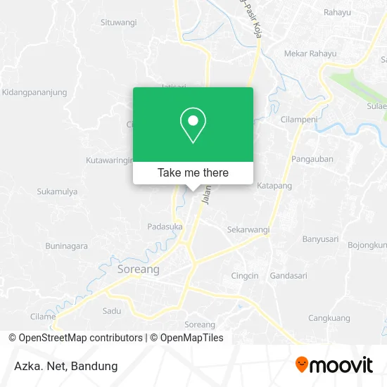
See Azka. Net, Bandung, on the map
Public Transit to Azka. Net in Bandung
Wondering how to get to Azka. Net in Bandung? Moovit helps you find the best way to get to Azka. Net with step-by-step directions from the nearest public transit station.
Moovit provides free maps and live directions to help you navigate through your city. View schedules, routes, timetables, and find out how long does it take to get to Azka. Net in real time.
Looking for the nearest stop or station to Azka. Net? Check out this list of stops closest to your destination: Hotel Soreang B; Sindang Mekar Bunisari 35.
Bus: SOREANG-CILILIN, SOREANG-CIMAHI, TMP 1D.
Want to see if there’s another route that gets you there at an earlier time? Moovit helps you find alternative routes or times. Get directions from and directions to Azka. Net easily from the Moovit App or Website.
We make riding to Azka. Net easy, which is why over 1.5 million users, including users in Bandung, trust Moovit as the best app for public transit. You don’t need to download an individual bus app or train app, Moovit is your all-in-one transit app that helps you find the best bus time or train time available.
For information on prices of bus, costs and ride fares to Azka. Net, please check the Moovit app.
Use the app to navigate to popular places including to the airport, hospital, stadium, grocery store, mall, coffee shop, school, college, and university.
Azka. Net Address: Jalan Parung Serab Bandung Kabupaten 40319 street in Bandung
- Yanyan Penjait Baju Muslim Anak Dan Dewasa,
- Toko Ali Sahnan,
- Seblak Anta,
- Izdihaar,
- Bengkel Mobil Truck,
- Shopee Express Dop Wahana Express Rgb Logistik Soreang Parungserab,
- Warung Isum,
- Toko Putra Jaya Kurnia,
- Toko Ari,
- Rc Ressy Drw Skincare,
- Baso Mantap Mas Heru,
- Kedai Armilah,
- House Burger Shabirafood,
- Kebon Anggur Soreang Bandung,
- Toko Maju Jaya,
- Toko Jaya Sampurna,
- Bapak Dadi,
- Kp. Tegal Caang Fishing Place,
- Raudlatul Athfal Al Falaah Kopo,
- Toko Umar
Places Near Azka. Net (Bandung)
- Subang, Kota Bandung,
- RSUP Dr. Hasan Sadikin (RSHS), Kota Bandung,
- Braga, Kota Bandung,
- YYY, Kota Bandung,
- Jl.L.L.R.E.Martadinata no.47,Bandung Regency, Bandung,
- Summarecon Mall Bandung, Kota Bandung,
- Warung bokep, Bandung,
- Taman Hutan Raya (TAHURA), Kota Bandung,
- Pasteur, Kota Bandung,
- 23 Paskal Shopping Mall, Kota Bandung,
- Trans Studio Mall (TSM), Kota Bandung,
- Pantai Santolo - Pameungpeuk Garut, Bandung,
- Stadion Gelora Bandung Lautan Api (GBLA), Kota Bandung,
- Bus Damri Dipati Ukur-Jatinangor, Bandung,
- bus damri “Dago - Leuwi panjang”, Kota Bandung,
- Rumah Sakit Hasan Sadikin, Kota Bandung,
- Cililin, Kab. Bandung Barat, Bandung,
- Batujajar, Bandung,
- Rs Hasan Sadikin, Kota Bandung,
- Universitas Pendidikan Indonesia (UPI), Kota Bandung
How to get to popular places in Bandung with public transit
Get around Bandung by public transit!
Traveling around Bandung has never been so easy. See step by step directions as you travel to any attraction, street or major public transit station. View bus and train schedules, arrival times, service alerts and detailed routes on a map, so you know exactly how to get to anywhere in Bandung.
When traveling to any destination around Bandung use Moovit's Live Directions with Get Off Notifications to know exactly where and how far to walk, how long to wait for your line, and how many stops are left. Moovit will alert you when it's time to get off — no need to constantly re-check whether yours is the next stop.
Wondering how to use public transit in Bandung or how to pay for public transit in Bandung? Moovit public transit app can help you navigate your way with public transit easily, and at minimum cost. It includes public transit fees, ticket prices, and costs. Looking for a map of Bandung public transit lines? Moovit public transit app shows all public transit maps in Bandung with all Bus and Train routes and stops on an interactive map.
Bandung has 2 transit type(s), including: Bus and Train, operated by several transit agencies, including Trans Metro Bandung, Trans Metro Pasundan - Teman Bus, Angkutan Antarkota Dalam Provinsi, DAMRI, KAI Commuter, Angkutan Kota Bandung, Angkutan Kabupaten Bandung, Kobanter Baru, Bus Wisata DISHUB Kota Bandung, Bus Sekolah DISHUB Kota Bandung and Dinas Perhubungan Provinsi Jawa Barat