Directions to Azulao (Portão) with public transportation
The following transit lines have routes that pass near Azulao
How to get to Azulao by bus?
Click on the bus route to see step by step directions with maps, line arrival times and updated time schedules.
From Centro Médico Comunitário Bairro Novo, Sítio Cercado
73 minFrom Shopping & Sports, Alto Boqueirão
64 minFrom UPA 24h - Unidade de Pronto Atendimento Cajuru, Cajuru
64 minFrom Bairro Thomaz Coelho, Araucária
72 minFrom UFPR - Universidade Federal do Paraná, Centro
40 minFrom Parque Tanguá, O Parque Mais Lindo de Curitiba, Taboão
66 minFrom Rua Gago Coutinho, Bacacheri
50 minFrom Avenida Senador Souza Naves, Alto Da Rua XV
48 minFrom Rua Emílio de Menezes, São Francisco
46 minFrom Jockey Club do Paraná, Tarumã
58 min
Bus stops near Azulao in Portão
Bus lines to Azulao in Portão
- 762 VILA ROSINHA, Praça Rui Barbosa → Vila Rosinha,VIEW
- 611 FAZENDINHA / PORTÃO, Terminal Fazendinha → Terminal Portão,VIEW
- 761 VILA IZABEL, Praça Rui Barbosa → Vila Izabel,VIEW
- 701 FAZENDINHA, Praça Rui Barbosa → Terminal Fazendinha,VIEW
- 706 CAIUÁ - FAZENDINHA / CENTRO, Praça Rui Barbosa → Terminal Caiuá,VIEW
What are the closest stations to Azulao?
The closest stations to Azulao are:
- Rua Pinheiro Guimarães, 538 is 52 meters away, 2 min walk.
- R. Carlos Dietzsch, 1273 is 176 meters away, 3 min walk.
- R. Agostinho Merlin, 740 is 224 meters away, 4 min walk.
- R. Amadeu Do Amaral, 513 is 282 meters away, 4 min walk.
Which bus lines stop near Azulao?
These bus lines stop near Azulao: 021 INTERBAIRROS II (ANTI-HORÁRIO), 611 FAZENDINHA / PORTÃO, 761 VILA IZABEL, 762 VILA ROSINHA.
What’s the nearest bus station to Azulao in Portão?
The nearest bus station to Azulao in Portão is Rua Pinheiro Guimarães, 538. It’s a 2 min walk away.
What time is the first bus to Azulao in Portão?
The 701 FAZENDINHA is the first bus that goes to Azulao in Portão. It stops nearby at 5:29 AM.
What time is the last bus to Azulao in Portão?
The 701 FAZENDINHA is the last bus that goes to Azulao in Portão. It stops nearby at 12:46 AM.
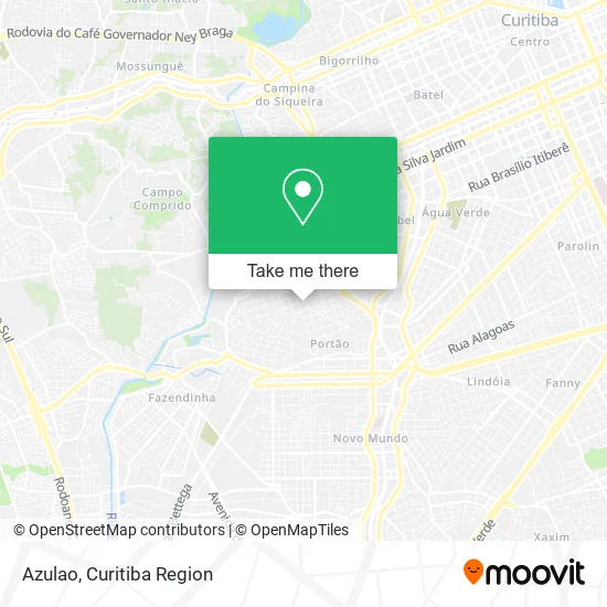
See Azulao, Portão, on the map
Public Transit to Azulao in Portão
Wondering how to get to Azulao in Portão? Moovit helps you find the best way to get to Azulao with step-by-step directions from the nearest public transit station.
Moovit provides free maps and live directions to help you navigate through your city. View schedules, routes, timetables, and find out how long does it take to get to Azulao in real time.
Looking for the nearest stop or station to Azulao? Check out this list of stops closest to your destination: Rua Pinheiro Guimarães; R. Carlos Dietzsch; R. Agostinho Merlin; R. Amadeu Do Amaral.
Bus: 021 INTERBAIRROS II (ANTI-HORÁRIO), 611 FAZENDINHA / PORTÃO, 761 VILA IZABEL, 762 VILA ROSINHA, 701 FAZENDINHA, 706 CAIUÁ - FAZENDINHA / CENTRO.
Want to see if there’s another route that gets you there at an earlier time? Moovit helps you find alternative routes or times. Get directions from and directions to Azulao easily from the Moovit App or Website.
We make riding to Azulao easy, which is why over 1.5 million users, including users in Portão, trust Moovit as the best app for public transit. You don’t need to download an individual bus app or train app, Moovit is your all-in-one transit app that helps you find the best bus time or train time available.
For information on prices of bus, costs and ride fares to Azulao, please check the Moovit app.
Use the app to navigate to popular places including to the airport, hospital, stadium, grocery store, mall, coffee shop, school, college, and university.
Azulao Address: Rua Pinheiro Guimarães, 635 Portão Curitiba-PR 80330-250 street in Portão
- Belotto e Belotto,
- Gaste Pouco,
- Low Cost,
- Surf Bar,
- Borracharia Ferreira,
- Rua Professor Fábio de Souza 1668,
- Material De Construcao Azulao,
- Blue Barbearia,
- Escola Siloé,
- Tiemann Administradora de Bens e Incorporadora,
- Bapka,
- Pró-Vida Comercio de Equipamentos,
- Rua Agostinho Merlin 586,
- Rentlog Material Handling Locação e Revenda de Maquinas e Veiculos,
- Wellner & Ruaro Moveis Planejados,
- Maestral Corretora de Seguros,
- Kl3 Empreendimentos - Construtora e Incorporadora,
- Felice Planejados,
- Cds Ciscato Representacoes,
- Sindicato Empreg Emp Ref Col Ref Conv Coz IND Curitiba
Places Near Azulao (Portão)
- Park Shopping Barigüi, Mossunguê,
- Hospital do Rocio, Campo,
- Hospital Da Cruz Vermelha, Batel,
- Hospital Madalena Sofia, Bairro Alto,
- Jockey Plaza Shopping Center, Tarumã,
- Hospital de Clínicas (HC - UFPR), Centro,
- Rua General Mário Tourinho, Campina Do Siqueira,
- Shopping Palladium, Portão,
- Hospital Nossa Senhora Das Graças, Mercês,
- Pontifícia Universidade Católica do Paraná (PUCPR), Prado Velho,
- Parque Barigui, Mercês,
- Shopping Estação, Rebouças,
- Jardim Botânico de Curitiba PR, Centro,
- Hhhhh, Fazendinha,
- Hospital Angelina Caron, Campina Grande Do Sul,
- Hospital Universitário Evangélico de Curitiba, Bigorrilho,
- Campo Largo, Campo,
- Hospital Erasto Gaertner, Jardim Das Américas,
- Rua Martim Afonso 558, Mercês,
- Arena Da Baixada - Curitiba
How to get to popular places in Curitiba Region with public transit
Get around Portão by public transit!
Traveling around Portão has never been so easy. See step by step directions as you travel to any attraction, street or major public transit station. View bus and train schedules, arrival times, service alerts and detailed routes on a map, so you know exactly how to get to anywhere in Portão.
When traveling to any destination around Portão use Moovit's Live Directions with Get Off Notifications to know exactly where and how far to walk, how long to wait for your line, and how many stops are left. Moovit will alert you when it's time to get off — no need to constantly re-check whether yours is the next stop.
Wondering how to use public transit in Portão or how to pay for public transit in Portão? Moovit public transit app can help you navigate your way with public transit easily, and at minimum cost. It includes public transit fees, ticket prices, and costs. Looking for a map of Portão public transit lines? Moovit public transit app shows all public transit maps in Portão with all Bus and Cable Car routes and stops on an interactive map.
Curitiba Region has 2 transit type(s), including: Bus and Cable Car, operated by several transit agencies, including Sistema Integrado de Mobilidade (URBS), Sistema Integrado de Mobilidade (AMEP), URBS (Cartões bancários e Dinheiro), URBS (Cartões bancários / Cartão URBS), AMEP (Cartões bancários / Cartão MetroCard), AMEP (Cartões bancários / Cartão MetroCard / Dinheiro), Viação Colombo (Dinheiro), TRIAR (Cartão TRIAR / Dinheiro), Empresa Curitiba Cerro Azul (Dinheiro), Expresso Nossa Senhora da Penha (Dinheiro), Empresa Campo Alto Tijucas (Dinheiro), Auto Viação São José (Cartão VEM / Dinheiro), BRT S/A (Cartão VEM / Dinheiro), TransPiedade (Cartão Cidadão / Dinheiro) and Oceânica Sul (Cartão Transporte / Dinheiro)