How to get to BBVA by bus?
Click on the bus route to see step by step directions with maps, line arrival times and updated time schedules.
From Minth, Aguascalientes
42 minFrom Cavalia Residencial, Aguascalientes
44 minFrom Universidad Autónoma de Aguascalientes, Aguascalientes
39 minFrom Fraccionamiento Viña Antigua, Aguascalientes
59 minFrom Coyote Ugly, Aguascalientes
50 minFrom Cortijo San Marcos, Aguascalientes
69 minFrom Sam's Club, Aguascalientes
39 minFrom Avenida Guadalupe González, Aguascalientes
60 minFrom Fraccionamiento Camino Real, Aguascalientes
50 min
Bus stops near BBVA in Aguascalientes
Bus lines to BBVA in Aguascalientes
- RUTA 02, Los Cactus,VIEW
- RUTA 07, Villa Las Palmas,VIEW
- RUTA 28, Jesús María,VIEW
- RUTA 37, Hacienda San Marcos,VIEW
- RUTA 04, Mahatma Gandhi - Jesús María,VIEW
- RUTA 33, Jesús María,VIEW
- RUTA 43, Utma,VIEW
- RUTA 43, San Antonio Via Lomas De New York,VIEW
- RUTA 42, Bellavista,VIEW
- RUTA 40, Terminal Oriente - Terminal Oriente (N),VIEW
- RUTA 40, Terminal Oriente - Terminal Oriente (S),VIEW
- RUTA 20N, Terminal Oriente - Terminal Oriente (N),VIEW
What are the closest stations to BBVA?
The closest stations to BBVA are:
- Avenida Héroe De Nacozari, 1809(1810) is 56 meters away, 1 min walk.
- Boulevard José María Chávez, 1605a is 264 meters away, 4 min walk.
- Avenida Héroe De Nacozari, 204 is 369 meters away, 5 min walk.
- Avenida Aguascalientes Sur, 2729 is 579 meters away, 8 min walk.
- No Name is 620 meters away, 8 min walk.
- Avenida De La Convención De 1914 Sur, 401(3) is 1181 meters away, 16 min walk.
Which bus lines stop near BBVA?
These bus lines stop near BBVA: RUTA 04, RUTA 40, RUTA 43.
What’s the nearest bus station to BBVA in Aguascalientes?
The nearest bus station to BBVA in Aguascalientes is Avenida Héroe De Nacozari, 1809(1810). It’s a 1 min walk away.
What time is the first bus to BBVA in Aguascalientes?
The RUTA 40 is the first bus that goes to BBVA in Aguascalientes. It stops nearby at 5:59 AM.
What time is the last bus to BBVA in Aguascalientes?
The RUTA 07 is the last bus that goes to BBVA in Aguascalientes. It stops nearby at 10:55 PM.
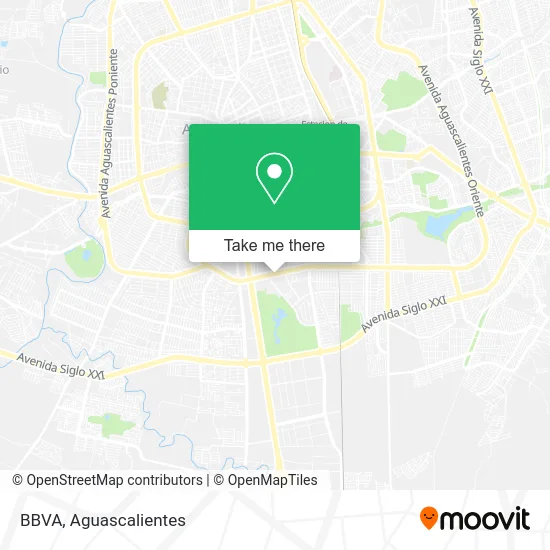
See BBVA, Aguascalientes, on the map
Public Transit to BBVA in Aguascalientes
Wondering how to get to BBVA in Aguascalientes? Moovit helps you find the best way to get to BBVA with step-by-step directions from the nearest public transit station.
Moovit provides free maps and live directions to help you navigate through your city. View schedules, routes, timetables, and find out how long does it take to get to BBVA in real time.
Looking for the nearest stop or station to BBVA? Check out this list of stops closest to your destination: Avenida Héroe De Nacozari; Boulevard José María Chávez; Avenida Héroe De Nacozari; Avenida Aguascalientes Sur; No Name; Avenida De La Convención De 1914 Sur.
Bus: RUTA 04, RUTA 40, RUTA 43, RUTA 02, RUTA 07, RUTA 28, RUTA 37, RUTA 33, RUTA 42, RUTA 20N.
Want to see if there’s another route that gets you there at an earlier time? Moovit helps you find alternative routes or times. Get directions from and directions to BBVA easily from the Moovit App or Website.
We make riding to BBVA easy, which is why over 1.5 million users, including users in Aguascalientes, trust Moovit as the best app for public transit. You don’t need to download an individual bus app or train app, Moovit is your all-in-one transit app that helps you find the best bus time or train time available.
For information on prices of bus, costs and ride fares to BBVA, please check the Moovit app.
Use the app to navigate to popular places including to the airport, hospital, stadium, grocery store, mall, coffee shop, school, college, and university.
BBVA Address: Avenida Aguascalientes Sur 703, Jardines de las Bugambilias, 20276 Aguascalientes, Aguascalientes street in Aguascalientes
- Ine Aguascalientes,
- Plaza Marbella,
- Calabria,
- Cajero Automático Banco Multiva,
- Quinta Real,
- Hotel Quinta Real,
- Banco Bbva,
- San Jeronimo Laboratorios Servicios Integrales Diagnostico,
- Leenker Business Center,
- Dra. Gabriela Velasco,
- Venta de Herramientas Herramental Monterrey,
- Howa México,
- Bbva Bancomer,
- Escuela de Idiomas Best y Active English,
- Restaurante de la Tierra,
- Asociacion Mexicana de Mujeres Empresarias de Aguascalientes, a.C.,
- WESTERN UNION,
- Notaria Publica 50,
- Grupo Promomex,
- Consultorio de Pscicologia Vivet Clinic
Places Near BBVA (Aguascalientes)
- Parque Las Tres Centurias, Aguascalientes,
- Terminal De Combis, Aguascalientes,
- clinica 3 uaa, Aguascalientes,
- ESPACIOS, Aguascalientes,
- Isla San Marcos, Aguascalientes,
- Aeropuerto de Aguascalientes S.A. de C.V., Aguascalientes,
- Central De Autobuses, Aguascalientes,
- Ciudad industrial, Aguascalientes,
- La Isla San Marcos, Aguascalientes,
- Agropecuario, Aguascalientes,
- Villasuncion, Aguascalientes,
- Imss Clinica 1, Aguascalientes,
- Villas de Nuestra Señora de la Asunción, Aguascalientes,
- Universidad Autónoma de Aguascalientes, Aguascalientes,
- Jesús María, Aguascalientes,
- Hospital Imss No. 3, Aguascalientes,
- Centro, Aguascalientes,
- Nuevo Hospital Hidalgo, Aguascalientes,
- Centro Comercial Altaria, Aguascalientes,
- Blvd. Luis Donaldo Colosio, Aguascalientes
How to get to popular places in Aguascalientes with public transit
Get around Aguascalientes by public transit!
Traveling around Aguascalientes has never been so easy. See step by step directions as you travel to any attraction, street or major public transit station. View bus and train schedules, arrival times, service alerts and detailed routes on a map, so you know exactly how to get to anywhere in Aguascalientes.
When traveling to any destination around Aguascalientes use Moovit's Live Directions with Get Off Notifications to know exactly where and how far to walk, how long to wait for your line, and how many stops are left. Moovit will alert you when it's time to get off — no need to constantly re-check whether yours is the next stop.
Wondering how to use public transit in Aguascalientes or how to pay for public transit in Aguascalientes? Moovit public transit app can help you navigate your way with public transit easily, and at minimum cost. It includes public transit fees, ticket prices, and costs. Looking for a map of Aguascalientes public transit lines? Moovit public transit app shows all public transit maps in Aguascalientes with all bus routes and stops on an interactive map.
Aguascalientes has 1 transit type(s), including: bus, operated by several transit agencies, including Coordinación General de Movilidad