Directions to BC BANDUNG FREEDOM (Bandung) with public transportation
The following transit lines have routes that pass near BC BANDUNG FREEDOM
 Bus: 12.
How to get to BC BANDUNG FREEDOM by bus?
Click on the bus route to see step by step directions with maps, line arrival times and updated time schedules.
From PDAM Tirta Raharja Cabang Ciparay, Bandung
53 minFrom Solokan jeruk majalaya, Bandung
49 minFrom Dr.Gunawan (Klinik El-Shadai Utama), Bandung
56 minFrom PT. Himalaya Tunas Texindo, Bandung
39 minFrom jongor,ciparay,kab bandung, Bandung
55 minFrom Warung Jengkol Majalaya, Bandung
46 minFrom Bank BRI cab Majalaya, Bandung
54 minFrom Mie Baso "ADEM AYEM" Rancabali, Bandung
23 minFrom Bojong majalaya, Bandung
46 minFrom Baranang siang, Bandung
53 min
Bus stop near BC BANDUNG FREEDOM in Bandung
- Jalan Oma Anggawisastra 414, 5 min walk,VIEW
Bus lines to BC BANDUNG FREEDOM in Bandung
- 12, Ibun,VIEW
What are the closest stations to BC BANDUNG FREEDOM?
The closest stations to BC BANDUNG FREEDOM are:
- Jalan Oma Anggawisastra 414 is 338 meters away, 5 min walk.
Which bus line stops near BC BANDUNG FREEDOM?
12
What’s the nearest bus station to BC BANDUNG FREEDOM in Bandung?
The nearest bus station to BC BANDUNG FREEDOM in Bandung is Jalan Oma Anggawisastra 414. It’s a 5 min walk away.
What time is the first bus to BC BANDUNG FREEDOM in Bandung?
The 12 is the first bus that goes to BC BANDUNG FREEDOM in Bandung. It stops nearby at 5:00 AM.
What time is the last bus to BC BANDUNG FREEDOM in Bandung?
The 12 is the last bus that goes to BC BANDUNG FREEDOM in Bandung. It stops nearby at 6:17 PM.
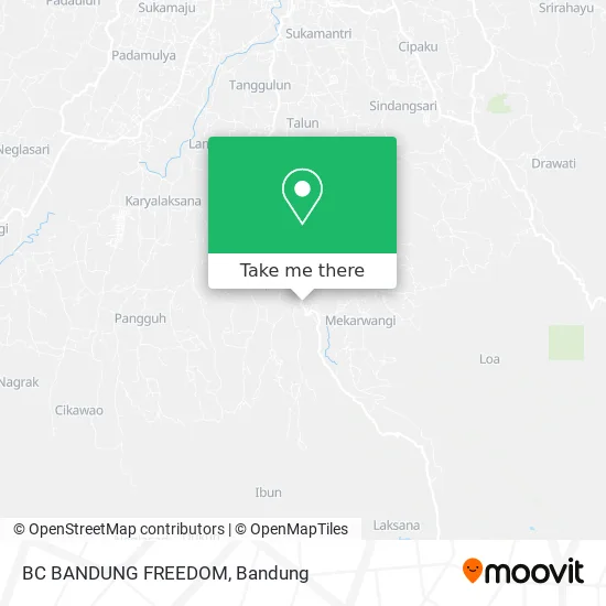
See BC BANDUNG FREEDOM, Bandung, on the map
Public Transit to BC BANDUNG FREEDOM in Bandung
Wondering how to get to BC BANDUNG FREEDOM in Bandung? Moovit helps you find the best way to get to BC BANDUNG FREEDOM with step-by-step directions from the nearest public transit station.
Moovit provides free maps and live directions to help you navigate through your city. View schedules, routes, timetables, and find out how long does it take to get to BC BANDUNG FREEDOM in real time.
Looking for the nearest stop or station to BC BANDUNG FREEDOM? Check out this list of stops closest to your destination: Jalan Oma Anggawisastra 414.
Bus: 12.
Want to see if there’s another route that gets you there at an earlier time? Moovit helps you find alternative routes or times. Get directions from and directions to BC BANDUNG FREEDOM easily from the Moovit App or Website.
We make riding to BC BANDUNG FREEDOM easy, which is why over 1.5 million users, including users in Bandung, trust Moovit as the best app for public transit. You don’t need to download an individual bus app or train app, Moovit is your all-in-one transit app that helps you find the best bus time or train time available.
For information on prices of bus, costs and ride fares to BC BANDUNG FREEDOM, please check the Moovit app.
Use the app to navigate to popular places including to the airport, hospital, stadium, grocery store, mall, coffee shop, school, college, and university.
Location: Bandung
- Toko Ateng Belokan Gandol,
- Kupat Tahu Petis,
- Toko Perhiasan Mas Berkah,
- Jl IBUN Majalaya,
- SPBU Manirancan,
- Mie Bakso Cah Solo Mas Larno,
- Tiis Dingin, Ibun - Bandung,
- Warung Nasi Bu Engkom,
- Toko Kue Ngudi Rasa,
- Yayasan Pondok Pesantren Miftahul Ulum Almusri 1,
- Kantor kecamatan Ibun,
- Puskesmas Ibun,
- PT Tiga saudara garment industries,
- Alum Alun Paseh,
- Lapangan Kecamatan Ibun,
- Smpn 2 Ibun,
- Kamojang Green Resort,
- Indomaret,
- Desa Paseh, Majalaya,
- Bypass Tanjung Cipanas Garut
Places Near BC BANDUNG FREEDOM (Bandung)
- Warung bokep, Bandung,
- Taman Hutan Raya (TAHURA), Kota Bandung,
- YYY, Kota Bandung,
- 23 Paskal Shopping Mall, Kota Bandung,
- Bus Damri Dipati Ukur-Jatinangor, Bandung,
- RSUP Dr. Hasan Sadikin (RSHS), Kota Bandung,
- Rumah Sakit Hasan Sadikin, Kota Bandung,
- Jl.L.L.R.E.Martadinata no.47,Bandung Regency, Bandung,
- Summarecon Mall Bandung, Kota Bandung,
- Pantai Santolo - Pameungpeuk Garut, Bandung,
- Batujajar, Bandung,
- Rs Hasan Sadikin, Kota Bandung,
- Cililin, Kab. Bandung Barat, Bandung,
- Trans Studio Mall (TSM), Kota Bandung,
- Subang, Kota Bandung,
- Stadion Gelora Bandung Lautan Api (GBLA), Kota Bandung,
- Universitas Pendidikan Indonesia (UPI), Kota Bandung,
- bus damri “Dago - Leuwi panjang”, Kota Bandung,
- Braga, Kota Bandung,
- Pasteur, Kota Bandung
How to get to popular places in Bandung with public transit
Get around Bandung by public transit!
Traveling around Bandung has never been so easy. See step by step directions as you travel to any attraction, street or major public transit station. View bus and train schedules, arrival times, service alerts and detailed routes on a map, so you know exactly how to get to anywhere in Bandung.
When traveling to any destination around Bandung use Moovit's Live Directions with Get Off Notifications to know exactly where and how far to walk, how long to wait for your line, and how many stops are left. Moovit will alert you when it's time to get off — no need to constantly re-check whether yours is the next stop.
Wondering how to use public transit in Bandung or how to pay for public transit in Bandung? Moovit public transit app can help you navigate your way with public transit easily, and at minimum cost. It includes public transit fees, ticket prices, and costs. Looking for a map of Bandung public transit lines? Moovit public transit app shows all public transit maps in Bandung with all Bus and Train routes and stops on an interactive map.
Bandung has 2 transit type(s), including: Bus and Train, operated by several transit agencies, including Trans Metro Bandung, Trans Metro Pasundan - Teman Bus, Angkutan Antarkota Dalam Provinsi, DAMRI, KAI Commuter, Angkutan Kota Bandung, Angkutan Kabupaten Bandung, Kobanter Baru, Bus Wisata DISHUB Kota Bandung, Bus Sekolah DISHUB Kota Bandung and Dinas Perhubungan Provinsi Jawa Barat