How to get to BFD Design Miami by bus?
Click on the bus route to see step by step directions with maps, line arrival times and updated time schedules.
From Comfort Inn & Suites Miami International Airport, Miami
32 minFrom Explorer 96 Mav, North Westside
62 minFrom Hialeah Park Casino, Hialeah
93 minFrom Department of Children and Families, Miami
76 minFrom Amelia Earhart Park, Miami
94 minFrom International Mall., Miami
82 minFrom SW 8th St / Ponce de Leon Blvd, Miami
62 minFrom Mt Sinai Medical Center, Miami
62 minFrom Miami Lakes, Hialeah
110 minFrom Nicklaus Children's Hospital, Miami
87 min
How to get to BFD Design Miami by train?
Click on the train route to see step by step directions with maps, line arrival times and updated time schedules.
Bus stops near BFD Design Miami in North Westside
Train station near BFD Design Miami in North Westside
- Palmetto Station Rail Southbound, 41 min walk,VIEW
Bus lines to BFD Design Miami in North Westside
What are the closest stations to BFD Design Miami?
The closest stations to BFD Design Miami are:
- Nw 84 Av & Nw 58 St is 168 yards away, 3 min walk.
- 5680 Northwest 87th Avenue is 614 yards away, 8 min walk.
- Nw 53 St & Op # 8325 is 685 yards away, 9 min walk.
- Nw 53 St & # 8325 is 687 yards away, 9 min walk.
- Palmetto Station Rail Southbound is 3387 yards away, 41 min walk.
Which bus lines stop near BFD Design Miami?
These bus lines stop near BFD Design Miami: 132, 36, 87, DLOOP2.
Which train line stops near BFD Design Miami?
GREEN (Dadeland South Stat.rail Northbound→Palmetto Station Rail Northbound)
What’s the nearest bus station to BFD Design Miami in North Westside?
The nearest bus station to BFD Design Miami in North Westside is Nw 84 Av & Nw 58 St. It’s a 3 min walk away.
What time is the first train to BFD Design Miami in North Westside?
The GREEN is the first train that goes to BFD Design Miami in North Westside. It stops nearby at 5:00 AM.
What time is the last train to BFD Design Miami in North Westside?
The GREEN is the last train that goes to BFD Design Miami in North Westside. It stops nearby at 1:01 AM.
What time is the first bus to BFD Design Miami in North Westside?
The 36 is the first bus that goes to BFD Design Miami in North Westside. It stops nearby at 4:03 AM.
What time is the last bus to BFD Design Miami in North Westside?
The 36 is the last bus that goes to BFD Design Miami in North Westside. It stops nearby at 12:49 AM.
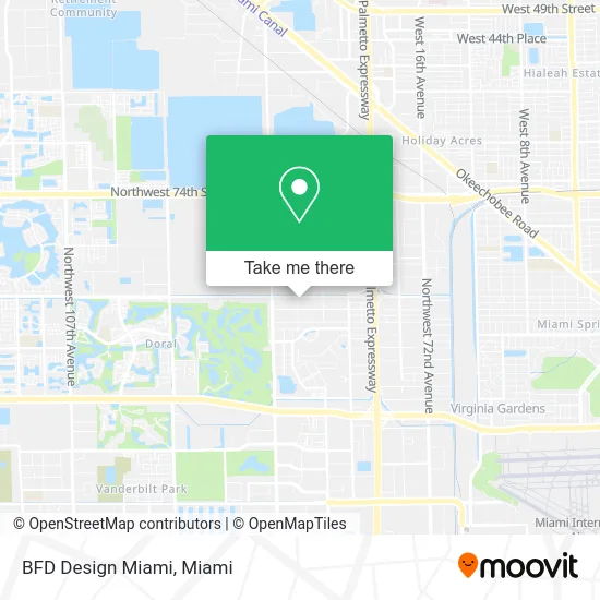
See BFD Design Miami, North Westside, on the map
Public Transit to BFD Design Miami in North Westside
Wondering how to get to BFD Design Miami in North Westside? Moovit helps you find the best way to get to BFD Design Miami with step-by-step directions from the nearest public transit station.
Moovit provides free maps and live directions to help you navigate through your city. View schedules, routes, timetables, and find out how long does it take to get to BFD Design Miami in real time.
Looking for the nearest stop or station to BFD Design Miami? Check out this list of stops closest to your destination: Nw 84 Av & Nw 58 St; 5680 Northwest 87th Avenue; Nw 53 St & Op # 8325; Nw 53 St & # 8325; Palmetto Station Rail Southbound.
Bus: 132, 36, 87, DLOOP2.Train: GREEN.
Want to see if there’s another route that gets you there at an earlier time? Moovit helps you find alternative routes or times. Get directions from and directions to BFD Design Miami easily from the Moovit App or Website.
We make riding to BFD Design Miami easy, which is why over 1.5 million users, including users in North Westside, trust Moovit as the best app for public transit. You don’t need to download an individual bus app or train app, Moovit is your all-in-one transit app that helps you find the best bus time or train time available.
For information on prices of bus and train, costs and ride fares to BFD Design Miami, please check the Moovit app.
Use the app to navigate to popular places including to the airport, hospital, stadium, grocery store, mall, coffee shop, school, college, and university.
BFD Design Miami Address: 5765 NW 84th Ave Miami, FL 33166 street in North Westside
- Doral Contemporary Art Museum,
- Doral Bar Association,
- Guayaba,
- Valery Swimwear,
- Lyon Oil Investments,
- Brick Paver,
- Christy & Co. Photography,
- Bobcat of Miami,
- Reef Kitchens,
- Vessel Fl Operations,
- Antares Portfolio,
- Ceramic Tile Group,
- Handyman Repair & Maintenance.,
- Megawatts Group,
- Perusa,
- Northwest 84th Avenue & Northwest 58th Street,
- Rock Fitness,
- The Blessing Touch,
- Oe Max Inc.,
- Cat
Places Near BFD Design Miami (North Westside)
- Miami Freedom Park, Miami,
- Hard Rock Stadium, Miami Gardens,
- Aventura Mall, Miami,
- Little Havana, Miami,
- Miami Design District, Miami,
- Zoo Miami, Miami,
- Brickell City Centre, Miami,
- Aventura Mall, Miami Beach,
- Dolphin Mall Bus, Miami,
- Sawgrass mall ( FL ), Miami Beach,
- Wynwood, Miami,
- Richard E. Gerstein Justice Building, Miami,
- Dolphin Mall, Miami,
- Sawgrass Mall, Miami,
- Port of Miami Cruise Terminal, Miami,
- Miami VA Hospital, Miami,
- Marlins Park, Miami,
- Miami-Dade County Courthouse, Miami,
- Bayside Marketplace, Miami,
- Keiser University Flagship Campus, West Palm Beach
How to get to popular places in Miami with public transit
Get around North Westside by public transit!
Traveling around North Westside has never been so easy. See step by step directions as you travel to any attraction, street or major public transit station. View bus and train schedules, arrival times, service alerts and detailed routes on a map, so you know exactly how to get to anywhere in North Westside.
When traveling to any destination around North Westside use Moovit's Live Directions with Get Off Notifications to know exactly where and how far to walk, how long to wait for your line, and how many stops are left. Moovit will alert you when it's time to get off — no need to constantly re-check whether yours is the next stop.
Wondering how to use public transit in North Westside or how to pay for public transit in North Westside? Moovit public transit app can help you navigate your way with public transit easily, and at minimum cost. It includes public transit fees, ticket prices, and costs. Looking for a map of North Westside public transit lines? Moovit public transit app shows all public transit maps in North Westside with all Bus, Train, Light Rail and Ferry routes and stops on an interactive map.
Miami has 4 transit type(s), including: Bus, Train, Light Rail and Ferry, operated by several transit agencies, including Broward County Transit, Miami-Dade Transit, Metrorail, Palm Tran, Tri-Rail, Brightline, MARTY, City of Homestead Trolley, Key West Transit, Treasure Coast Connector, GoLine IRT, Amtrak, Greyhound-us, FlixBus-us and Aventura Express Shuttle Bus