Directions to BLUMARKET (Niterói) with public transportation
The following transit lines have routes that pass near BLUMARKET
 Bus: 1775D (EXECUTIVO), 2755D (EXECUTIVO), 760D, 775D, 47-B.
- Ferry: PRAÇA ARARIBÓIA - PRAÇA XV.
How to get to BLUMARKET by bus?
Click on the bus route to see step by step directions with maps, line arrival times and updated time schedules.
From Rio Imagem, Centro
30 minFrom São Cristóvão, Imperial De São Cristóvão
37 minFrom Av. Mem de Sá, Centro
34 minFrom Cemitério São Francisco Xavier, Caju
58 minFrom Rua Barão de Itapagipe, Tijuca
43 minFrom Glória, Glória
39 minFrom Tijuca, Tijuca
35 minFrom Rua Voluntários da Pátria 445, Botafogo
44 minFrom Rua Frei Caneca, Centro
35 minFrom Rua Dezenove de Fevereiro, Botafogo
41 min
Bus stops near BLUMARKET in Niterói
- Rua Maestro Felício Toledo, 551-559, 6 min walk,VIEW
- Plaza Shopping | Extra Supermercado, 6 min walk,VIEW
- Rua Visconde Do Rio Branco 511 Centro Niterói - Rio De Janeiro 24010 Brasil, 7 min walk,VIEW
- Rua São Sebastião 102, 7 min walk,VIEW
- Plaza Shopping / Extra Supermercado (Barcas), 8 min walk,VIEW
- Praça Araribóia 15069, 8 min walk,VIEW
Ferry station near BLUMARKET in Niterói
- Praça Araribóia ⛴, 21 min walk,VIEW
Bus lines to BLUMARKET in Niterói
- 47-B, Circular Via Mac,VIEW
- 24, Palmeiras - Centro (via Terminal João Goulart),VIEW
- 740D, Charitas - Leblon (BRS I - via Copacabana / T. Gentileza / Ipanema),VIEW
- 755D, Charitas - Gávea (BRS I - via Túnel Santa Bárbara),VIEW
- 760D, Charitas - Galeão ✈,VIEW
- 775D, Charitas - Gávea (BRS I - via Lapa / Gasômetro),VIEW
- 785D, Charitas - Barra da Tijuca (BRS I - via Túnel Santa Bárbara),VIEW
- 1760D (EXECUTIVO), Charitas - Galeão ✈,VIEW
- 1775D (EXECUTIVO), Charitas - Gávea (BRS I - via Lapa / Gasômetro),VIEW
- 1785D (EXECUTIVO), Charitas - Barra da Tijuca (Via Túnel Santa Bárbara),VIEW
- 2740D (EXECUTIVO), Charitas - Leblon (BRS I - via Copacabana / T. Gentileza / Ipanema),VIEW
- 2755D (EXECUTIVO), Charitas - Gávea (Brs I - Via Túnel Santa Bárbara),VIEW
- 47, Centro,VIEW
- 47-A, Circular,VIEW
- OC1, Oc1 Piratininga,VIEW
- OC2, Oc2 Itaipu,VIEW
- OC3, Oc3 Terminal (Praia De Icaraí),VIEW
- OC3A, Oc3a Itaipu (Via Eng.Do Mato),VIEW
- 32, 32 Terminal Rodoviario,VIEW
- 33, 33 Terminal Rodoviário,VIEW
What are the closest stations to BLUMARKET?
The closest stations to BLUMARKET are:
- Rua Maestro Felício Toledo, 551-559 is 395 meters away, 6 min walk.
- Plaza Shopping | Extra Supermercado is 418 meters away, 6 min walk.
- Rua Visconde Do Rio Branco 511 Centro Niterói - Rio De Janeiro 24010 Brasil is 470 meters away, 7 min walk.
- Rua São Sebastião 102 is 472 meters away, 7 min walk.
- Plaza Shopping / Extra Supermercado (Barcas) is 510 meters away, 8 min walk.
- Praça Araribóia 15069 is 535 meters away, 8 min walk.
- Praça Araribóia ⛴ is 1566 meters away, 21 min walk.
Which bus lines stop near BLUMARKET?
These bus lines stop near BLUMARKET: 1775D (EXECUTIVO), 2755D (EXECUTIVO), 760D, 775D.
What’s the nearest bus station to BLUMARKET in Niterói?
The nearest bus stations to BLUMARKET in Niterói are Rua Maestro Felício Toledo, 551-559 and Plaza Shopping | Extra Supermercado. The closest one is a 6 min walk away.
What’s the nearest ferry station to BLUMARKET in Niterói?
The nearest ferry station to BLUMARKET in Niterói is Praça Araribóia ⛴. It’s a 21 min walk away.
What time is the first bus to BLUMARKET in Niterói?
The 36 is the first bus that goes to BLUMARKET in Niterói. It stops nearby at 3:00 AM.
What time is the last bus to BLUMARKET in Niterói?
The 46 is the last bus that goes to BLUMARKET in Niterói. It stops nearby at 3:11 AM.
What time is the first ferry to BLUMARKET in Niterói?
The PRAÇA ARARIBÓIA - PRAÇA XV is the first ferry that goes to BLUMARKET in Niterói. It stops nearby at 5:40 AM.
What time is the last ferry to BLUMARKET in Niterói?
The PRAÇA ARARIBÓIA - PRAÇA XV is the last ferry that goes to BLUMARKET in Niterói. It stops nearby at 11:50 PM.
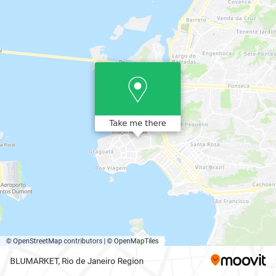
See BLUMARKET, Niterói, on the map
Public Transit to BLUMARKET in Niterói
Wondering how to get to BLUMARKET in Niterói? Moovit helps you find the best way to get to BLUMARKET with step-by-step directions from the nearest public transit station.
Moovit provides free maps and live directions to help you navigate through your city. View schedules, routes, timetables, and find out how long does it take to get to BLUMARKET in real time.
Looking for the nearest stop or station to BLUMARKET? Check out this list of stops closest to your destination: Rua Maestro Felício Toledo; Plaza Shopping | Extra Supermercado; Rua Visconde Do Rio Branco 511 Centro Niterói - Rio De Janeiro 24010 Brasil; Rua São Sebastião 102; Plaza Shopping / Extra Supermercado (Barcas); Praça Araribóia 15069; Praça Araribóia ⛴.
Bus: 1775D (EXECUTIVO), 2755D (EXECUTIVO), 760D, 775D, 47-B, 24, 740D, 755D, OC1, OC2, OC3, OC3A, 32, 47, 47-A, 43.2, 49.2, 740D, 2740D.Ferry: PRAÇA ARARIBÓIA - PRAÇA XV.
Want to see if there’s another route that gets you there at an earlier time? Moovit helps you find alternative routes or times. Get directions from and directions to BLUMARKET easily from the Moovit App or Website.
We make riding to BLUMARKET easy, which is why over 1.5 million users, including users in Niterói, trust Moovit as the best app for public transit. You don’t need to download an individual bus app or train app, Moovit is your all-in-one transit app that helps you find the best bus time or train time available.
For information on prices of bus, costs and ride fares to BLUMARKET, please check the Moovit app.
Use the app to navigate to popular places including to the airport, hospital, stadium, grocery store, mall, coffee shop, school, college, and university.
BLUMARKET Address: Rua General Andrade Neves, 25 Centro Niterói-RJ 24210-000 street in Niterói
- Demetrio Willian Margem,
- EMPRESA CONSTRUTORA E IMOBILIARIA TAMOIO,
- Nit Sign Suprimentos e Servicos,
- Mp Representacao,
- Sebrae RJ,
- Guia-SE Agência Digital Unidade Niterói,
- loja maçonica,
- CDL Niterói,
- Tessa Restier Estrategias Para Negocios,
- Trend Tower Office,
- Visconde De Mauá,
- Loja Maçônica Hiram Nr. 7,
- Travessa General Penha Brasil,
- Camara Dirigente dos Lojistas de Niteroi,
- Fraternidade Espiritualista São Francisco de Assis (Fesfa),
- Decordis,
- Medshore Servicos Medicos,
- rua XV de Novembro,
- Absoluta Criações,
- Açaí Frutal / Niterói Distribuidora Rio Mix
Places Near BLUMARKET (Niterói)
- Rodoviária Novo Rio (Rodoviária do Rio de Janeiro), Santo Cristo,
- Shopping RioSul, Botafogo,
- Hospital Municipal Ronaldo Gazolla, Acari,
- Niterói, Niterói,
- Shopping Nova América, Del Castilho,
- Shopping Downtown, Barra Da Tijuca,
- Museu Do Amanhã, Centro,
- Feirão De Malhas, Duque De Caxias,
- Hospital Federal Cardoso Fontes, Jacarepaguá,
- Praia do Arpoador, Ipanema,
- Shopping Rio Sul, Botafogo,
- Rio De Janeiro,
- Avenida Venezuela 134, Saúde,
- Feira Livre da Gloria, Glória,
- Rua Licínio Cardoso, São Francisco Xavier,
- Avenida Rio Branco, Centro,
- Norte Shopping, Cachambi,
- Hospital Pedro Ernesto, Vila Isabel,
- Hospital Federal Do Andaraí, Andaraí,
- Rua Ulysses Guimarães 16, Cidade Nova
How to get to popular places in Rio de Janeiro Region with public transit
Get around Niterói by public transit!
Traveling around Niterói has never been so easy. See step by step directions as you travel to any attraction, street or major public transit station. View bus and train schedules, arrival times, service alerts and detailed routes on a map, so you know exactly how to get to anywhere in Niterói.
When traveling to any destination around Niterói use Moovit's Live Directions with Get Off Notifications to know exactly where and how far to walk, how long to wait for your line, and how many stops are left. Moovit will alert you when it's time to get off — no need to constantly re-check whether yours is the next stop.
Wondering how to use public transit in Niterói or how to pay for public transit in Niterói? Moovit public transit app can help you navigate your way with public transit easily, and at minimum cost. It includes public transit fees, ticket prices, and costs. Looking for a map of Niterói public transit lines? Moovit public transit app shows all public transit maps in Niterói with all Bus, Train, Metro, Light Rail, Ferry, Cable Car, Gondola and Funicular routes and stops on an interactive map.
Rio de Janeiro Region has 8 transit type(s), including: Bus, Train, Metro, Light Rail, Ferry, Cable Car, Gondola and Funicular, operated by several transit agencies, including TrensRJ, Metrô Rio, VLT Carioca, Barcas Rio, BRT MOBI-Rio, Auto Viação Alpha, Auto Viação Tijuca, Gire Transportes, Transurb, Viação Nossa Senhora das Graças, Consórcio INTERSUL, Braso Lisboa (Municipal), Caprichosa Auto Ônibus, Auto Viação Três Amigos and Rodoviária Âncora Matias