How to get to BL Lab by bus?
Click on the bus route to see step by step directions with maps, line arrival times and updated time schedules.
From Sawgrass Recreation Park / Airboat Rides, Plantation
59 minFrom Oakwood Plaza, Hollywood
66 minFrom Crystal River, Fort Lauderdale
29 minFrom Walmart Supercenter, Pompano Beach
66 minFrom Cardinal Gibbons High School, Fort Lauderdale
35 minFrom DRV PNK Stadium, Fort Lauderdale
57 minFrom Tri-Rail Shuttle To FLL Airport, Hollywood
48 minFrom Griffin Road And 441, Hollywood
62 minFrom 595 Express, Davie
73 minFrom Bepxxx, Fort Lauderdale
56 min
How to get to BL Lab by train?
Click on the train route to see step by step directions with maps, line arrival times and updated time schedules.
Bus stops near BL Lab in Fort Lauderdale
Ferry station near BL Lab in Fort Lauderdale
- Laura Ward Riverwalk Plaza, 45 min walk,VIEW
Train station near BL Lab in Fort Lauderdale
- Fort Lauderdale, 48 min walk,VIEW
Bus lines to BL Lab in Fort Lauderdale
What are the closest stations to BL Lab?
The closest stations to BL Lab are:
- US 1/Ninninger Drive (Northeast 8th Street) is 73 yards away, 2 min walk.
- Northeast 3rd Avenue/Northeast 8th Street is 358 yards away, 5 min walk.
- Sunrise Boulevard/Flagler Drive is 575 yards away, 7 min walk.
- Laura Ward Riverwalk Plaza is 3837 yards away, 45 min walk.
- Fort Lauderdale is 4082 yards away, 48 min walk.
Which bus lines stop near BL Lab?
These bus lines stop near BL Lab: 10, 20, 36, 50.
Which train line stops near BL Lab?
BLFM (Wpt)
What’s the nearest bus station to BL Lab in Fort Lauderdale?
The nearest bus station to BL Lab in Fort Lauderdale is US 1/Ninninger Drive (Northeast 8th Street). It’s a 2 min walk away.
What time is the first train to BL Lab in Fort Lauderdale?
The BLFM is the first train that goes to BL Lab in Fort Lauderdale. It stops nearby at 6:25 AM.
What time is the last train to BL Lab in Fort Lauderdale?
The BLFM is the last train that goes to BL Lab in Fort Lauderdale. It stops nearby at 11:51 PM.
What time is the first bus to BL Lab in Fort Lauderdale?
The 36 is the first bus that goes to BL Lab in Fort Lauderdale. It stops nearby at 5:26 AM.
What time is the last bus to BL Lab in Fort Lauderdale?
The 36 is the last bus that goes to BL Lab in Fort Lauderdale. It stops nearby at 12:20 AM.
What time is the first ferry to BL Lab in Fort Lauderdale?
The WATER TROLLEY is the first ferry that goes to BL Lab in Fort Lauderdale. It stops nearby at 10:00 AM.
What time is the last ferry to BL Lab in Fort Lauderdale?
The WATER TROLLEY is the last ferry that goes to BL Lab in Fort Lauderdale. It stops nearby at 10:20 PM.
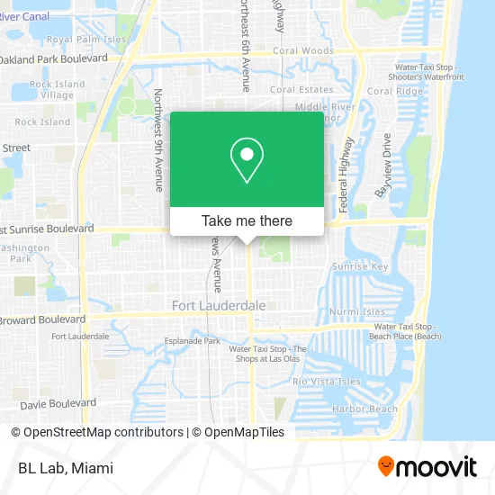
See BL Lab, Fort Lauderdale, on the map
Public Transit to BL Lab in Fort Lauderdale
Wondering how to get to BL Lab in Fort Lauderdale? Moovit helps you find the best way to get to BL Lab with step-by-step directions from the nearest public transit station.
Moovit provides free maps and live directions to help you navigate through your city. View schedules, routes, timetables, and find out how long does it take to get to BL Lab in real time.
Looking for the nearest stop or station to BL Lab? Check out this list of stops closest to your destination: US 1/Ninninger Drive (Northeast 8th Street); Northeast 3rd Avenue/Northeast 8th Street; Sunrise Boulevard/Flagler Drive; Laura Ward Riverwalk Plaza; Fort Lauderdale.
Bus: 10, 20, 36, 50.Train: BLFM.Ferry: WATER TROLLEY.
Want to see if there’s another route that gets you there at an earlier time? Moovit helps you find alternative routes or times. Get directions from and directions to BL Lab easily from the Moovit App or Website.
We make riding to BL Lab easy, which is why over 1.5 million users, including users in Fort Lauderdale, trust Moovit as the best app for public transit. You don’t need to download an individual bus app or train app, Moovit is your all-in-one transit app that helps you find the best bus time or train time available.
For information on prices of bus and train, costs and ride fares to BL Lab, please check the Moovit app.
Use the app to navigate to popular places including to the airport, hospital, stadium, grocery store, mall, coffee shop, school, college, and university.
BL Lab Address: 555 NE 8th St Fort Lauderdale, FL 33304 street in Fort Lauderdale
- Quick Springs Garage Doors,
- Ocean1gutters,
- Strouse Digital,
- Missouri Gutter Installers,
- Fort Lauderdale Plumbers Piping Repair,
- Samantha Freedman at SMF Insurance,
- Shampooch,
- Tony Waffles,
- Lokal Moko,
- 24 Marie Fine Art Gallery,
- Samantha Freedman at First Family Insurance,
- Vintage Consign Com,
- Tora Serenity Spa,
- M L Studio1,
- Evolution Capital Group,
- Sushi Mas Fort Lauderdale,
- City of Fort Lauderdale Facilities,
- Sev Laser,
- Filomena's Bean Coffee,
- Hatch
Places Near BL Lab (Fort Lauderdale)
- Dolphin Mall, Miami,
- Bayside Marketplace, Miami,
- 1351 NW 12th St, Miami,
- Little Havana, Miami,
- Sawgrass mall ( FL ), Miami Beach,
- Keiser University Flagship Campus, West Palm Beach,
- Brickell City Centre, Miami,
- Marlins Park, Miami,
- Aventura Mall, Miami Beach,
- Port of Miami Cruise Terminal, Miami,
- Wynwood, Miami,
- Zoo Miami, Miami,
- Miami Design District, Miami,
- Miami Freedom Park, Miami,
- Sawgrass Mall, Miami,
- Miami-Dade County Courthouse, Miami,
- Aventura Mall, Miami,
- Hard Rock Stadium, Miami Gardens,
- Dolphin Mall Bus, Miami,
- Richard E. Gerstein Justice Building, Miami
How to get to popular places in Miami with public transit
Get around Fort Lauderdale by public transit!
Traveling around Fort Lauderdale has never been so easy. See step by step directions as you travel to any attraction, street or major public transit station. View bus and train schedules, arrival times, service alerts and detailed routes on a map, so you know exactly how to get to anywhere in Fort Lauderdale.
When traveling to any destination around Fort Lauderdale use Moovit's Live Directions with Get Off Notifications to know exactly where and how far to walk, how long to wait for your line, and how many stops are left. Moovit will alert you when it's time to get off — no need to constantly re-check whether yours is the next stop.
Wondering how to use public transit in Fort Lauderdale or how to pay for public transit in Fort Lauderdale? Moovit public transit app can help you navigate your way with public transit easily, and at minimum cost. It includes public transit fees, ticket prices, and costs. Looking for a map of Fort Lauderdale public transit lines? Moovit public transit app shows all public transit maps in Fort Lauderdale with all Bus, Train, Light Rail and Ferry routes and stops on an interactive map.
Miami has 4 transit type(s), including: Bus, Train, Light Rail and Ferry, operated by several transit agencies, including Broward County Transit, Miami-Dade Transit, Metrorail, Palm Tran, Tri-Rail, Brightline, MARTY, City of Homestead Trolley, Key West Transit, Treasure Coast Connector, GoLine IRT, Amtrak, Greyhound-us, FlixBus-us and Aventura Express Shuttle Bus