Directions to BOSCH Car Service (Deerfield Beach) with public transportation
The following transit lines have routes that pass near BOSCH Car Service
 Bus: 10, 50.
- Train: TRIRAIL, FLORIDIAN, SILVER METEOR.
How to get to BOSCH Car Service by bus?
Click on the bus route to see step by step directions with maps, line arrival times and updated time schedules.
From Butterfly World, Pompano Beach
47 minFrom Quebec-Florida Chamber of Commerce, Fort Lauderdale
65 minFrom Palm Beach State College, Boca Raton
61 minFrom The Westin Fort Lauderdale, Fort Lauderdale
47 minFrom Harrah's Pompano Beach, Pompano Beach
60 minFrom Military Trail & Yamato Rd., Boca Raton
97 minFrom Boca Raton, FL, Boca Raton
44 minFrom Sample Rd, Deerfield Beach
32 minFrom Amazon Fulfillment Center-DMF3, Pompano Beach
34 minFrom N Federal Hwy, Fort Lauderdale
50 min
How to get to BOSCH Car Service by train?
Click on the train route to see step by step directions with maps, line arrival times and updated time schedules.
Bus stop near BOSCH Car Service in Deerfield Beach
- Dixie Highway/Southwest 10th Street, 3 min walk,VIEW
Train station near BOSCH Car Service in Deerfield Beach
- Deerfield Beach Station, 45 min walk,VIEW
Bus lines to BOSCH Car Service in Deerfield Beach
- 50, Hillsboro - SW 3 Av Via Northeast Transit Center,VIEW
What are the closest stations to BOSCH Car Service?
The closest stations to BOSCH Car Service are:
- Dixie Highway/Southwest 10th Street is 165 yards away, 3 min walk.
- Deerfield Beach Station is 3832 yards away, 45 min walk.
Which bus lines stop near BOSCH Car Service?
These bus lines stop near BOSCH Car Service: 10, 50.
Which train line stops near BOSCH Car Service?
TRIRAIL (Northbound To Mangonia Park)
What’s the nearest bus station to BOSCH Car Service in Deerfield Beach?
The nearest bus station to BOSCH Car Service in Deerfield Beach is Dixie Highway/Southwest 10th Street. It’s a 3 min walk away.
What time is the first train to BOSCH Car Service in Deerfield Beach?
The TRIRAIL is the first train that goes to BOSCH Car Service in Deerfield Beach. It stops nearby at 4:35 AM.
What time is the last train to BOSCH Car Service in Deerfield Beach?
The FLORIDIAN is the last train that goes to BOSCH Car Service in Deerfield Beach. It stops nearby at 4:57 PM.
What time is the first bus to BOSCH Car Service in Deerfield Beach?
The 50 is the first bus that goes to BOSCH Car Service in Deerfield Beach. It stops nearby at 5:12 AM.
What time is the last bus to BOSCH Car Service in Deerfield Beach?
The 50 is the last bus that goes to BOSCH Car Service in Deerfield Beach. It stops nearby at 12:08 AM.
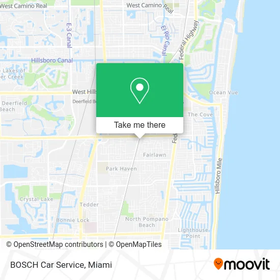
See BOSCH Car Service, Deerfield Beach, on the map
Public Transit to BOSCH Car Service in Deerfield Beach
Wondering how to get to BOSCH Car Service in Deerfield Beach? Moovit helps you find the best way to get to BOSCH Car Service with step-by-step directions from the nearest public transit station.
Moovit provides free maps and live directions to help you navigate through your city. View schedules, routes, timetables, and find out how long does it take to get to BOSCH Car Service in real time.
Looking for the nearest stop or station to BOSCH Car Service? Check out this list of stops closest to your destination: Dixie Highway/Southwest 10th Street; Deerfield Beach Station.
Bus: 10, 50.Train: TRIRAIL, FLORIDIAN, SILVER METEOR.
Want to see if there’s another route that gets you there at an earlier time? Moovit helps you find alternative routes or times. Get directions from and directions to BOSCH Car Service easily from the Moovit App or Website.
We make riding to BOSCH Car Service easy, which is why over 1.5 million users, including users in Deerfield Beach, trust Moovit as the best app for public transit. You don’t need to download an individual bus app or train app, Moovit is your all-in-one transit app that helps you find the best bus time or train time available.
For information on prices of bus and train, costs and ride fares to BOSCH Car Service, please check the Moovit app.
Use the app to navigate to popular places including to the airport, hospital, stadium, grocery store, mall, coffee shop, school, college, and university.
BOSCH Car Service Address: 1067 SW 1st Way Deerfield Beach, FL 33441 street in Deerfield Beach
- Point Supply Company,
- To Swimmill, .The Swimmers Treadmill.,
- M & M Custom Building and Renovations,
- Temple of God Church of God in Christ,
- BL Wheels,
- First Call Services Air Conditioning,
- Mercedes Mike,
- N Broward Storage DB,
- Monarch Roofing & Construction,
- RBH Distributions,
- Kay Kay Auto Repair,
- Black Bear Asphalt and Sealcoating,
- Faith and Deliverance Community Center,
- Barros Meat,
- It's Electrique Bike Shop,
- Mucelin Auto Repair,
- It's Electrique,
- Taqueria Dona Raquel,
- Fly Fulfillment,
- Hypnotized Clothing Showroom
Places Near BOSCH Car Service (Deerfield Beach)
- Wynwood, Miami,
- Aventura Mall, Miami Beach,
- Dolphin Mall, Miami,
- Richard E. Gerstein Justice Building, Miami,
- Marlins Park, Miami,
- Bayside Marketplace, Miami,
- Miami VA Hospital, Miami,
- Miami Freedom Park, Miami,
- Sawgrass Mall, Miami,
- Little Havana, Miami,
- Sawgrass mall ( FL ), Miami Beach,
- Aventura Mall, Miami,
- Hard Rock Stadium, Miami Gardens,
- Dolphin Mall Bus, Miami,
- Miami-Dade County Courthouse, Miami,
- Port of Miami Cruise Terminal, Miami,
- Zoo Miami, Miami,
- Brickell City Centre, Miami,
- Keiser University Flagship Campus, West Palm Beach,
- Miami Design District, Miami
How to get to popular places in Miami with public transit
Get around Deerfield Beach by public transit!
Traveling around Deerfield Beach has never been so easy. See step by step directions as you travel to any attraction, street or major public transit station. View bus and train schedules, arrival times, service alerts and detailed routes on a map, so you know exactly how to get to anywhere in Deerfield Beach.
When traveling to any destination around Deerfield Beach use Moovit's Live Directions with Get Off Notifications to know exactly where and how far to walk, how long to wait for your line, and how many stops are left. Moovit will alert you when it's time to get off — no need to constantly re-check whether yours is the next stop.
Wondering how to use public transit in Deerfield Beach or how to pay for public transit in Deerfield Beach? Moovit public transit app can help you navigate your way with public transit easily, and at minimum cost. It includes public transit fees, ticket prices, and costs. Looking for a map of Deerfield Beach public transit lines? Moovit public transit app shows all public transit maps in Deerfield Beach with all Bus, Train, Light Rail and Ferry routes and stops on an interactive map.
Miami has 4 transit type(s), including: Bus, Train, Light Rail and Ferry, operated by several transit agencies, including Broward County Transit, Miami-Dade Transit, Metrorail, Palm Tran, Tri-Rail, Brightline, MARTY, City of Homestead Trolley, Key West Transit, Treasure Coast Connector, GoLine IRT, Amtrak, Greyhound-us, FlixBus-us and Aventura Express Shuttle Bus