How to get to BZB Shop til Ya Drop by bus?
Click on the bus route to see step by step directions with maps, line arrival times and updated time schedules.
From St John's College High School, Washington
40 minFrom Headquarters - U.S. Coast Guard, Washington
81 minFrom Sheraton Suites Old Town Alexandria, Alexandria
49 minFrom Wheaton Mall, Montgomery County
56 minFrom U.S. Census Bureau, Prince George's County
89 minFrom Washington Nationals Youth Baseball Academy, Washington
54 minFrom Arlington Cinema 'N' Drafthouse, Arlington County
58 minFrom Iverson Mall, Prince George's County
87 minFrom College Park Marriott Hotel & Conference Center, Prince George's County
82 minFrom Fort Myer, Arlington County
59 min
How to get to BZB Shop til Ya Drop by train?
Click on the train route to see step by step directions with maps, line arrival times and updated time schedules.
How to get to BZB Shop til Ya Drop by metro?
Click on the metro route to see step by step directions with maps, line arrival times and updated time schedules.
Bus stops near BZB Shop til Ya Drop in Washington
Metro stations near BZB Shop til Ya Drop in Washington
Bus lines to BZB Shop til Ya Drop in Washington
What are the closest stations to BZB Shop til Ya Drop?
The closest stations to BZB Shop til Ya Drop are:
- P St Nw+9 St NW is 82 yards away, 2 min walk.
- Rhode Island Av Nw+9 St NW is 172 yards away, 3 min walk.
- 7 St Nw+P St NW is 304 yards away, 4 min walk.
- 11 St Nw+P St NW is 347 yards away, 5 min walk.
- 7 St Nw+Rhode Island Av NW is 379 yards away, 5 min walk.
- Mt Vernon Sq/7th St-Convention Center is 1691 yards away, 20 min walk.
- Gallery Place-Chinatown is 2131 yards away, 25 min walk.
- Mcpherson Sq Metro Station is 2227 yards away, 27 min walk.
Which bus lines stop near BZB Shop til Ya Drop?
These bus lines stop near BZB Shop til Ya Drop: C51, D32, D40, D44, D4X.
Which train line stops near BZB Shop til Ya Drop?
MARC (Outbound - Washington)
Which metro lines stop near BZB Shop til Ya Drop?
These metro lines stop near BZB Shop til Ya Drop: GREEN, YELLOW.
What’s the nearest metro station to BZB Shop til Ya Drop in Washington?
The nearest metro station to BZB Shop til Ya Drop in Washington is Mt Vernon Sq/7th St-Convention Center. It’s a 20 min walk away.
What’s the nearest bus station to BZB Shop til Ya Drop in Washington?
The nearest bus station to BZB Shop til Ya Drop in Washington is P St Nw+9 St NW. It’s a 2 min walk away.
What time is the first metro to BZB Shop til Ya Drop in Washington?
The GREEN is the first metro that goes to BZB Shop til Ya Drop in Washington. It stops nearby at 5:18 AM.
What time is the last metro to BZB Shop til Ya Drop in Washington?
The GREEN is the last metro that goes to BZB Shop til Ya Drop in Washington. It stops nearby at 12:23 AM.
What time is the first bus to BZB Shop til Ya Drop in Washington?
The D40 is the first bus that goes to BZB Shop til Ya Drop in Washington. It stops nearby at 3:11 AM.
What time is the last bus to BZB Shop til Ya Drop in Washington?
The D40 is the last bus that goes to BZB Shop til Ya Drop in Washington. It stops nearby at 3:11 AM.
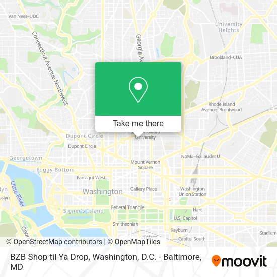
See BZB Shop til Ya Drop, Washington, on the map
Public Transit to BZB Shop til Ya Drop in Washington
Wondering how to get to BZB Shop til Ya Drop in Washington? Moovit helps you find the best way to get to BZB Shop til Ya Drop with step-by-step directions from the nearest public transit station.
Moovit provides free maps and live directions to help you navigate through your city. View schedules, routes, timetables, and find out how long does it take to get to BZB Shop til Ya Drop in real time.
Looking for the nearest stop or station to BZB Shop til Ya Drop? Check out this list of stops closest to your destination: P St Nw+9 St NW; Rhode Island Av Nw+9 St NW; 7 St Nw+P St NW; 11 St Nw+P St NW; 7 St Nw+Rhode Island Av NW; Mt Vernon Sq/7th St-Convention Center; Gallery Place-Chinatown; Mcpherson Sq Metro Station.
Bus: C51, D32, D40, D44, D4X, C91.Train: MARC.Metro: GREEN, YELLOW, RED, BLUE, ORANGE, SILVER.
Want to see if there’s another route that gets you there at an earlier time? Moovit helps you find alternative routes or times. Get directions from and directions to BZB Shop til Ya Drop easily from the Moovit App or Website.
We make riding to BZB Shop til Ya Drop easy, which is why over 1.5 million users, including users in Washington, trust Moovit as the best app for public transit. You don’t need to download an individual bus app or train app, Moovit is your all-in-one transit app that helps you find the best bus time or train time available.
For information on prices of bus, metro and train, costs and ride fares to BZB Shop til Ya Drop, please check the Moovit app.
Use the app to navigate to popular places including to the airport, hospital, stadium, grocery store, mall, coffee shop, school, college, and university.
BZB Shop til Ya Drop Address: 1510 9th St NW street in Washington
- Shiloh Baptist Church (Shiloh Senior Citizens Center),
- Chaplin's,
- Shiloh Baptist Church,
- Chaplin's Restaurant,
- DC International Hostel ,
- City Market at O,
- Cambria Hotel-Washington, D.C. (Cambria Suites),
- Sqin,
- Cambria Hotel & Suites Washington, D.C. Convention Center,
- Howard University Hospital,
- PETCO,
- Cambria Hotel &Suites,
- Chercher,
- Trice Investigations & Mobile Notary Services,
- Dacha Beer Garden,
- Mayweather Boxing + Fitness,
- Qui Qui,
- Yourchime,
- Peet's Coffee and Tea,
- 1525 7th St NW
Places Near BZB Shop til Ya Drop (Washington)
- Washington National Cathedral, Washington,
- Sibley Memorial Hospital, Washington,
- Museum Of The Bible, Washington,
- Basilica of the National Shrine, Washington,
- Warner Theatre, Washington,
- National Mall, Washington,
- Rock Creek Tennis Center, Washington,
- Westfield Montgomery Mall, Montgomery County,
- Washington DC VA Medical Center, Washington,
- Amazon Hq2, Arlington County,
- Camden Yards, Baltimore,
- Pennsylvania Ave NW (3rd st and pennsylvania), Washington,
- M&T Bank Stadium, Baltimore,
- The Anthem, Washington,
- Georgetown, Washington,
- Marriott Marquis Washington, DC, Washington,
- Capital One Arena, Washington,
- National Museum of African American History and Culture, Washington,
- National Zoo, Washington,
- PG Mall, Prince George's County
How to get to popular places in Washington, D.C. - Baltimore, MD with public transit
Get around Washington by public transit!
Traveling around Washington has never been so easy. See step by step directions as you travel to any attraction, street or major public transit station. View bus and train schedules, arrival times, service alerts and detailed routes on a map, so you know exactly how to get to anywhere in Washington.
When traveling to any destination around Washington use Moovit's Live Directions with Get Off Notifications to know exactly where and how far to walk, how long to wait for your line, and how many stops are left. Moovit will alert you when it's time to get off — no need to constantly re-check whether yours is the next stop.
Wondering how to use public transit in Washington or how to pay for public transit in Washington? Moovit public transit app can help you navigate your way with public transit easily, and at minimum cost. It includes public transit fees, ticket prices, and costs. Looking for a map of Washington public transit lines? Moovit public transit app shows all public transit maps in Washington with all Bus, Train, Metro, Light Rail and Ferry routes and stops on an interactive map.
Washington, D.C. - Baltimore, MD has 5 transit type(s), including: Bus, Train, Metro, Light Rail and Ferry, operated by several transit agencies, including WMATA, Montgomery County Ride On, Fairfax Connector, TheBus, PRTC, DASH - Alexandria, Arlington Transit (ART), RTA of Central Maryland, MDOT MTA, MDOT MTA Light RailLink, MDOT MTA Commuter Bus, MDOT MTA Local Bus, FXBGO!, Virginia Railway Express (VRE) and MARC