How to get to B.Clean Solutions by bus?
Click on the bus route to see step by step directions with maps, line arrival times and updated time schedules.
From Walterdale Hill & Queen Elizabeth Park Road, Edmonton
44 minFrom 50 Corriveau Avenue, St. Albert
79 minFrom University of Alberta - Medical Sciences Building, Edmonton
54 minFrom 1E4 University of Alberta Hospital, Edmonton
53 minFrom The Westin Edmonton, Edmonton
48 minFrom Bay Enterprise Square Station, Edmonton
45 minFrom Edmonton Fire Station #8 (Hagmann), Edmonton
39 minFrom Butterdome Craft Sale, Edmonton
53 minFrom Hearinglife, Edmonton
56 minFrom Clare Drake Arena, Edmonton
54 min
Bus stops near B.Clean Solutions in Edmonton
Light Rail stations near B.Clean Solutions in Edmonton
- Coliseum Station, 7 min walk,VIEW
Bus lines to B.Clean Solutions in Edmonton
What are the closest stations to B.Clean Solutions?
The closest stations to B.Clean Solutions are:
- 66 Street & 134 Avenue is 407 meters away, 6 min walk.
- 62 Street & 132 Avenue is 484 meters away, 7 min walk.
- Coliseum Station is 532 meters away, 7 min walk.
- 63 Street & 137 Avenue is 686 meters away, 9 min walk.
Which bus lines stop near B.Clean Solutions?
These bus lines stop near B.Clean Solutions: 053, 054.
What’s the nearest light rail station to B.Clean Solutions in Edmonton?
The nearest light rail station to B.Clean Solutions in Edmonton is Coliseum Station. It’s a 7 min walk away.
What’s the nearest bus station to B.Clean Solutions in Edmonton?
The nearest bus station to B.Clean Solutions in Edmonton is 66 Street & 134 Avenue. It’s a 6 min walk away.
What time is the first bus to B.Clean Solutions in Edmonton?
The 106 is the first bus that goes to B.Clean Solutions in Edmonton. It stops nearby at 6:18 AM.
What time is the last bus to B.Clean Solutions in Edmonton?
The 054 is the last bus that goes to B.Clean Solutions in Edmonton. It stops nearby at 12:41 AM.
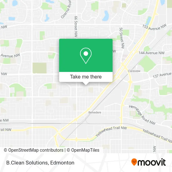
See B.Clean Solutions, Edmonton, on the map
Public Transit to B.Clean Solutions in Edmonton
Wondering how to get to B.Clean Solutions in Edmonton? Moovit helps you find the best way to get to B.Clean Solutions with step-by-step directions from the nearest public transit station.
Moovit provides free maps and live directions to help you navigate through your city. View schedules, routes, timetables, and find out how long does it take to get to B.Clean Solutions in real time.
Looking for the nearest stop or station to B.Clean Solutions? Check out this list of stops closest to your destination: 66 Street & 134 Avenue; 62 Street & 132 Avenue; Coliseum Station; 63 Street & 137 Avenue.
Bus: 053, 054, 107, 626, 106.
Want to see if there’s another route that gets you there at an earlier time? Moovit helps you find alternative routes or times. Get directions from and directions to B.Clean Solutions easily from the Moovit App or Website.
We make riding to B.Clean Solutions easy, which is why over 1.5 million users, including users in Edmonton, trust Moovit as the best app for public transit. You don’t need to download an individual bus app or train app, Moovit is your all-in-one transit app that helps you find the best bus time or train time available.
For information on prices of bus, costs and ride fares to B.Clean Solutions, please check the Moovit app.
Use the app to navigate to popular places including to the airport, hospital, stadium, grocery store, mall, coffee shop, school, college, and university.
B.Clean Solutions Address: Edmonton, AB T5A 0A8 street in Edmonton
- Pro Base Construction,
- Eagle Plumbing & Gas Fitting,
- Phoenix Flames Beauty,
- Younique by Jessica-Lee,
- Lashesbyanmol,
- Christopher Rittman,
- VIP Detailing,
- DS Appliance Rescue,
- Dear Doula,
- Pinecase,
- Panzica's Animal Trapping and Relocation,
- NVS Demolition,
- Babysitting Services,
- Four Seasons Property Maintenance,
- Sonco Painting,
- D&D Installations,
- Nearme Construction,
- Escala Developments,
- Nikki's Catering Services,
- Remedy Commercial Realty Group
Places Near B.Clean Solutions (Edmonton)
- Northgate Centre, Edmonton,
- Edmonton EXPO Centre, Edmonton,
- Canada Place Service Canada Centre, Edmonton,
- Edmonton Valley Zoo, Edmonton,
- Grey Nuns Community Hospital, Edmonton,
- Edmonton Commonwealth Stadium, Edmonton,
- Kaye Edmonton Clinic, Edmonton,
- Whyte Avenue, Edmonton,
- West Edmonton Mall, Edmonton,
- Rogers Place, Edmonton,
- MacEwan University, Edmonton,
- Cross Cancer Institute, Edmonton,
- Londonderry Mall, Edmonton,
- Fort Edmonton Park, Edmonton,
- Edmonton VIA Rail Station, Edmonton,
- Royal Alexandra Hospital, Edmonton,
- Alberta Legislature Building, Edmonton,
- Kingsway Mall, Edmonton,
- University of Alberta, Edmonton,
- Borden Park, Edmonton
How to get to popular places in Edmonton with public transit
Get around Edmonton by public transit!
Traveling around Edmonton has never been so easy. See step by step directions as you travel to any attraction, street or major public transit station. View bus and train schedules, arrival times, service alerts and detailed routes on a map, so you know exactly how to get to anywhere in Edmonton.
When traveling to any destination around Edmonton use Moovit's Live Directions with Get Off Notifications to know exactly where and how far to walk, how long to wait for your line, and how many stops are left. Moovit will alert you when it's time to get off — no need to constantly re-check whether yours is the next stop.
Wondering how to use public transit in Edmonton or how to pay for public transit in Edmonton? Moovit public transit app can help you navigate your way with public transit easily, and at minimum cost. It includes public transit fees, ticket prices, and costs. Looking for a map of Edmonton public transit lines? Moovit public transit app shows all public transit maps in Edmonton with all Bus and Light Rail routes and stops on an interactive map.
Edmonton has 2 transit type(s), including: Bus and Light Rail, operated by several transit agencies, including ETS LRT, ETS, Strathcona County Transit, St. Albert Transit, Spruce Grove Transit, Fort Saskatchewan Transit, Beaumont Transit and Leduc Transit