Directions to B Multiservices (Allentown) with public transportation
The following transit lines have routes that pass near B Multiservices
 Bus: FLIXBUS 2651, FLIXBUS N2640, BLU, GRN, 210.
How to get to B Multiservices by bus?
Click on the bus route to see step by step directions with maps, line arrival times and updated time schedules.
From Lakeland Bus Stop, Parsippany-Troy Hills
239 minFrom Robert Wood Johnson University Hospital, New Brunswick
255 minFrom Parsippany, NJ, Parsippany-Troy Hills
251 minFrom MMNJ, Parsippany-Troy Hills
251 minFrom Highland Park, NJ, Highland Park
266 minFrom Rutgers, New Brunswick
256 minFrom Plainfield, NJ, Plainfield
246 minFrom Edison NJ, Edison
273 minFrom Baps Shri Swaminarayan Mandir, Edison, NJ, USA, Edison
278 min
Bus stops near B Multiservices in Allentown
Bus lines to B Multiservices in Allentown
What are the closest stations to B Multiservices?
The closest stations to B Multiservices are:
- 6th at Liberty is 80 yards away, 2 min walk.
- Old Fairgrounds is 81 yards away, 2 min walk.
- Allen at 6th is 108 yards away, 2 min walk.
- 7th at Liberty is 225 yards away, 3 min walk.
Which bus lines stop near B Multiservices?
These bus lines stop near B Multiservices: FLIXBUS 2651, FLIXBUS N2640.
What’s the nearest bus station to B Multiservices in Allentown?
The nearest bus stations to B Multiservices in Allentown are 6th at Liberty, Old Fairgrounds and Allen at 6th. The closest one is a 2 min walk away.
What time is the first bus to B Multiservices in Allentown?
The 319 is the first bus that goes to B Multiservices in Allentown. It stops nearby at 3:05 AM.
What time is the last bus to B Multiservices in Allentown?
The BLU is the last bus that goes to B Multiservices in Allentown. It stops nearby at 2:05 AM.
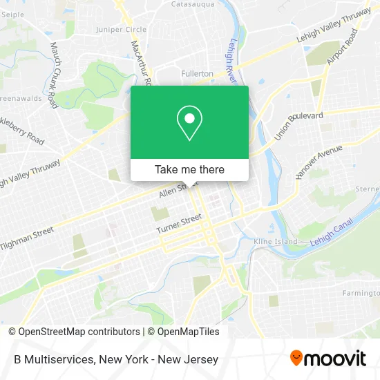
See B Multiservices, Allentown, on the map
Public Transit to B Multiservices in Allentown
Wondering how to get to B Multiservices in Allentown? Moovit helps you find the best way to get to B Multiservices with step-by-step directions from the nearest public transit station.
Moovit provides free maps and live directions to help you navigate through your city. View schedules, routes, timetables, and find out how long does it take to get to B Multiservices in real time.
Looking for the nearest stop or station to B Multiservices? Check out this list of stops closest to your destination: 6th at Liberty; Old Fairgrounds; Allen at 6th; 7th at Liberty.
Bus: FLIXBUS 2651, FLIXBUS N2640, BLU, GRN, 210, 319, 209, 211.
Want to see if there’s another route that gets you there at an earlier time? Moovit helps you find alternative routes or times. Get directions from and directions to B Multiservices easily from the Moovit App or Website.
We make riding to B Multiservices easy, which is why over 1.5 million users, including users in Allentown, trust Moovit as the best app for public transit. You don’t need to download an individual bus app or train app, Moovit is your all-in-one transit app that helps you find the best bus time or train time available.
For information on prices of bus and train, costs and ride fares to B Multiservices, please check the Moovit app.
Use the app to navigate to popular places including to the airport, hospital, stadium, grocery store, mall, coffee shop, school, college, and university.
B Multiservices Address: 519 N 7th St street in Allentown
- Ups Access Point Location,
- Total Wireless,
- Chicken and Pizza Halal,
- Brianna Jewelry,
- North 7th Street,
- Crispy Halal,
- Cricket Wireless Authorized Retailer,
- Gregory Barber Shop,
- Klean Eats Lehigh Valley,
- Skin Deep Studios,
- Lehigh Valley Education Center,
- Botanica Spiritual Wnder,
- Digital Feast Hq,
- Jehovah's Witnesses,
- Roberta B Gonzalez MD,
- 7th Liberty St,
- Yocco's - the Hot Dog King,
- Almost Vegan Cafe,
- Call Me Vegan Catering,
- Meals by Zy
Places Near B Multiservices (Allentown)
- SoHo, Manhattan,
- Pier 83, Manhattan,
- Hudson Yards, Manhattan,
- 111 Centre New York City Supreme Court, Manhattan,
- Bellevue Hospital, Manhattan,
- 911 Memorial, Manhattan,
- 3 Stone St, Manhattan,
- qqqq, Manhattan,
- 1 Police Plaza, Manhattan,
- Katz's Deli, Manhattan,
- San Gennaro Feast, Manhattan,
- 26 Federal Plaza, Manhattan,
- 376 Hudson Street, Manhattan,
- 66 John Street, Manhattan,
- Wall Street, Manhattan,
- Mountainside Hospital, Glen Ridge,
- Times Square, Manhattan,
- Chinatown, Manhattan,
- Queens Center Mall, Queens,
- Rockefeller Center, Manhattan
How to get to popular places in New York - New Jersey with public transit
Get around Allentown by public transit!
Traveling around Allentown has never been so easy. See step by step directions as you travel to any attraction, street or major public transit station. View bus and train schedules, arrival times, service alerts and detailed routes on a map, so you know exactly how to get to anywhere in Allentown.
When traveling to any destination around Allentown use Moovit's Live Directions with Get Off Notifications to know exactly where and how far to walk, how long to wait for your line, and how many stops are left. Moovit will alert you when it's time to get off — no need to constantly re-check whether yours is the next stop.
Wondering how to use public transit in Allentown or how to pay for public transit in Allentown? Moovit public transit app can help you navigate your way with public transit easily, and at minimum cost. It includes public transit fees, ticket prices, and costs. Looking for a map of Allentown public transit lines? Moovit public transit app shows all public transit maps in Allentown with all Bus, Train, Subway, Light Rail, Ferry and Cable Car routes and stops on an interactive map.
New York - New Jersey has 6 transit type(s), including: Bus, Train, Subway, Light Rail, Ferry and Cable Car, operated by several transit agencies, including MTA Subway, Metro-North Railroad, LIRR, PATH, MTA New York City Transit - Express routes, MTA Bus, NJ Transit, NYC Ferry, NICE bus, Bee-Line Bus, NJ Transit Rail, Norwalk Transit District, Hartford Line, River Valley Transit and HART