How to get to B&N by bus?
Click on the bus route to see step by step directions with maps, line arrival times and updated time schedules.
From Olleria, L'Olleria
41 minFrom Estación de Tren Xátiva, Xàtiva
76 minFrom Benigànim, Benigánim
112 minFrom Hospital Lluís Alcanyís, Xàtiva
77 minFrom Anna Spain, Anna
367 minFrom Hm Plaza Mayor, Xàtiva
79 minFrom Castillo de Xàtiva, Xàtiva
86 minFrom Alberique, Alberic
97 minFrom Moixent, Mogente
248 minFrom Massalavés, Masalavés
81 min
Bus stops near B&N in Ontinyent
Bus lines to B&N in Ontinyent
- L2, Hospital - Estació,VIEW
- L1, Urbà - Ciutat,VIEW
- L482*, L482*_Banyeres - Ontinyent,VIEW
- L483*, L483*_La Font de la Figuera - Ontinyent,VIEW
- L480A*, L480a*_Ontinyent – Xàtiva (per Albaida amb Bufalí i Carricola a demanda),VIEW
- L481A*, L481a*_Castelló de Rugat - Ontinyent (per Otos),VIEW
- L480B*, L480b*_Ontinyent – Xàtiva (per l'Olleria),VIEW
- L481B*, L481b*_Castelló de Rugat - Ontinyent (per Bélgida),VIEW
- L481C*, L481c*_Atzeneta d'Albaida - Ontinyent,VIEW
What are the closest stations to B&N?
The closest stations to B&N are:
- Av. Dos De Maig, 54 is 105 meters away, 2 min walk.
- Glorieta Dels Moros I Cristians, 3 is 173 meters away, 3 min walk.
- Av. Dos De Maig, 136 is 312 meters away, 5 min walk.
Which bus lines stop near B&N?
These bus lines stop near B&N: L480B*, L716.
What’s the nearest bus station to B&N in Ontinyent?
The nearest bus station to B&N in Ontinyent is Av. Dos De Maig, 54. It’s a 2 min walk away.
What time is the first bus to B&N in Ontinyent?
The L482* is the first bus that goes to B&N in Ontinyent. It stops nearby at 7:21 AM.
What time is the last bus to B&N in Ontinyent?
The L1 is the last bus that goes to B&N in Ontinyent. It stops nearby at 7:59 PM.
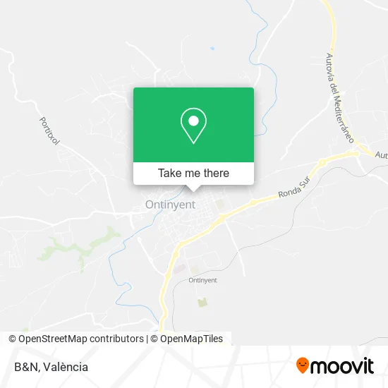
See B&N, Ontinyent, on the map
Public Transit to B&N in Ontinyent
Wondering how to get to B&N in Ontinyent? Moovit helps you find the best way to get to B&N with step-by-step directions from the nearest public transit station.
Moovit provides free maps and live directions to help you navigate through your city. View schedules, routes, timetables, and find out how long does it take to get to B&N in real time.
Looking for the nearest stop or station to B&N? Check out this list of stops closest to your destination: Av. Dos De Maig; Glorieta Dels Moros I Cristians; Av. Dos De Maig.
Bus: L480B*, L716, L2, L1, L482*, L483*, L480A*, L481A*.
Want to see if there’s another route that gets you there at an earlier time? Moovit helps you find alternative routes or times. Get directions from and directions to B&N easily from the Moovit App or Website.
We make riding to B&N easy, which is why over 1.5 million users, including users in Ontinyent, trust Moovit as the best app for public transit. You don’t need to download an individual bus app or train app, Moovit is your all-in-one transit app that helps you find the best bus time or train time available.
For information on prices of bus and train, costs and ride fares to B&N, please check the Moovit app.
Use the app to navigate to popular places including to the airport, hospital, stadium, grocery store, mall, coffee shop, school, college, and university.
B&N Address: Carrer del Dos de Maig, 18 46870 Ontinyent street in Ontinyent
- Saritisima,
- Gimnasio Ana María,
- El Pastador de Pedro Inmaculada Reig Bas,
- Inclasa,
- Top Mind Servi,
- Atreya Industrias,
- Don Baco,
- Domestival,
- Remember contra La Ela,
- Medina Embutidos Artesanos y Yo,
- Maria Pilar Serrano García,
- Open English School,
- Buenos Aires,
- Tek Seguros,
- Inrem,
- Must Have,
- José Ramon Valls Guillem,
- del Rio Serna, m.J,
- Esparza Sarrio Rosario,
- Frutería Casa La Plana
Places Near B&N (Ontinyent)
- Malvarrosa, Valencia,
- HOSPITAL CASA DE SALUD, Valencia,
- Centro Comercial El Saler, Valencia,
- Plaza España, Valencia,
- Estación De Autobuses De Valencia, Valencia,
- Av. de la Constitución, Valencia,
- Ikea, Alfafar,
- Parque Tecnológico de Paterna, Paterna,
- Centro Comercial Bonaire, Aldaia,
- Playa de la Malvarrosa (Valencia),
- Bus lanzadera Estació del Nord-Joaquín Sorolla, Valencia,
- Port Saplaya,
- Playa La Patacona,
- Kinepolis Valencia, Paterna,
- Avenida del Puerto, Valencia,
- Nuevo Centro, Valencia,
- Hospital General, Valencia,
- Hospital Vithas 9 d'Octubre, Valencia,
- Hospital IMED, Burjassot,
- Hospital Clínico, Valencia
How to get to popular places in València with public transit
Get around Ontinyent by public transit!
Traveling around Ontinyent has never been so easy. See step by step directions as you travel to any attraction, street or major public transit station. View bus and train schedules, arrival times, service alerts and detailed routes on a map, so you know exactly how to get to anywhere in Ontinyent.
When traveling to any destination around Ontinyent use Moovit's Live Directions with Get Off Notifications to know exactly where and how far to walk, how long to wait for your line, and how many stops are left. Moovit will alert you when it's time to get off — no need to constantly re-check whether yours is the next stop.
Wondering how to use public transit in Ontinyent or how to pay for public transit in Ontinyent? Moovit public transit app can help you navigate your way with public transit easily, and at minimum cost. It includes public transit fees, ticket prices, and costs. Looking for a map of Ontinyent public transit lines? Moovit public transit app shows all public transit maps in Ontinyent with all Bus, Train and Metrovalencia routes and stops on an interactive map.
València has 3 transit type(s), including: Bus, Train and Metrovalencia, operated by several transit agencies, including Metrovalencia, Renfe Cercanias, EMT, MetroBus, València Metropolitana Nord, València Metropolitana Sud, Transport urbà de Torrent (TorrentBus), La Hoya de Buñol - València, La Ribera - València, Montserrat - València, La Marina Gandiense, La Ribera Baixa – Algemesí – Alzira, València - Benifaió, Alcoi Metropolitano and València Metropolitana Nord-Oest